Why the Upper Midwest Has So Many Waterfalls
People who picture the Upper Midwest as flat farmland are often surprised to learn that Minnesota, Wisconsin, and Michigan together hold hundreds of waterfalls — and that the best of them are genuinely tall. The reason is geology, and it comes in three distinct flavors that this guide follows like a map. Along Lake Superior's North Shore in Minnesota and across Michigan's western Upper Peninsula, the bedrock is volcanic. Around the lake's southern rim through the Pictured Rocks country, it is layered sandstone. And in the unglaciated Driftless Area of southwestern Wisconsin and southeastern Minnesota, it is limestone and sandstone carved by streams that the glaciers never flattened.
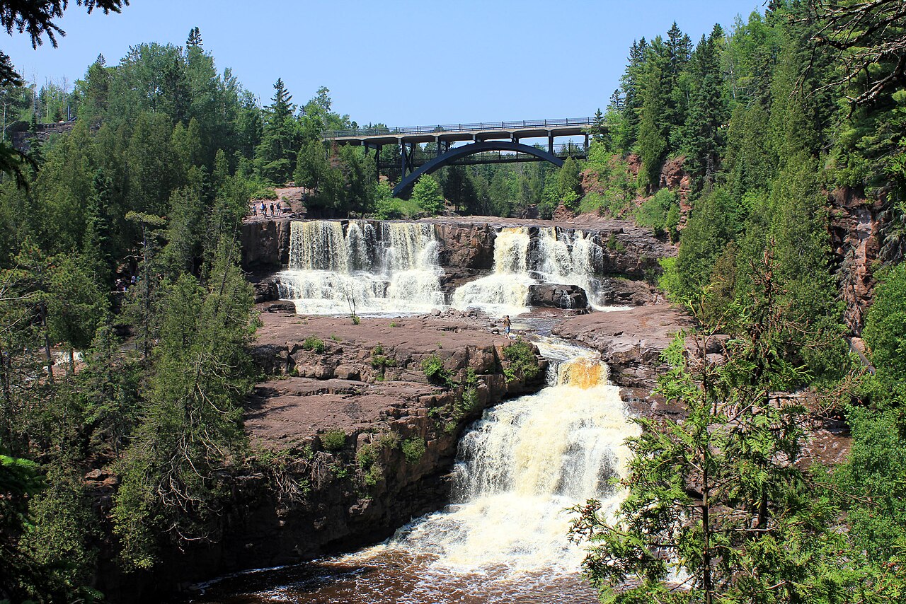
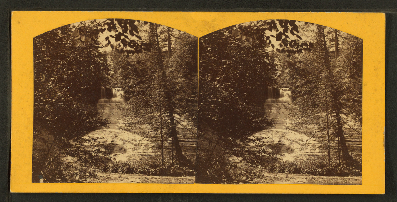
The North Shore story begins roughly 1.1 billion years ago, when the continent began to tear apart along the Midcontinent Rift. According to Lake Superior Magazine and the National Park Service, the rift erupted layer upon layer of runny basalt lava — more than 240,000 cubic miles of volcanic rock over some 30 million years — stacking flows up to 20 kilometers thick in the Lake Superior region. When rivers later cut down through those stacked flows, they eroded into giant stair steps, which is exactly why so many North Shore falls tumble in tiers. The Minnesota DNR notes that the three drops along the Gooseberry River each correspond to a separate lava flow.
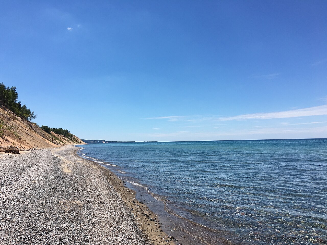
The Pictured Rocks falls work differently. There, water pours over cliffs of Munising and Jacobsville sandstone, soft enough to undercut and sculpt into the curtains and fans you see at Sable, Munising, and Miners Falls. The Driftless Area is a third world entirely: because the last continental ice sheets bypassed it, the region kept its steep ridges, deep valleys, and karst plumbing of caves, sinkholes, and disappearing streams — terrain the Wisconsin Geological and Natural History Survey describes as in 'marked contrast' to the glacier-smoothed land around it. Understanding which of these three landscapes you are standing in tells you a lot about the waterfall in front of you.
The Tallest of the Three States
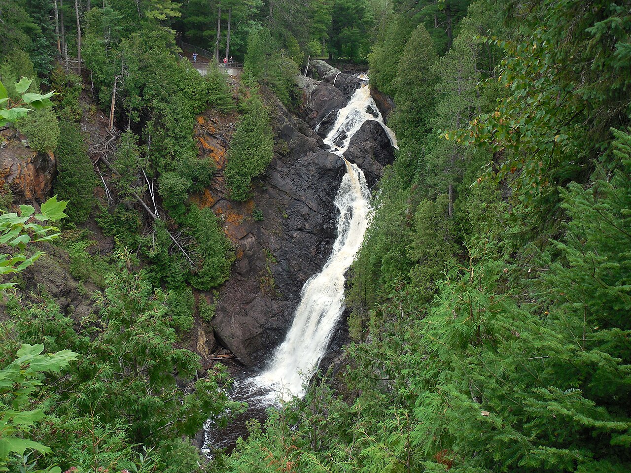
If raw height is the measure, Wisconsin holds the crown for this corner of the country. Big Manitou Falls, on the Black River inside Pattison State Park near Superior, drops about 165 feet — the tallest waterfall in Wisconsin and, by Wikipedia and World of Waterfalls accounts, the fourth-highest east of the Rocky Mountains. Reaching it is almost absurdly easy for a falls of that stature: a short walk of roughly half a mile on easy trail from the Wisconsin DNR's developed overlooks. Spring snowmelt is when the Black River runs hardest and the plunge is most dramatic.
Michigan's Laughing Whitefish Falls answers with about 100 feet of height, though of a very different character. Rather than a single clean plunge, it fans and slides down a long limestone face on the Laughing Whitefish River, protected as a Michigan DNR State Scenic Site near Sundell. A roughly one-mile walk on easy trail leads to the viewing area, and like most falls in this guide it peaks during spring snowmelt from April into June. The fan shape means it reads more as a broad, glittering staircase than a thundering drop, which is part of its quiet appeal.
Minnesota's signature heights live on the North Shore. High Falls of the Baptism River, inside Tettegouche State Park near Silver Bay, falls about 63 feet and is frequently described as one of the tallest waterfalls entirely within Minnesota. Reaching it is a moderate outing of roughly three miles round trip from the park trailheads, with a suspension footbridge over the river as a bonus along the way. Heights for all of these falls should be read with a grain of salt — sources measure differently, some counting a single clean drop and others adding up a stepped cascade — so treat the numbers here as well-documented approximations rather than surveyed certainties.
Lake Superior's North Shore: Minnesota's Lava-Step Falls
No stretch of the Upper Midwest packs more accessible waterfalls into a single scenic drive than Minnesota Highway 61 along Lake Superior. Gooseberry Falls State Park, near Two Harbors, is the gateway and the crowd favorite. The Lower Falls of the Gooseberry River drop about 60 feet in tiers, and the park's paved and stair-stepped paths — roughly a mile of easy walking — put you close enough to feel the spray. As the Minnesota DNR explains, each of the river's main drops sits on a separate ancient lava flow, a living illustration of the billion-year-old basalt geology underfoot. Snowmelt brings the highest volume.
Farther up the shore near Grand Marais sits the most famous geological riddle in Minnesota: Devil's Kettle Falls, in Judge C.R. Magney State Park. The Brule River splits at a rock outcrop, with half plunging about 50 feet and the other half disappearing into a churning pothole that, for over a century, seemed to lead nowhere. The mystery was largely put to rest in 2017, when the Minnesota DNR measured flow of 123 cubic feet per second above the falls and 121 below — essentially identical — strongly indicating the water simply rejoins the river just downstream rather than vanishing into some underground river. Researchers planned biodegradable dye tracing to confirm it. Reaching the kettle is a roughly two-mile round trip rated strenuous, largely thanks to the long stairway down to the gorge.
Closer to the Twin Cities, Minnehaha Falls offers a completely different kind of North Shore-adjacent experience — urban, immortalized in Longfellow's poem, and easy to reach. The roughly 53-foot plunge of Minnehaha Creek sits inside Minneapolis's Minnehaha Regional Park, managed by the Minneapolis Park and Recreation Board, with under a mile of easy paved and stair paths to the overlooks and the base. It is fed by rain and snowmelt rather than a large river, so it runs hardest in spring and after storms and can slow to a trickle in a dry late summer — worth checking conditions before a special trip.
Michigan's Upper Peninsula: Pictured Rocks and the Keweenaw
Michigan's Upper Peninsula is arguably the richest waterfall country in the region, and Pictured Rocks National Lakeshore around Munising and Grand Marais is its showcase. The National Park Service maintains a cluster of falls here that pour over soft sandstone cliffs. Munising Falls drops about 50 feet just minutes from town, reached by a short, easy paved walk of under half a mile. Miners Falls sends the Miners River about 50 feet over a sandstone outcrop at the end of a roughly 1.2-mile interpretive trail with a staircase down to the platform. Both are easy family outings and run strongest in spring.
The two showpieces require a little more effort. Chapel Falls cascades about 60 feet down the cliffs on a moderate trail of roughly 2.9 miles round trip from the Chapel Basin trailhead — and the same path continues to Chapel Rock and the Lake Superior shoreline if you want to make a day of it. Sable Falls, about 75 feet of tiered drops over Munising and Jacobsville sandstone, sits a mile west of Grand Marais; a short half-mile walk down a staircase reaches it, but the steps earn it a moderate rating, and the creek tumbles on toward a Lake Superior beach below.
West of Pictured Rocks, the Keweenaw and Ontonagon country hide quieter gems. Bond Falls, on the Middle Branch of the Ontonagon River near Paulding, is one of the most photographed cascades in the U.P. — a wide, roughly 50-foot rock-tiered cascade reached by a short, essentially roadside boardwalk loop, making it one of the most accessible big falls in this guide. Up in the Keweenaw near Hubbell, Hungarian Falls is a tiered set of drops on Dover Creek protected by the Keweenaw Land Trust as a nature area; a moderate hike of around 1.6 miles links the upper and lower falls. Both shine in spring snowmelt.
Wisconsin's Northwoods and the Driftless Contrast
Beyond Big Manitou Falls, Wisconsin's waterfalls cluster in two very different places. The Northwoods of the Chequamegon-Nicolet National Forest and the rivers along the Michigan border hold the bigger drops. Morgan Falls, on Morgan Creek near Mellen, is a slender roughly 70-foot horsetail that streams down a rock face deep in the U.S. Forest Service's Chequamegon-Nicolet land; a moderate hike of about 1.2 miles reaches it, often combined with the nearby St. Peter's Dome viewpoint. Long Slide Falls, on the Pemebonwon River near Pembine, is a roughly 50-foot cascade in a Marinette County park — and Marinette County bills itself as Wisconsin's 'Waterfall Capital,' with a short, easy 0.3-mile trail leading to a dramatic overlook of the river sliding down its rock chute.
The Driftless Area in the state's southwest is the counterpoint to all of this. Because the glaciers never reached it, the region kept its deep, branching valleys and karst topography — and its waterfalls tend to be smaller, spring-fed drops over limestone ledges rather than the towering basalt and sandstone falls of the north. The Wisconsin Geological and Natural History Survey emphasizes how distinct this unglaciated landscape is from the rest of the state, and the same character extends across the border into the Blufflands of southeastern Minnesota. It is a region better known for trout streams, bluff overlooks, and hidden coulee cascades than for marquee waterfalls.
Taken together, the three states reward a road-trip mindset. The North Shore of Minnesota offers the densest, most accessible run of tall falls. Michigan's Upper Peninsula offers the greatest variety and the highest count. And Wisconsin offers both the single tallest drop in the region at Pattison State Park and a quieter, geologically fascinating Driftless contrast in the south. Spring snowmelt — roughly April through June — is the strongest season nearly everywhere here, when frozen winters release their meltwater and even modest creeks roar.