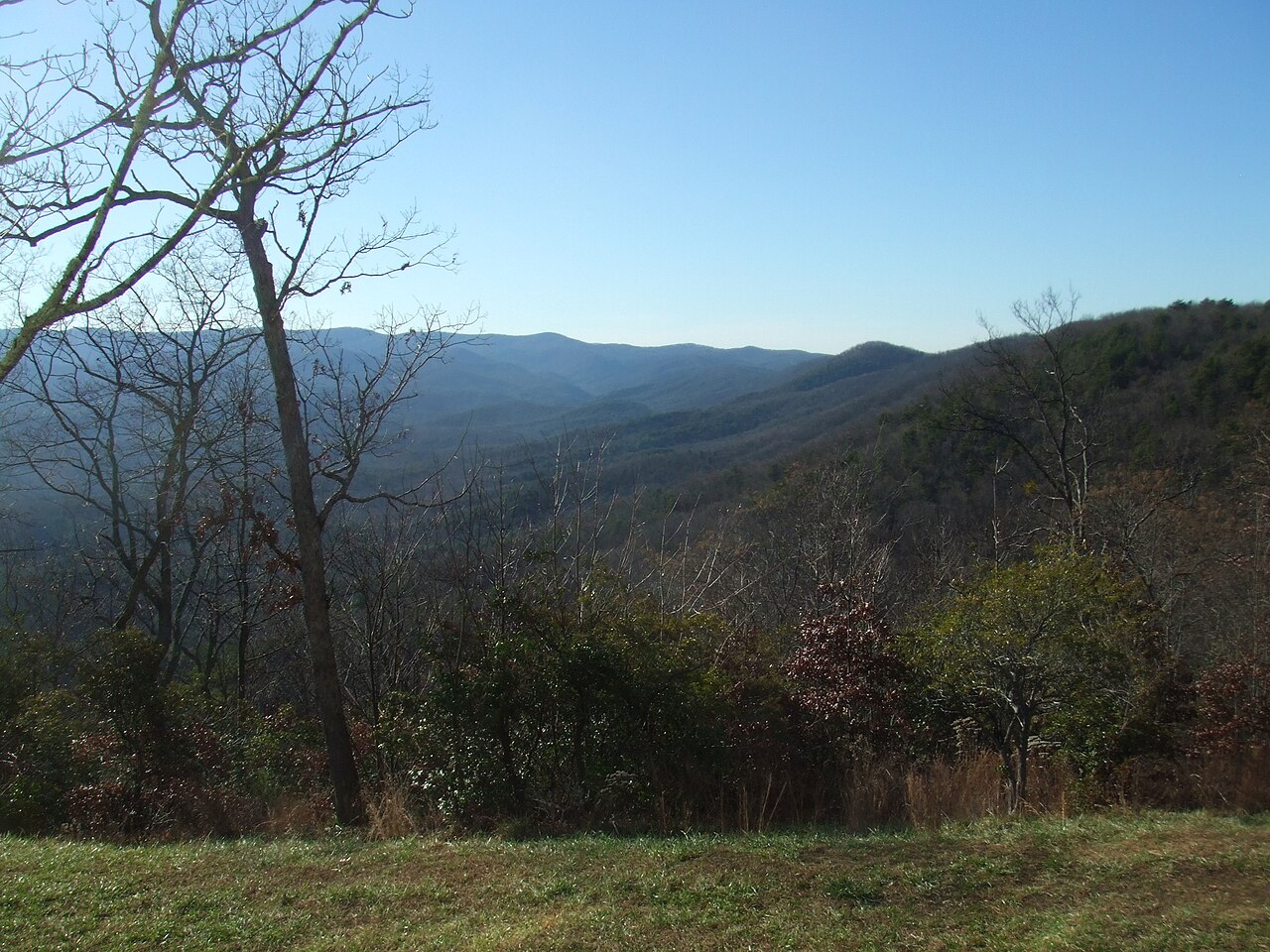
Why the Short Hike Is the Best Hike
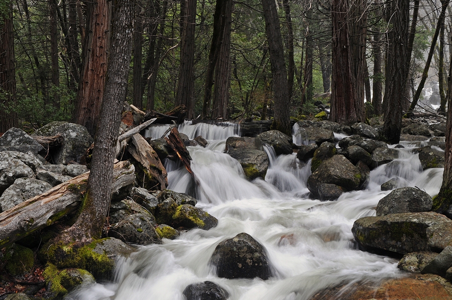
There is a stubborn myth that the best waterfalls demand a backcountry slog. The public-land record says otherwise. Some of the tallest, loudest, most photographed cataracts in the country are reached on paved paths, gravel loops, and gorge trails that a child or a grandparent can manage in under half an hour. The twelve falls in this guide were chosen on a single test: maximum drama for minimum trail. Every one is classified as a short-hike waterfall in the ChasingFalls database, and the longest documented approach here is roughly a mile and a half.
When you plot reported height against trail length, the sweet spot is obvious. Multnomah Falls in Oregon pours 620 feet down two tiers, and the paved path to Benson Bridge — the iconic footbridge spanning the gap between the upper and lower drops — runs about 0.2 miles from the lodge. Latourell Falls, a few miles west in the same Columbia River Gorge, drops 224 feet in a single plunge and is visible within 0.2 miles of the trailhead. ʻAkaka Falls on Hawaii's Big Island plunges 442 feet, and the loop through ʻAkaka Falls State Park is only about 0.4 miles. These are not consolation prizes for people who don't want to hike. They are, by any measure, the headline acts.
A word on the numbers before we rank them. Reported waterfall heights vary by source and method. A single clean plunge is easy to measure; a long cascade that bounces down a slope can be reported as a single tall figure (the full vertical drop, top to bottom) or as a series of smaller tiers. The USGS Geographic Names Information System (GNIS) catalogs the feature and its location but does not certify a height, so most heights in circulation trace back to surveys, park literature, or the World Waterfall Database. Treat the figures here as well-sourced estimates, not laboratory measurements — and know that the cascading falls in particular invite honest disagreement.
Trail lengths matter too, and the ones cited here come from the ChasingFalls field data. In a few cases that number reflects a round trip rather than a one-way walk — Taughannock Falls, for instance, is reached on a gorge trail commonly described as three-quarters of a mile each way, which lines up with the 1.5-mile figure in our data. We'll flag those cases as they come up so you can plan honestly.
The Giants You Barely Have to Walk For
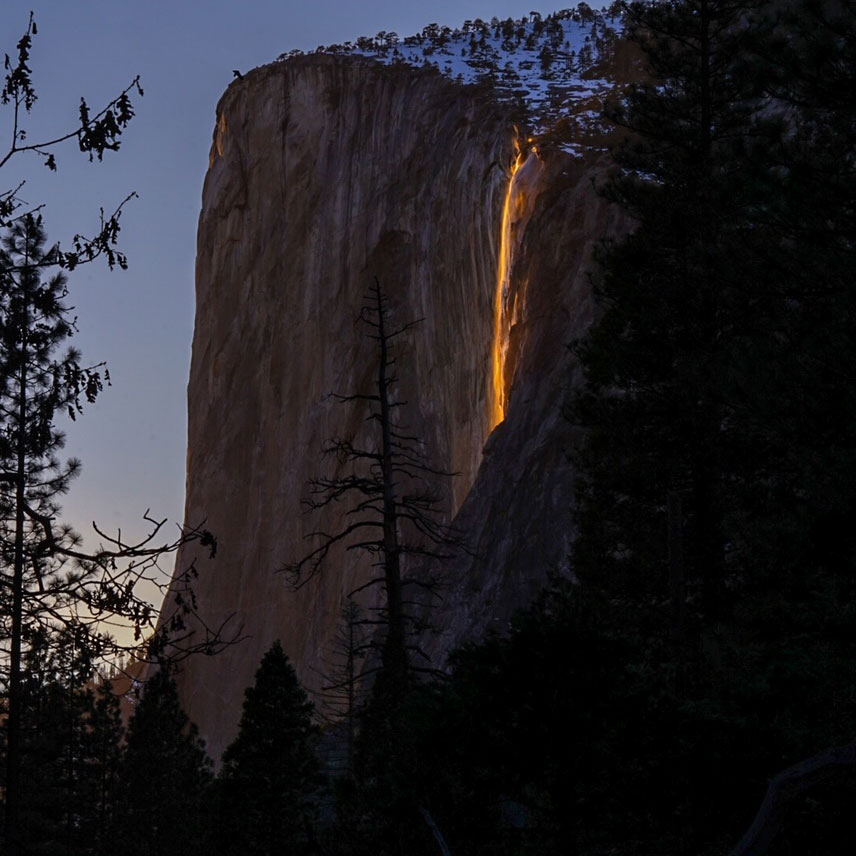
If raw height per step is the metric, four falls run away with it. Horsetail Fall in Yosemite Valley tops the list at a reported 1,570 feet, reached by a roughly 1.5-mile walk — but it comes with the heaviest asterisk on this page. That 1,570-foot figure describes the western airborne stream; counting the steep slabs below, the full descent is often cited at well over 2,000 feet. More to the point, Horsetail is a seasonal trickle that only flows reliably in winter and early spring, and its real fame is the 'firefall,' a roughly ten-minute window in mid-to-late February when, given snowmelt water and a clear western sky, the setting sun lights the water orange. Yosemite National Park manages access tightly during those weeks. If you go any other time of year, you may find the cliff dry.
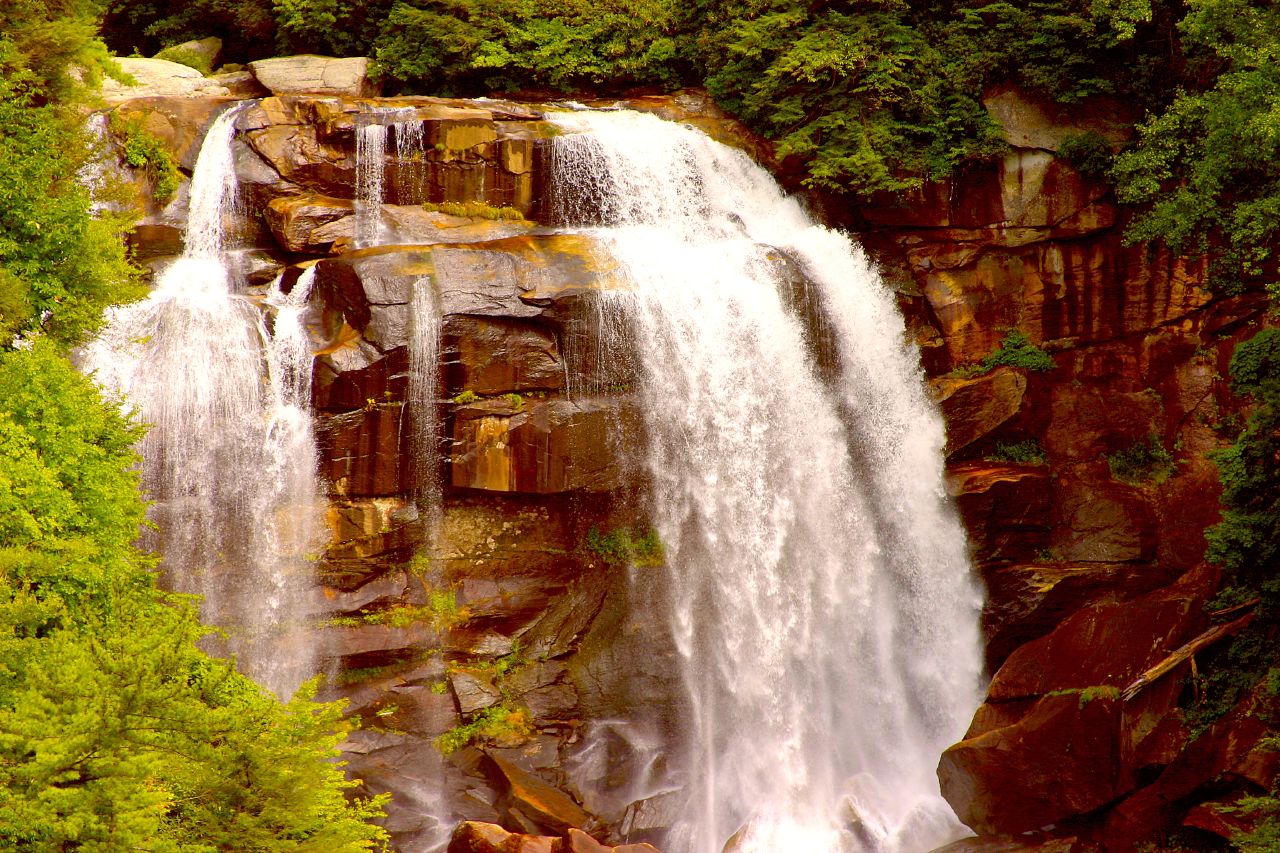
Amicalola Falls in north Georgia is the more dependable giant. At a reported 729 feet down a series of rocky tiers along Amicalola Creek, it is widely billed as the tallest cascading waterfall east of the Mississippi, and Amicalola Falls State Park has engineered the visit for payoff: a short trail of about a mile (with a well-known staircase of more than 175 steps on the steeper variants) takes you from a reflection pool at the base up alongside the cascade. Come in spring or after heavy rain (March through May) when Amicalola Creek is running full. The nearest town is Dawsonville, and the park doubles as the approach to Springer Mountain, the southern terminus of the Appalachian Trail.
Then there's the Columbia River Gorge double-header. Multnomah Falls (620 feet, two tiers, Multnomah Creek) is the most visited natural attraction in Oregon for good reason — the 0.2-mile paved climb to Benson Bridge is one of the highest payoff-to-effort ratios in the country, and because it's fed by springs and creek flow rather than pure snowmelt, it runs year-round, peaking November through May. It sits within the Columbia River Gorge National Scenic Area, managed by the U.S. Forest Service. Across the valley in Yosemite, Bridalveil Fall plunges 620 feet off the south rim of the valley; the rebuilt approach trail is about half a mile, and the show peaks with the April–June snowmelt. Two 620-foot walls of water, neither asking more than a short stroll.
The Big Plunges of the West and the Islands
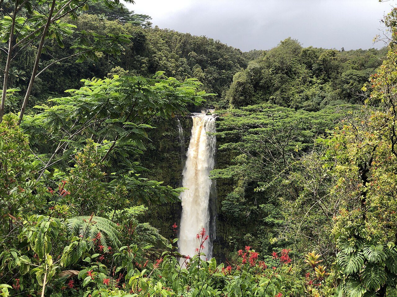
Drop into the 300-to-450-foot range and the short-hike inventory only gets richer. ʻAkaka Falls is the standout — a 442-foot free-falling plunge where Kolekole Stream pours off a cliff into a fern-draped gorge near Honomū on Hawaii's Big Island. The paved loop through ʻAkaka Falls State Park, managed by Hawaii's Division of State Parks, is roughly 0.4 miles and threads through bamboo and tropical growth. Because the Hilo side of the island is reliably wet, there is no single 'best season' in our data; the fall runs essentially year-round, though it swells after heavy rain.
Whitewater Falls in North Carolina is the tallest waterfall east of the Rockies by some reckonings, dropping a reported 411 feet in tiers on the Whitewater River inside Nantahala National Forest near Sapphire. A paved path of about 0.6 miles leads to a developed overlook; the falls run hardest with spring snowmelt and after heavy rain, March through May. A serious caution applies here that applies to many of these short walks: the easy trail ends at the overlook for a reason. People die climbing past the railings on wet rock at Whitewater. The short hike is the whole experience — stay on it.
Lower Yellowstone Falls is the thunder of the Grand Canyon of the Yellowstone: a 308-foot plunge of the entire Yellowstone River, peaking with late-spring runoff in May and June near Canyon Village. Note one important change on the ground — the famous Uncle Tom's Trail, the steep staircase that once dropped toward the base, has been permanently closed by the National Park Service. The short hike that remains is the Brink of the Lower Falls Trail, roughly 0.7 miles round trip and steep, delivering you to a platform directly over the lip where the river goes vertical. It is one of the most visceral waterfall experiences in the national park system, and it's a half-hour of walking.
The Mountain-West and Appalachian Sweet Spots
Fish Creek Falls near Steamboat Springs, Colorado, is a local institution: a 283-foot plunge on Fish Creek in Routt National Forest, reached by an easy overlook trail of about half a mile (a steeper path continues to the base for those who want it). It's a snowmelt fall, roaring in May and June and quieting through the dry summer, so time a visit for late spring if you want the full volume. The proximity to a resort town makes it one of the easiest 'big waterfall' day trips in the Rockies.
Fall Creek Falls in Tennessee anchors one of the largest state parks in the eastern United States. At a reported 256 feet, the plunge of Cane Creek is often cited among the highest free-falling waterfalls east of the Mississippi. The overlook is essentially roadside, and a trail of about a mile descends toward the base for those who want the bottom-up view. Fall Creek Falls State Park is best after winter and early-spring rain, December through April, when the Cumberland Plateau is wet; like many plateau falls, it can slow to a thin ribbon in a dry late summer.
Back in the Columbia River Gorge, Latourell Falls rewards the laziest possible walk. The 224-foot single plunge of Latourell Creek is visible roughly 0.2 miles from the trailhead in Guy W. Talbot State Park (Oregon State Parks), and it's distinctive for the wall of bright yellow-green lichen on the columnar basalt behind it. It runs best in the wet season, November through May. Pair it with Multnomah a short drive east and you have two of the Gorge's signature falls in a single easy morning.
Eastern Gorges and the Desert Surprise
Taughannock Falls in the Finger Lakes is the East's quiet giant. At 215 feet, this single free-falling plunge of Taughannock Creek is the tallest single-drop waterfall east of the Rocky Mountains — taller than Niagara, set inside a 400-foot-deep amphitheater of 400-million-year-old shale. The Gorge Trail in Taughannock Falls State Park (New York State Parks) runs a flat, wide three-quarters of a mile each way along the creek to the base; our 1.5-mile field figure reflects the round trip. It peaks with spring snowmelt, April through June, and the nearly level approach makes it one of the most family-friendly big falls in the country. The nearest town is Trumansburg, just northwest of Ithaca.
Palouse Falls is the desert wild card and the most geologically dramatic entry here. A 198-foot plunge of the Palouse River into a stark basalt canyon in eastern Washington, it was named the state's official waterfall in 2014. The canyon and falls were carved by the cataclysmic Ice Age Missoula Floods, and the landscape — sagebrush steppe, sheer black rock, a turquoise plunge pool — looks like nowhere else on this list. The trail in Palouse Falls State Park (Washington State Parks) is short, roughly 0.3 miles, with overlooks essentially at the parking area near Washtucna. It runs hardest with spring snowmelt, April through June. The cliff edges here are unfenced and deadly; the views from the maintained overlooks are the safe and complete experience.
Taken together, these twelve show the pattern clearly: a great waterfall trip is rarely a question of endurance. From a 1,570-foot seasonal cliff in Yosemite to a 198-foot desert plunge in the Washington scablands, the country's signature falls cluster around short, well-built trails managed by the National Park Service, the U.S. Forest Service, and a deep bench of excellent state park systems. The effort is small. The payoff is enormous. That is the whole point.