Why Seattle Is a Waterfall Town
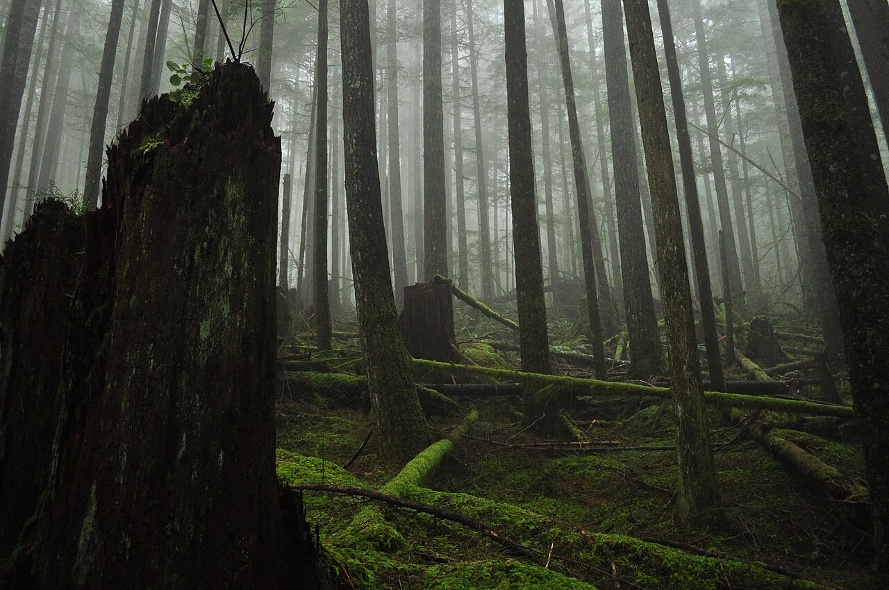
Few major American cities sit closer to so much falling water. Seattle is wedged between Puget Sound and the western front of the Cascade Range, where moist Pacific air slams into steep terrain and dumps rain and snow across a thousand-foot wall of foothills. The result is a dense cluster of waterfalls, most of them within a 90-minute drive of downtown, fed by rivers like the Snoqualmie, the Wallace, and the Boulder that drain the high country every spring.
This guide is organized the way you'd actually drive it: the Snoqualmie corridor along Interstate 90 and the small towns of Snoqualmie and North Bend; the Cascades foothills north toward Gold Bar and Index along U.S. Route 2; and the Mountain Loop country around Darrington and Granite Falls. A few in-city options on Cougar Mountain round it out for days when you don't want to leave the suburbs. Each waterfall below lists a real trail distance and a difficulty drawn from land-manager and trail-database records, so you can match the outing to your group.
One honest caveat before the heights: reported waterfall heights in Washington vary a lot depending on the source and the method. Some figures describe a single clean drop, others sum a long staircase of cascades, and a few count terrain you can't even see from the trail. Where a number is contested, this guide flags it rather than pretending to a precision the records don't support. Heights here come from the dataset behind ChasingFalls and from public sources like the Northwest Waterfall Survey and the World Waterfall Database; treat them as well-documented estimates, not surveyed certainties.
Seasonality matters more here than almost anywhere. Cascade waterfalls run on snowmelt, so the same drop that thunders in May can thin to a trickle by late August. Spring (roughly April through June) is the sweet spot for volume on the snowmelt-fed falls, while the dam-regulated Snoqualmie Falls and the year-round Wallace River keep flowing even in a dry summer. Winter brings the high-flow drama to the lowland falls but closes the higher trailheads under snow.
The Roadside Icon: Snoqualmie Falls
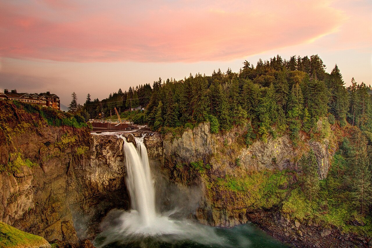
If you make one waterfall stop near Seattle, it's Snoqualmie Falls. The Snoqualmie River drops 268 feet over a basalt cliff in a single plunge taller than Niagara, just off Interstate 90 about 30 miles east of downtown near the town of Snoqualmie. It is the most-visited waterfall in the state, drawing on the order of 1.5 million people a year, and it requires essentially no hiking to enjoy — the upper viewing area is a short, paved, ADA-accessible walk from the parking lot.
The site is jointly stewarded as a public viewing park: Puget Sound Energy operates a hydroelectric plant here (it has generated power at the falls since 1898) and maintains the surrounding park alongside the City of Snoqualmie. An upper observation deck looks straight across at the plunge, and a roughly 1.4-mile round-trip trail switchbacks down to a lower viewpoint near the river. Budget a little extra time and a little extra effort for the descent — the climb back up is the only real exertion of the visit. The falls are also a sacred site to the Snoqualmie Tribe, a fact the interpretive signage at the park foregrounds.
Snoqualmie Falls is one of the few falls in this guide that's genuinely a year-round, all-weather destination. Because the river is large and partly regulated by the upstream powerhouse, it never fully runs dry. It's at its most ferocious during winter and spring high flow, roughly November through May, when snowmelt and rain swell the Snoqualmie and the spray fogs the entire gorge. That same power can make the lower viewpoint slick, so mind the railings. For travelers with limited mobility, small kids, or only an hour to spare, no other waterfall near Seattle delivers this much spectacle for this little effort.
The Snoqualmie / I-90 Corridor
East of North Bend, Interstate 90 climbs toward Snoqualmie Pass and threads past a string of approachable waterfall hikes on the South Fork Snoqualmie River. Twin Falls, in Olallie State Park, is the closest of these — a roughly 3-mile round-trip on a well-built trail that the state parks classify as moderate, climbing through old-growth Douglas fir to viewpoints of a falls that cuts through a narrow rock canyon before a final drop of about 135 feet. A footbridge between the lower and upper falls is the classic turnaround. It holds water year-round and is best in late winter and spring when the South Fork is high.
Farther up the pass, Franklin Falls is the friendliest waterfall hike in the corridor and an excellent choice for families. It's only about 2 miles round trip with roughly 400 feet of gain on Mount Baker-Snoqualmie National Forest land, ending at a misty tiered falls of around 135 feet in a rocky amphitheater on the South Fork. The trail is snow-free roughly late spring through fall; in winter it becomes a popular (and beautiful) snowshoe route, but the access road closes and you'll add miles. Because it's short, easy, and stunning, expect crowds on summer weekends — go early.
Mount Teneriffe, just outside North Bend, holds Teneriffe Falls (long known as Kamikaze Falls), a tall, sliding cascade on an unnamed creek that veils down the mountainside in tiers. The hike is about 5.6 miles round trip and earns its moderate rating with a steep final push — the trail gains gently for the first mile and then climbs hard over the last stretch to the falls viewpoint. The trail sits on Washington Department of Natural Resources land and was improved by DNR and the Mountains-to-Sound Greenway. It peaks in spring when snowmelt is at full volume; by late summer the cascade thins considerably.
For experienced hikers willing to go deeper, Otter Falls is the corridor's hidden reward. Reached via the long, flat, old-logging-grade Taylor River Trail, it's a strenuous outing of roughly 9.5 miles round trip into Mount Baker-Snoqualmie backcountry. The payoff is dramatic: a vast granite slab where water streams hundreds of feet down bare rock into the tiny pool of Lipsy Lake at its base. Sources describe the full slab as enormous (figures around 1,200 feet circulate), but you only see a portion of it from the small beach that serves as the viewpoint — a good reminder that a quoted height and what your eyes actually take in can be two very different things. Go in spring or early summer; by late summer the falls can shrink to a thread.
The U.S. 2 Foothills: Gold Bar and Index
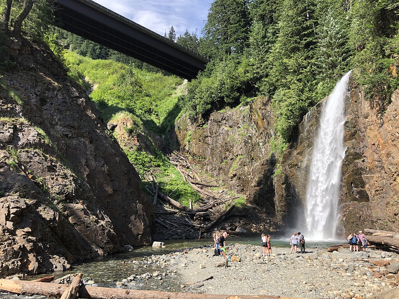
North of the interstate, U.S. Route 2 follows the Skykomish River into a second cluster of falls around the small towns of Gold Bar and Index. The headliner is Wallace Falls, the centerpiece of Wallace Falls State Park and one of the most popular waterfall hikes in the entire Puget Sound region. The classic Woody Trail runs about 5.6 miles round trip with roughly 1,500 feet of elevation gain, which earns it a solid moderate rating — manageable for fit hikers but a genuine workout with kids.
Wallace Falls is really a staircase of drops on the Wallace River, and this is exactly where height reporting gets slippery. The trail passes a Lower Falls, a Middle Falls, and an Upper Falls. The Middle Falls is the showpiece most people picture — a roughly 367-foot tiered plunge that the trail frames at a dedicated overlook, and the figure most commonly attached to the name 'Wallace Falls.' The Lower and Upper tiers add substantially more falling water above and below it, which is why you'll see different totals depending on whether a source is describing one tier or the whole cascade. However you count it, the Middle Falls viewpoint is the natural turnaround and the photo everyone comes for. The river runs year-round, with the biggest flow in spring.
A short drive east near the climbing town of Index, Bridal Veil Falls drapes down the flank of Mount Index in long, lacy tiers on Bridal Veil Creek, on Mount Baker-Snoqualmie National Forest land. The falls are reached on a moderate hike of roughly 4 miles round trip to the falls overlook; many hikers continue and combine it with the steeper climb to Lake Serene above, which turns it into a much longer and harder day. Bridal Veil is at its most photogenic in spring, when snowmelt fans the water out across the rock into the gauzy veil that gives it its name. Both of these foothill falls are far enough from the city to feel like real mountains while still being a comfortable day trip from Seattle.
The Mountain Loop and a Couple of In-Town Falls
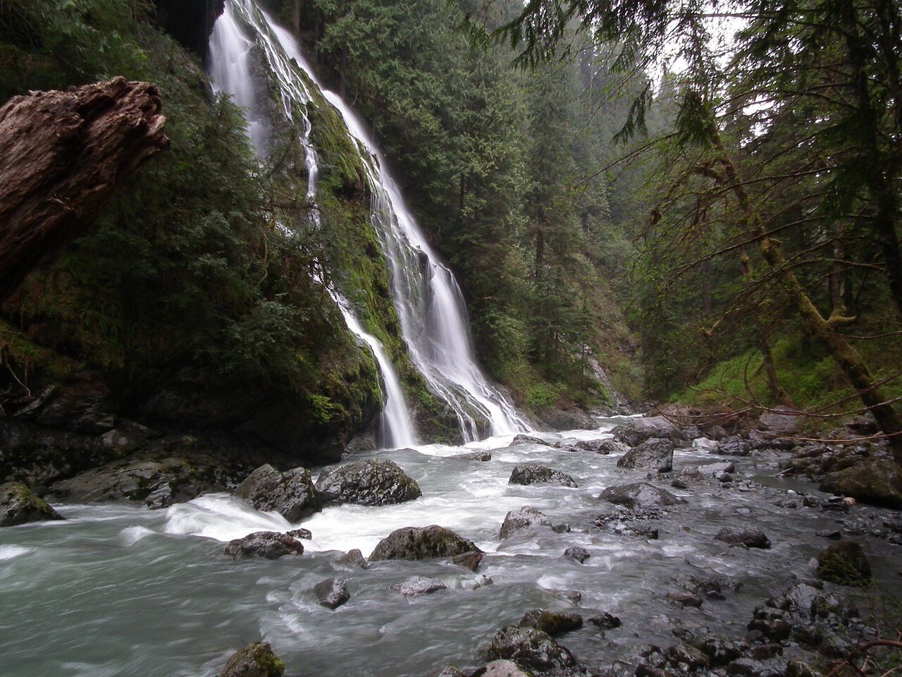
The northern reach of this waterfall country runs along the Mountain Loop Highway out of Darrington and Granite Falls, and the standout there is Feature Show Falls on the Boulder River. The Boulder River Trail follows another old railroad logging grade, which keeps the grade gentle even as it covers ground — about 8.6 miles round trip with only around 750 feet of gain, rating moderate mostly for its length rather than its steepness. Roughly partway in, twin streams pour off the canyon wall in a tall horsetail (commonly cited around 259 feet) directly across from the trail, often catching sun and mist for the 'feature show' the name promises. It runs in the Boulder River Wilderness of the Mount Baker-Snoqualmie National Forest and is best in spring once the trail is snow-free and the streams are full.
Not every waterfall near Seattle requires a mountain drive. Coal Creek Falls sits on Cougar Mountain, inside King County's Cougar Mountain Regional Wildland Park near Newcastle, deep in the suburbs east of Lake Washington. It's a modest 28-foot cascade on Coal Creek reached by an easy loop of roughly 2.2 miles through second-growth forest laced with the relics of the area's coal-mining past. Because the creek is small, this is a winter waterfall: it runs full and lovely during the wet season and can slow to a trickle in summer. For a quick after-work or rainy-day outing without leaving the metro area, it's hard to beat.
Taken together, these waterfalls map a clean weekend itinerary. A first-timer or a family might pair roadside Snoqualmie Falls with the easy Franklin Falls walk for a low-effort, high-reward day. A fit hiker chasing volume in May should aim for Wallace Falls or Feature Show Falls, both at their snowmelt peak. And anyone wanting solitude over scenery should make the long, quiet push to Otter Falls. Match the season to the source — snowmelt falls in spring, the regulated Snoqualmie any time, the small creeks in winter — and you'll catch each one at its best.
Planning Notes: Passes, Crowds, and Safety
Land access here is split across several agencies, and each has its own pass. The Forest Service trailheads — Franklin Falls, the Boulder River for Feature Show Falls, the Taylor River for Otter Falls, and Bridal Veil near Index — require a Northwest Forest Pass or a federal Interagency (America the Beautiful) pass at the trailhead. The Washington State Parks trailheads — Wallace Falls and Twin Falls in Olallie State Park — require a Discover Pass. The DNR land at Teneriffe Falls also takes a Discover Pass. Snoqualmie Falls and the King County trails at Coal Creek Falls are free. Check current requirements before you go, because parking enforcement at the popular lots is real.
Crowds are the other planning reality. Snoqualmie Falls, Franklin Falls, Wallace Falls, and Twin Falls are among the busiest trails in the region, and their lots fill early on summer and holiday weekends. Arriving before 9 a.m. — or going on a weekday, or in the shoulder seasons — transforms the experience. The longer, harder hikes (Otter Falls, Feature Show Falls, Bridal Veil) thin out naturally because the mileage filters the casual crowd.
Finally, treat falling water with respect. Wet rock near any of these falls is slick, and people are seriously injured most years by climbing on or near waterfalls in the Cascades. Stay behind railings at the developed viewpoints, keep to established trail at the wilder ones, and don't scramble onto algae-covered rock for a photo. Spring's spectacular flows are also its most dangerous — high, cold, fast water is unforgiving. Enjoy these falls at full roar from a safe vantage, and check trail conditions with the Washington Trails Association or the managing agency before any longer outing, since washouts and snow can change the math on distance and difficulty.