How to read this guide (and why it's a curated set)
Hawaii has more waterfalls than anyone has ever fully counted. The wettest spots on Earth sit on these islands — the slopes around Mount Waiʻaleʻale on Kauaʻi and Big Bog on Maui routinely log among the highest rainfall totals on the planet — and that rain feeds thousands of streams that drop off basalt cliffs into deep, green valleys. Many of the tallest are also the least reachable: Oloʻupena Falls on Molokaʻi's sea cliffs is widely cited at well over 2,500 feet and is reachable only by boat or air, with no trail at all. So this is deliberately not a list of Hawaii's biggest waterfalls. It is a curated set of five well-documented falls that a visitor can realistically connect with, ranging from roadside overlooks to a four-mile bamboo-forest hike to one you can only see from a helicopter.
We've grouped them loosely by how hard they are to reach rather than by height, because access is what actually shapes a trip. Two are essentially roadside (Wailua Falls and ʻŌpaekaʻa Falls, both on Kauaʻi). One is a short paved loop (ʻAkaka Falls on the Big Island). One is a substantial day hike (Waimoku Falls on Maui). And one is backcountry in the truest sense — Mānāwaiopuna, the 'Jurassic Falls,' sits on private, roadless land and is reached only by air. Across these five you'll cover three islands and most of the ways waterfalls present themselves in Hawaii.
One honest caveat that runs through everything below: reported waterfall heights in Hawaii vary by source and by method. A figure quoted as a 'single drop' can differ from a 'cumulative' measurement that adds up a tiered cascade, and historical surveys, the U.S. Geological Survey's Geographic Names Information System (GNIS), state parks signage, and the privately maintained World Waterfall Database don't always agree. ʻAkaka Falls is the clearest example — Hawaii's Division of State Parks and most local guides cite 442 feet, while the World Waterfall Database lists roughly 422 feet. We give the most commonly documented number for each fall and flag the disagreement rather than pretending to a precision the records don't support.
ʻAkaka Falls — the tall, easy one (Big Island)
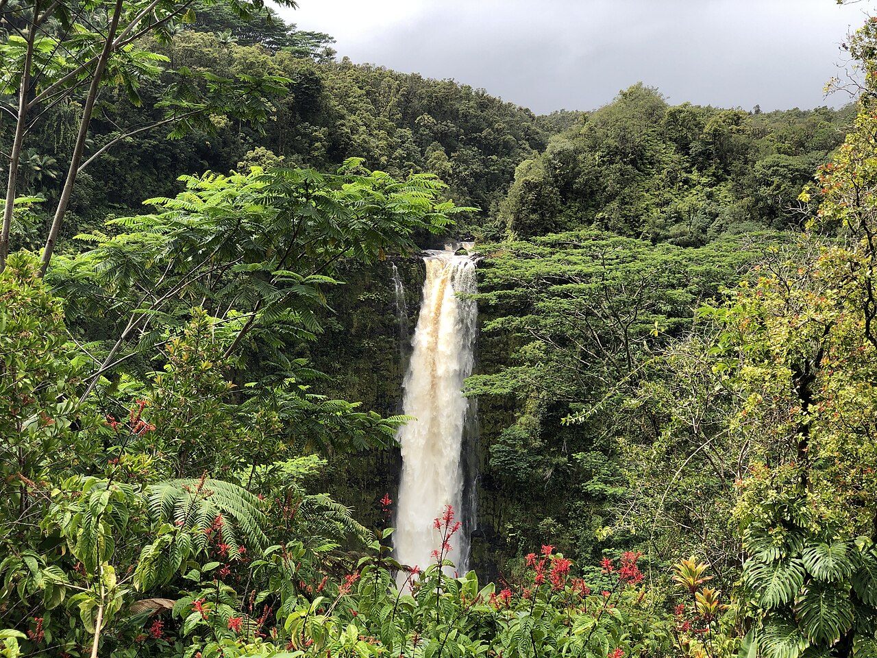
If you only have time for one waterfall on the Big Island, ʻAkaka Falls is the standard recommendation, and for good reason: it delivers an enormous single plunge for very little effort. ʻAkaka Falls drops about 442 feet where Kolekole Stream pours over the lip of a steep, fern-draped gorge — a clean, free-falling ribbon rather than a stair-stepped cascade. It sits inside ʻAkaka Falls State Park, managed by Hawaii's Department of Land and Natural Resources (DLNR) Division of State Parks, near the small former sugar town of Honomū, roughly 11 miles north of Hilo on the windward (rainy) side of the island.
Access is a paved loop trail of about 0.4 miles. It is short but not flat — the route descends and climbs through dense rainforest with multiple sets of steps, so it is not wheelchair accessible, but most reasonably mobile visitors finish the loop in around half an hour. Walking the loop in the recommended direction brings you to the main ʻAkaka overlook and also past Kahūnā Falls, a separate drop on the same gorge often cited around 300 feet, plus several smaller cascades. There is a parking and entrance fee for non-residents, and the lot is small, so early mornings are calmer.
On timing: because this is the windward Hāmākua coast, the stream runs year-round and the falls rarely disappear, which makes ʻAkaka a more reliable bet than the seasonal, rain-dependent falls common elsewhere in the islands. The trade-off is weather — the same moisture that keeps the falls flowing means frequent passing showers and mist. Mornings tend to offer the best light into the gorge and the best odds of clear viewing before afternoon clouds build over the Hilo side.
Waimoku Falls — the hike worth taking (Maui)
Waimoku Falls is the payoff at the end of the Pīpīwai Trail in the Kīpahulu District of Haleakalā National Park, on Maui's remote southeast coast near Hāna. It is a tall, thin plunge — commonly documented around 400 feet — that drips down a sheer, undercut rock face fed by Pīpīwai Stream. It is often described as the tallest single-drop waterfall easily hikeable on Maui, and standing near its base, with the cliff towering overhead, is the reason people make the long drive past Hāna to get here.
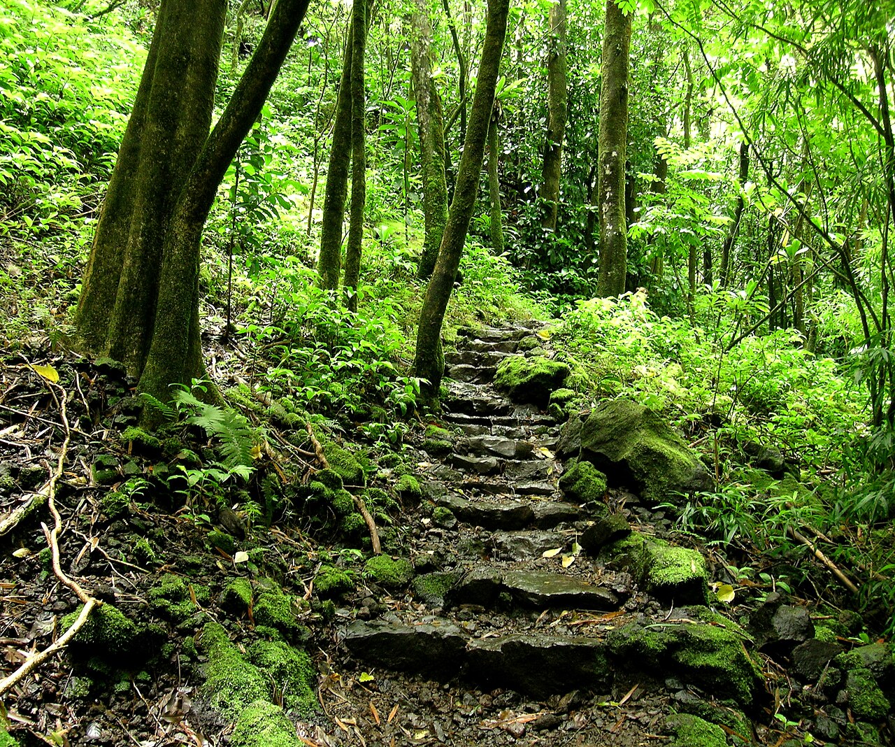
This is the most demanding of the five falls in this guide. The out-and-back Pīpīwai Trail runs roughly 4 miles round trip (some sources put it near 3.6 to 4 miles) with a few hundred feet of elevation gain. What makes it memorable isn't just the destination — the trail passes overlooks, crosses a boardwalk through a dense, dark bamboo forest, and offers views of other cascades on the way up. Because it's inside Haleakalā National Park, the standard NPS entrance fee applies, and the Kīpahulu area is a long, winding drive (the famed Road to Hāna and beyond), so most visitors plan it as a full-day outing rather than a quick stop.
Safety and timing matter more here than at any roadside overlook. The Pīpīwai drainage is prone to flash flooding, and rockfall near the base of Waimoku is a genuine hazard — the NPS advises against hiking under threat of heavy rain and against entering the water at the base. Flow is strongest after rain, but that's also exactly when the stream crossings and flash-flood risk are worst, so the goal is a recently-rained, currently-clear window. Check the forecast, start early, and turn around if water levels are rising.
Wailua Falls and ʻŌpaekaʻa Falls — Kauaʻi's roadside pair
On Kauaʻi's east side you can see two substantial waterfalls without committing to a hike, which makes this pair ideal for travelers short on time or hiking ability. Wailua Falls is the more dramatic of the two: a roughly 173-foot drop on the South Fork of the Wailua River, viewed from a short, paved, essentially roadside overlook at the end of Maʻalo Road (Route 583), about a 15-minute drive north of Līhuʻe. It's a segmented fall — at higher flows the water splits into two or more parallel ribbons — and it's famous enough to have served as the opening shot of the old television series Fantasy Island. Mornings are the classic time to visit, when sun angles into the spray and rainbows often form below the falls.
ʻŌpaekaʻa Falls is the gentler companion, a 151-foot plunge on ʻŌpaekaʻa Stream within Wailua River State Park, reached from a clearly signed lookout about two miles up Kuamoʻo Road (Route 580). The name means roughly 'rolling shrimp,' a reference to the freshwater ʻopae once abundant in the stream. The overlook is convenient and family-friendly, with parking, picnic tables, and restrooms nearby, and the view across the valley pairs well with the Wailua River overlook on the opposite side of the same road.
A clear word of caution for both: these are view-only stops, not swimming holes. There is no sanctioned trail down to the base of either fall. At ʻŌpaekaʻa, an unofficial scramble path was fenced off in 2006 after two visitors died trying to reach the pool, and the cliffs above both rivers are loose and steep. The honest, responsible move is to enjoy them from the railings. Because both are river-fed on Kauaʻi's wetter side, they flow year-round, but they swell noticeably and turn brown after heavy rain — which is when they look most powerful and least like a postcard.
Mānāwaiopuna ('Jurassic Falls') — the one you can't walk to (Kauaʻi)
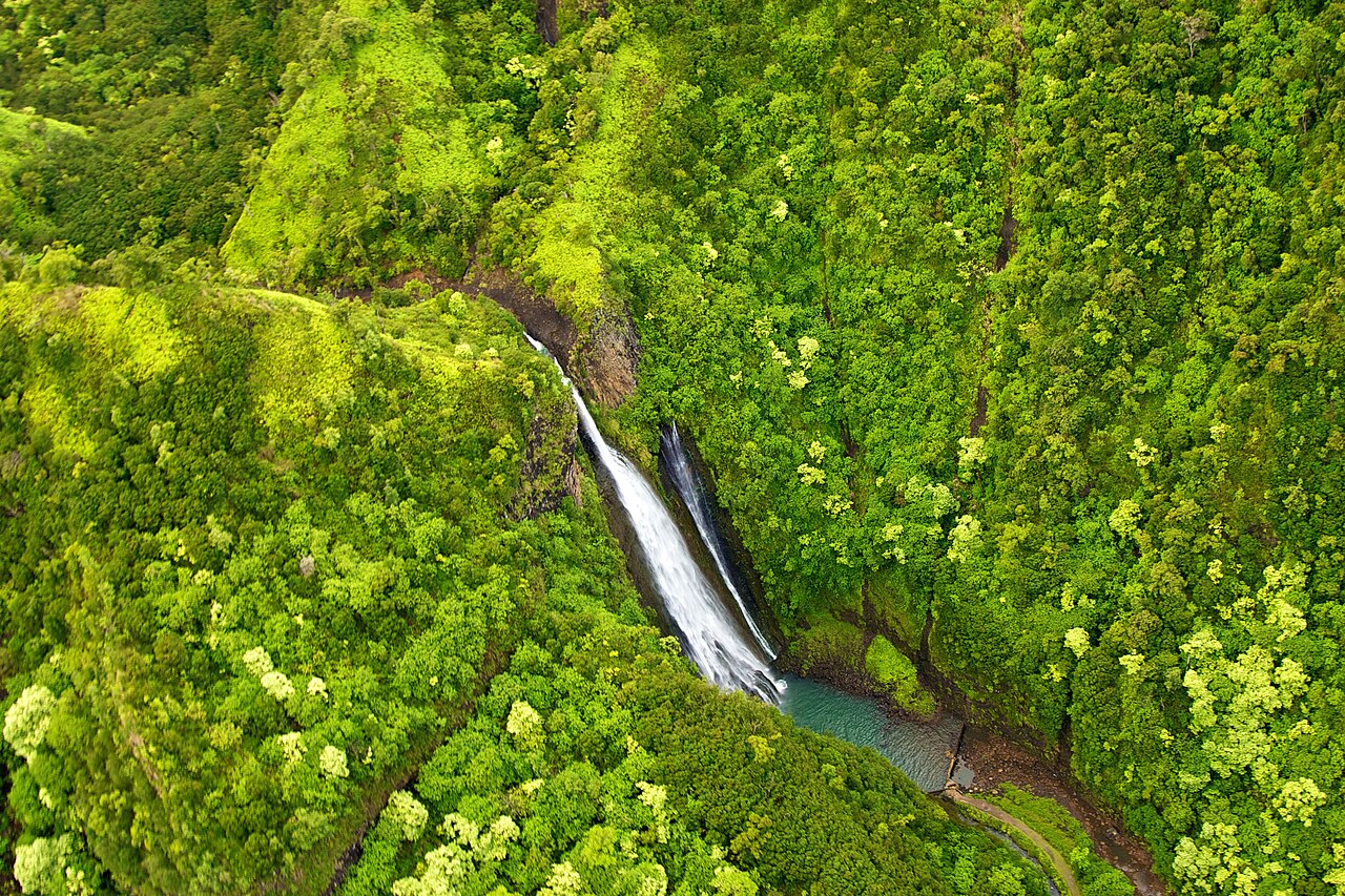
Mānāwaiopuna Falls — known to most visitors as 'Jurassic Falls' — is the outlier in this guide, included precisely because it represents a category that defines so much of Hawaii: spectacular waterfalls on land you simply cannot reach on foot. It is a roughly 400-foot plunge tucked in Hanapēpē Valley on Kauaʻi's drier southwest side, inland from the small town of ʻEleʻele. It earned its nickname by appearing in the background of the 1993 film Jurassic Park, and it has been a sought-after sight ever since.
There is no public trail and no roadside view. The falls sit on rugged, roadless, privately owned land, and the only practical way to see them is from the air. Helicopter landings at the base were prohibited until 2009, when one operator (Island Helicopters) received permission to land a limited number of times per week; most other tours view the falls from the air without landing. That means seeing Mānāwaiopuna is a paid, weather-dependent helicopter excursion, not a hike — a very different proposition from the other four falls here, and one worth setting expectations around before a trip.
Because access is by air and the surrounding land is private, the usual public-records details (a named managing agency, an official trail) don't apply the way they do for a state park or a national park unit — which is itself instructive about how Hawaii's waterfalls are distributed. The most photogenic ones are frequently the ones the public can't legally walk to. If you go, the same windward-rainfall logic applies: flow is heaviest in the wetter months and after storms, and tours are routinely grounded or rerouted when weather closes in over the valley.
Practical planning across the islands
These five falls span three islands, so seeing all of them means inter-island flights — ʻAkaka on Hawaiʻi Island (Big Island), Waimoku on Maui, and Wailua, ʻŌpaekaʻa, and Mānāwaiopuna on Kauaʻi. Within each island, plan around the geography: ʻAkaka pairs naturally with a Hilo and Hāmākua-coast day; Waimoku is an all-day commitment built around the drive past Hāna into Haleakalā's Kīpahulu District; and the three Kauaʻi falls cluster on the east and southwest sides, with the two roadside overlooks easily combined in a single morning out of Līhuʻe.
On seasonality, the honest answer is that none of these has a single 'best month' in the public record, and we've deliberately not invented one. The general pattern across Hawaii is that winter (roughly November through March) is the wetter season, which means fuller, more dramatic flow — and also more flash-flood risk, more closures, and muddier water. Summer trades some volume for steadier weather and clearer viewing. The river-fed falls (ʻAkaka, Wailua, ʻŌpaekaʻa) run year-round; the hike to Waimoku and the helicopter trip to Mānāwaiopuna are the ones most affected by storms, both for flow and for safety.
Two practical reminders tie everything together. First, respect the barriers: Hawaii's waterfall pools and the cliffs above them have caused real injuries and deaths, and several viewpoints here are fenced for that reason — admire from the overlook. Second, treat the height figures as approximate. We've used the most commonly documented numbers (442 feet for ʻAkaka, ~400 for Waimoku and Mānāwaiopuna, 173 for Wailua, 151 for ʻŌpaekaʻa), but cross-checking GNIS, the World Waterfall Database, and the relevant land manager is the right move before quoting any of them as exact.