How to read this guide (and a note on names and heights)
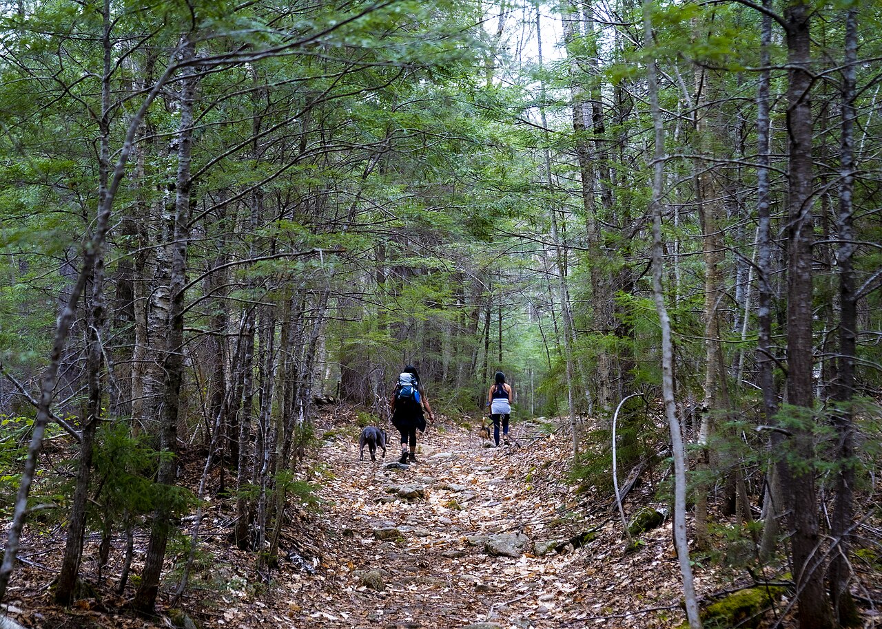
The White Mountains of New Hampshire and western Maine are one of the densest concentrations of accessible waterfalls in the eastern United States. Most of the land is the White Mountain National Forest, managed by the U.S. Forest Service, threaded by glacially carved passes the locals call notches — Franconia, Crawford, Pinkham — and by the Kancamagus Highway, the 34.5-mile scenic road that links Lincoln and Conway. Steep granite, heavy snowpack, and a short violent spring melt mean the brooks run hard from April into June and then settle down. This is a curated set of the region's strongest falls, not a complete census; if a brook you love isn't here, that's a limit of scope.
A note on names first, because it matters for this title. There is more than one 'White Mountains' in the country. The famous one is here in northern New England. But Arizona also has a range called the White Mountains, in the east-central part of the state on and around the Fort Apache Indian Reservation, home to falls like Pacheta Falls and Cibecue Falls. Those are real and worth knowing about, but they are a continent away and a completely different trip — different agency, different climate, different permits. This guide is about the New England White Mountains, and we flag the Arizona namesakes in their own short section at the end so nobody books the wrong flight.
A word on the numbers, too, because waterfall heights are slipperier than they look. A reported height depends on how someone measured it: the tallest single uninterrupted plunge, or the cumulative drop of a multi-tier cascade summed from the lip of the first tier to the base of the last. Tall White Mountain figures — the 300 feet often quoted for Nancy Cascades, the 250 for Silver Cascade — are cumulative cascade lengths, not single sheets of falling water. Different sources, using different methods, disagree by tens of feet. We give the commonly documented figures and flag where a number is a cumulative cascade rather than a clean plunge. Trail distances below are round-trip unless noted; check the managing agency for current conditions before you go.
We've grouped the falls by the kind of trip they make: the roadside and short-walk falls of the notches that anyone can reach, the tall-drop day hikes of the Kancamagus and Franconia, and a pair of quieter falls just over the line in western Maine.
The roadside and short-walk falls of the notches
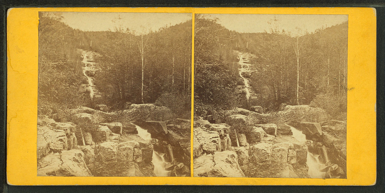
If you have an afternoon and don't want to commit to a real hike, the notches deliver. Silver Cascade is the easiest waterfall in the White Mountains to see: it pours roughly 250 feet down the east wall of Crawford Notch right beside U.S. Route 302, in Crawford Notch State Park near Hart's Location, with a pullout at the base. There is no trail to speak of — you walk a few steps from the car. Because it is fed by a small high brook rather than a major river, it is at its best during spring snowmelt from April into June; by late summer it can thin to a trickle. It is the classic 'first waterfall of the trip' on the drive north.
Glen Ellis Falls sits on the other side of the range in Pinkham Notch, where the Ellis River drops about 64 feet in a single clean plunge into a pool. It is a short, well-built trail of roughly 0.6 mile round trip from a Forest Service parking area off NH Route 16 near Jackson, including a stone stairway that descends to viewing platforms below the falls. It is one of the most photographed falls in the Whites and, like most of these, peaks with the April-to-June melt. The plunge form means it holds water better than the thin cascades, so it is a more reliable mid-summer stop than Silver Cascade.
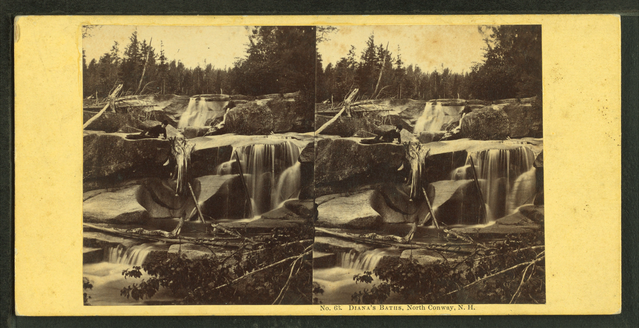
Sabbaday Falls is the showpiece of the Kancamagus Highway itself — a 38-foot tiered fall where Sabbaday Brook squeezes through a narrow flume of rock, reached by an easy, partly accessible 0.7-mile round-trip Forest Service trail with railings and viewing decks. Diana's Baths, near Bartlett, is the family favorite: a staircase of small drops on Lucy Brook totaling around 80 feet, reached by a flat, popular 1.2-mile round-trip walk on Forest Service land. Both are easy, both are best in late spring, and both get busy — arrive early, and remember that a recreation pass or parking fee applies at the Forest Service lots.
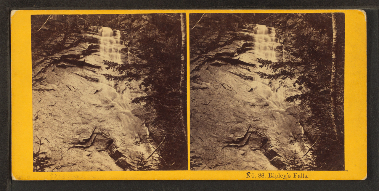
Avalanche Falls and Ripley Falls round out the short-walk group, both in the Crawford-Franconia corridor. Avalanche Falls is the 45-foot cascade at the top of the Flume Gorge boardwalk in Franconia Notch State Park near Lincoln — you reach it on the paid, roughly 2-mile gorge loop, typically open spring through fall, where Flume Brook funnels through a slot of granite. Ripley Falls is a 100-foot horsetail slide of Avalanche Brook in Crawford Notch, reached by a steeper but short trail of about 1.1 miles round trip; it runs spring through fall and rewards the modest climb.
The tall-drop day hikes: Kancamagus, Crawford, and Franconia
For the bigger falls you have to earn the view. Arethusa Falls, off U.S. 302 near Hart's Location, is the single most impressive plunge that most visitors can reach on a normal day hike: a roughly 140-foot horsetail of Bemis Brook, frequently cited as among the tallest waterfalls in New Hampshire. The Arethusa Falls Trail runs about 2.9 miles round trip and is rated moderate, climbing steadily through hemlock forest in Crawford Notch State Park and the White Mountain National Forest. It runs late spring through fall and, unlike the snowmelt-only cascades, carries enough water to be worth a trip even in summer.
Nancy Cascades is the heavyweight by raw number. Nancy Brook tumbles a cumulative 300 feet in a tiered series of drops on the slopes above Livermore, reached by a moderate hike of about 5 miles round trip through the national forest. Treat the 300-foot figure as cascade length, not a single plunge — it is the summed drop of multiple tiers, which is how big New England cascade numbers are usually built. It is best from late spring through fall, and the longer approach keeps the crowds down compared with the roadside falls.
On the Kancamagus and in the western notch, Cloudland Falls is the classic destination. It is an 80-foot fan-shaped fall of Dry Brook reached on the Falling Waters Trail in Franconia Notch State Park near Franconia — a moderate hike of roughly 2.8 miles round trip that, true to its name, passes a sequence of cascades (Stairs and Swiftwater among them) on the way up. The Falling Waters Trail is also the standard ascent of the Franconia Ridge loop, so Cloudland makes a strong half-day turnaround if you don't want the full ridge. Like the high cascades it peaks with the April-to-June melt.
Bridal Veil Falls completes the Franconia-area set. It is an 80-foot tiered fall of Coppermine Brook above the town of Franconia, reached by the Coppermine Trail at about 5 miles round trip, moderate, with a good flow from spring snowmelt through fall. The longer walk and the off-the-highway trailhead make it noticeably quieter than Cloudland or Diana's Baths, which is part of the appeal.
Just over the line: the western Maine falls
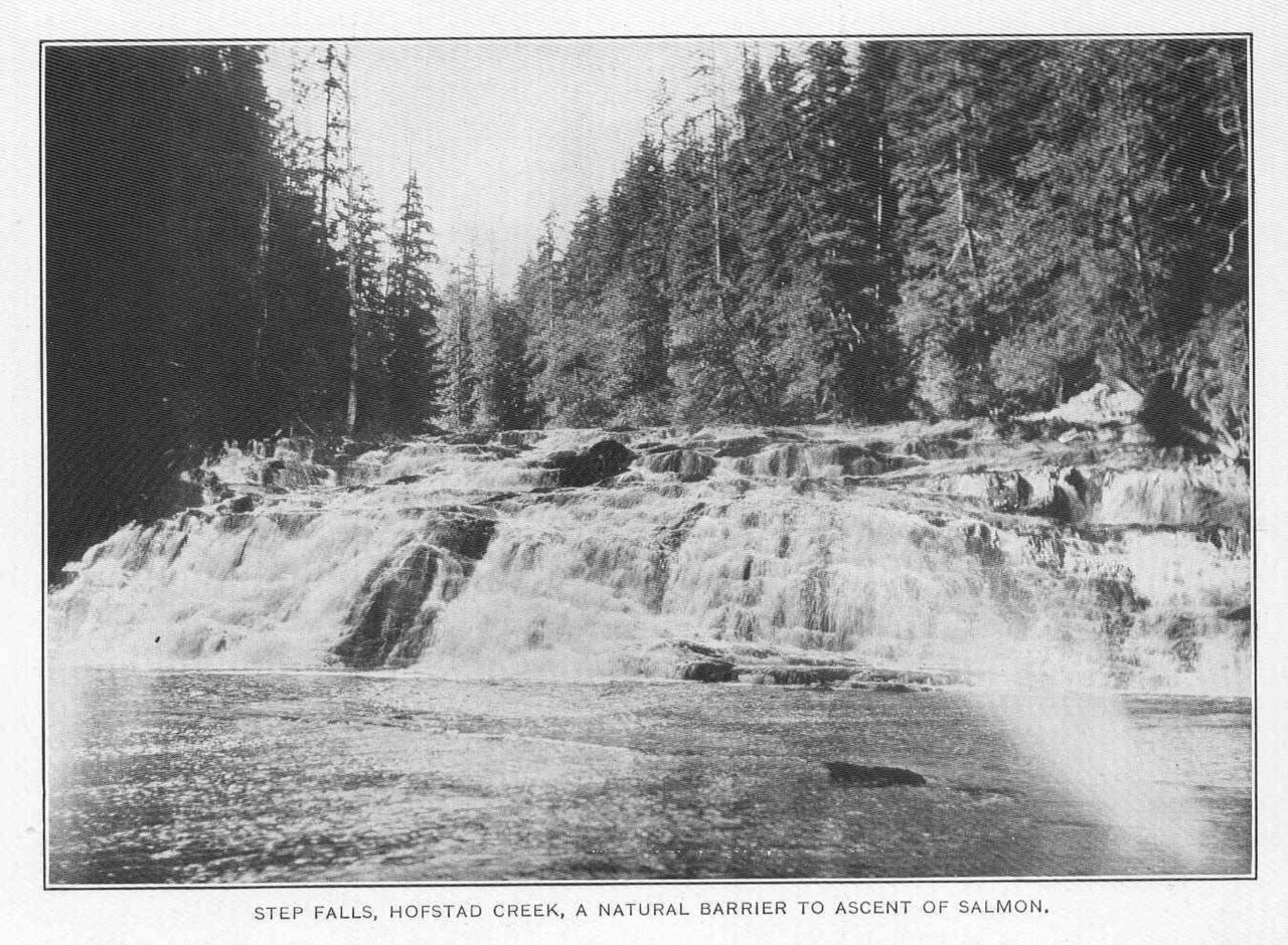
The White Mountains spill across the state line into western Maine, and two falls there belong on any serious list. Step Falls, near Newry, is the easiest to love: Wight Brook descends a long granite staircase of roughly 250 feet (cumulative cascade length, not a single drop) inside the Step Falls Preserve, owned and managed by the Mahoosuc Land Trust. A moderate trail of about 1.5 miles round trip follows the brook past pool after pool. It is best in spring and early summer when the brook is full, and because it is a land-trust preserve rather than a national-forest site, it offers a quieter, fee-free alternative to the New Hampshire crowds — just respect the preserve's rules and stay on the trail.
Dunn Falls, near Andover, is the more rugged of the two. The West Branch of the Ellis River drops in tiers totaling around 80 feet in a steep gorge, reached on a moderate hike of roughly 3.2 miles round trip that uses a section of the Appalachian National Scenic Trail through the Mahoosuc region. There are effectively two falls here — an upper and a lower drop — and the terrain is steeper and rootier than the New Hampshire short-walks, so allow time and wear real footwear. It runs late spring to fall, May through October, with the strongest flow earlier in that window.
Both Maine falls reward the slightly longer drive east. They sit on the same granite, fed by the same heavy snowpack, but see a fraction of the traffic of Franconia Notch. If your goal is a waterfall day without a parking-lot scrum, the Maine side of the range is the move.
A note on the other White Mountains: the Arizona namesakes
Because of the title, it's worth being explicit: two of the falls people search for under 'White Mountain waterfalls' are not in New England at all. Pacheta Falls and Cibecue Falls are in the White Mountains of east-central Arizona, on the Fort Apache Indian Reservation, managed by the White Mountain Apache Tribe. Pacheta Falls is a plunge of roughly 130 feet on Pacheta Creek, reached by a moderate hike of about 2.5 miles round trip near Whiteriver; Cibecue Falls is a roughly 30-foot plunge on Cibecue Creek, about 4 miles round trip and moderate, near the community of Cibecue. Both are at their best in spring, when desert snowmelt and runoff are highest.
These are genuinely worthwhile, but they are a different country entirely from the New Hampshire notches — high desert canyon rather than glaciated northern forest. The most important practical difference is access: the falls sit on tribal land, and visiting requires a recreation or hiking permit from the White Mountain Apache Tribe's Game and Fish department, with rules that change seasonally. Never assume open access. If your search for 'best waterfalls in the White Mountains' was about Arizona, plan around tribal permits and current conditions; if it was about New England, everything above this section is your trip.
We mention them here so the disambiguation is honest and complete. The ranking and the trip advice in the rest of this guide are about New Hampshire and western Maine.
Picking your trip: season, effort, and crowds
The single most important variable in the White Mountains is water, and water means season. These falls are snowmelt-driven: the brooks roar from roughly April into June and then drop, sometimes dramatically. The thin high cascades — Silver Cascade, Cloudland, Sabbaday — are spring-and-early-summer falls; by August several are shadows of their May selves. The plunge and horsetail falls fed by larger streams — Glen Ellis, Arethusa, Ripley — hold water better and stay worthwhile through summer and into the famous New England fall foliage in late September and early October, when the falls plus the color make for the best photography of the year.
Match effort to your group. For roadside or near-roadside payoff, go to Silver Cascade (no hike), Glen Ellis Falls (0.6 mile), Sabbaday Falls (0.7 mile), Diana's Baths (1.2 miles), or Ripley Falls (1.1 miles). For a real but moderate day hike, choose Arethusa Falls (2.9 miles), Cloudland Falls (2.8 miles), or Dunn Falls in Maine (3.2 miles). For the longer, quieter walks, take Bridal Veil Falls or Nancy Cascades, both around 5 miles round trip. Step Falls (1.5 miles) is the gentlest of the Maine options and a good family pick.
A few logistics. Most New Hampshire falls here sit on White Mountain National Forest land or in state parks, so expect a parking fee or a Forest Service recreation pass, and at Flume Gorge a paid admission for the Avalanche Falls loop. Trails are rocky, roots are slick when wet, and the most-photographed falls (Diana's Baths, Sabbaday, Glen Ellis) fill their lots by mid-morning on summer and foliage weekends — arrive early. Always check the managing agency for current trail and road status before you drive: the Forest Service, New Hampshire State Parks, and the Mahoosuc Land Trust all post conditions, and spring high water can make brook crossings genuinely dangerous.