How to use this guide (and a note on heights)
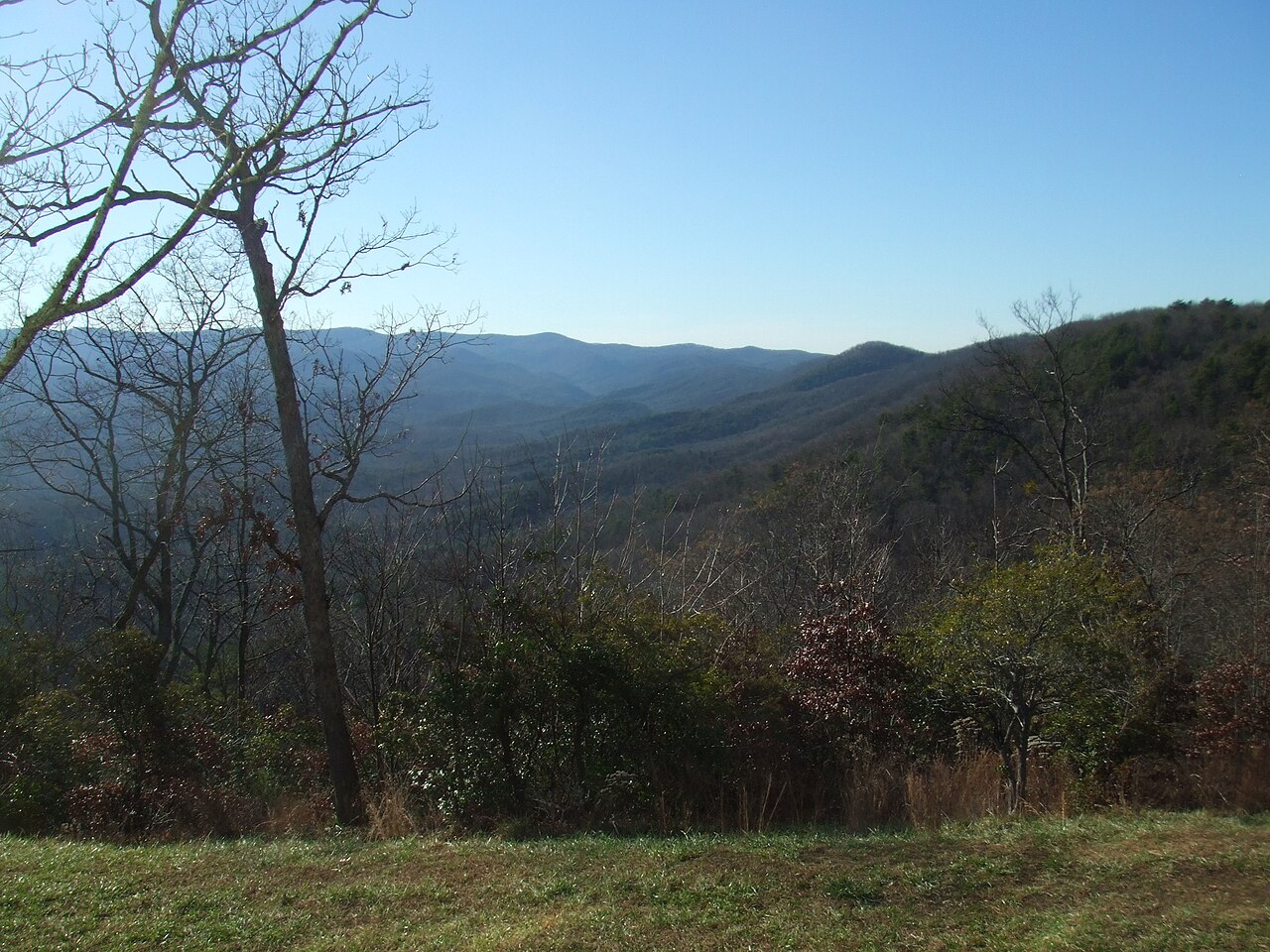
Atlanta sits in the Piedmont, where rivers run slow and wide and the land barely tilts. Drive an hour or two north, though, and the ground stands up: the southern end of the Blue Ridge Mountains crowds into a handful of North Georgia counties, and the Chattahoochee River and its tributaries spill off that escarpment. That edge — roughly the arc from Dawsonville and Dahlonega east through Helen, Clayton, and Tallulah Falls — is where nearly every waterfall worth driving for is concentrated. Most of the falls in this guide are between 60 and 120 minutes from downtown, which makes them genuine day trips rather than weekend expeditions.
Every waterfall named here is drawn from public land-manager records (the U.S. Forest Service, Georgia State Parks, and the U.S. Geological Survey's Geographic Names Information System) or, in one case, a private college that has long welcomed visitors. We have not invented heights, trail mileages, or coordinates. Where a figure appears, it comes from a managing agency or a recognized waterfall database, and where sources disagree we say so rather than pretend to a precision the records don't support.
That caveat matters most with height. Waterfall heights in Georgia are notoriously inconsistent between sources, because a 'waterfall' rarely has a clean top and bottom — many North Georgia falls are long, tiered cascades where one observer measures the single biggest drop and another measures the entire run of whitewater. Amicalola Falls is the classic example: it is widely cited at 729 feet, but that figure describes a series of cascades and a steep run of creek, not a single free-falling curtain. Read the numbers in this guide as useful orientation, not surveyor-grade fact.
A few practical notes. Spring (March through May) and the days right after heavy rain are the best windows for nearly all of these falls; many North Georgia creeks shrink to a trickle in late summer. Several sites — Amicalola Falls and Tallulah Gorge among them — are inside Georgia State Parks that charge a parking fee, and Forest Service trailheads such as Anna Ruby Falls and Dukes Creek Falls typically require a small day-use fee or pass. Always confirm current fees, hours, and any release schedules with the managing agency before you go.
The Dawson County giants: Amicalola and Cochrans
The closest serious waterfall to Atlanta — and the most famous in the state — is Amicalola Falls, near Dawsonville, about an hour and a quarter from downtown. At a widely cited 729 feet it is the tallest waterfall in Georgia and one of the tallest east of the Mississippi, though as noted above that figure measures a tiered cascade rather than a single plunge. The falls anchor Amicalola Falls State Park, run by Georgia State Parks, on Little Amicalola Creek. The name comes from a Cherokee word usually translated as 'tumbling waters,' and the park is also the staging point for the approach trail to the southern terminus of the Appalachian Trail at Springer Mountain.
Access is unusually flexible. You can drive to overlooks at the base and near the top and see the falls with almost no walking, or you can climb the roughly one-mile trail that includes a long staircase of more than 400 steps running alongside the cascade — rated moderate mainly because of those stairs and the elevation change. It is the rare Georgia waterfall that's genuinely doable for a wide range of visitors, which is part of why it's so heavily visited; expect crowds on spring and fall weekends. Plan your visit for spring or just after heavy rain, when the volume over the rock is at its most dramatic.
A few miles away, and a world apart in effort, is Cochrans Falls — sometimes cited as one of the tallest in Georgia at around 600 feet, again as a long cascade rather than a clean drop. It sits on Cochran Creek inside the Dawson Forest Wildlife Management Area, and reaching it is a strenuous backcountry undertaking: roughly 4.6 miles of rough, unsignposted hiking with creek crossings and route-finding, best attempted in the high-flow window of late winter and early spring (February through April), when the falls actually run. This is not a casual outing; it rewards experienced hikers comfortable navigating without a maintained trail, and it can disappoint in dry months when flow drops off.
Together these two falls bracket the range of what North Georgia offers: Amicalola is the accessible, fee-park headliner you can share with grandparents and toddlers, while Cochrans is the obscure, hard-won objective that most visitors will only ever read about. Both are on Little Amicalola Creek's broader watershed and both are best in spring, but they ask very different things of you.
The Helen corridor: Anna Ruby, Dukes Creek, DeSoto, and Raven Cliff
The Bavarian-themed tourist town of Helen, about 90 minutes to two hours from Atlanta, is the natural base for a cluster of falls in the Chattahoochee-Oconee National Forest. The most popular is Anna Ruby Falls, a striking segmented double waterfall where Curtis Creek and York Creek drop side by side — about 153 feet and 50 feet respectively — to join and form Smith Creek. A paved, roughly 0.9-mile round-trip trail leads from the Forest Service visitor area to a viewing platform; it's rated easy and is one of the few falls in this guide that's reasonably stroller- and wheelchair-friendly, though there is a fee to enter. Spring is the prime season for flow.
A short drive away on the Russell-Brasstown Scenic Byway, Dukes Creek Falls drops roughly 150 feet in tiers on what's variously described as Davis Creek and Dukes Creek. The trail is about 2.3 miles round trip, rated moderate, descending via switchbacks and boardwalks to viewing decks near the confluence — a steady climb back out is the main challenge. Nearby DeSoto Falls, closer to Dahlonega, is a more relaxed outing: a tiered falls of about 200 feet total on Frogtown Creek, reached by an easy trail of roughly 2.1 miles within a Forest Service recreation area, with separate spurs to an upper and a lower falls. Both are classic Chattahoochee-headwaters cascades and shine in spring and after rain.
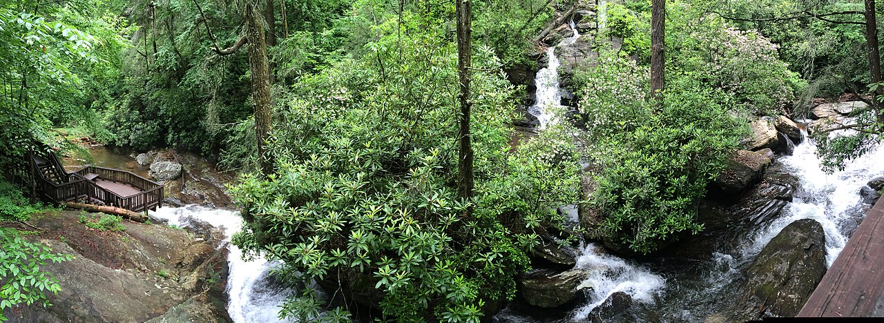
For hikers wanting more of a day, Raven Cliff Falls is the standout. The trail runs about 5 miles round trip on a gentle-to-moderate grade through the Raven Cliffs Wilderness, following Dodd Creek past a string of small cascades before arriving at the main event: an unusual roughly 100-foot tiered fall that pours through a dramatic split in a tall rock cliff, with water visible inside the cleft. Because it's a wilderness area, expect a primitive, unmarked-by-signs experience and pack accordingly. The longer mileage and the streamside scenery make it one of the most rewarding hikes in North Georgia, particularly in spring when Dodd Creek is full.
All four of these sit within a compact arc north of Helen, which makes the corridor the single most efficient base for a waterfall-focused day or weekend out of Atlanta. A reasonable itinerary pairs the easy, family-friendly Anna Ruby Falls in the morning with the moderate Dukes Creek Falls or the longer Raven Cliff hike in the afternoon, depending on your group's appetite for trail.
Tallulah Gorge and the Clayton-Lakemont falls
Push northeast toward the South Carolina line and you reach Tallulah Gorge State Park, a roughly two-hour drive from Atlanta and one of the most dramatic landscapes in the Southeast — a gorge nearly 1,000 feet deep carved by the Tallulah River, with a chain of waterfalls strung along its floor. Hurricane Falls, about 96 feet, is the centerpiece visible from the park's rim overlooks and from a suspension bridge reached by a strenuous staircase descent of several hundred steps; the round-trip rim-and-gorge route runs roughly 2 miles with significant elevation loss and gain. The river here is dam-controlled, so flow is muted most of the time and the falls look their fiercest during the park's scheduled aesthetic and whitewater water releases on select spring and fall weekends — check the release calendar before committing to the trip.
West of the gorge, near Lakemont, sit two falls that share a single trail and the same small watercourse, Joe Branch: Panther Falls and Angel Falls, each roughly 50 feet. A moderate hike of about 2.3 miles round trip climbs to both, with Panther typically reached first and Angel a bit higher up; spring (March through May) brings the best water. Nearby, Minnehaha Falls is a beloved, photogenic roughly 100-foot cascade on Falls Creek reached by a short, easy walk of only about 0.4 miles — one of the highest reward-to-effort ratios in this guide and a perfect add-on to a Lakemont visit, again best in spring.
Closer to the town of Clayton, Holcomb Creek Falls is a roughly 120-foot cascade on Holcomb Creek in the Chattahoochee-Oconee National Forest, reached by a short-but-moderate trail of about 1.75 miles; many hikers combine it with the neighboring Ammons Creek Falls on the same loop. The roads to these northeastern falls are often gravel Forest Service routes, so allow extra driving time and check conditions, especially after storms.
This northeastern corner — Tallulah Gorge plus the Lakemont and Clayton falls — makes the most sense as its own dedicated day rather than something tacked onto a Helen trip, simply because of the drive. The payoff is variety: a thousand-foot gorge with engineered water releases, two falls on one moderate hike, and an easy roadside-grade cascade, all within a short radius.
Easy wins and northern outliers: Toccoa, Helton Creek, High Shoals
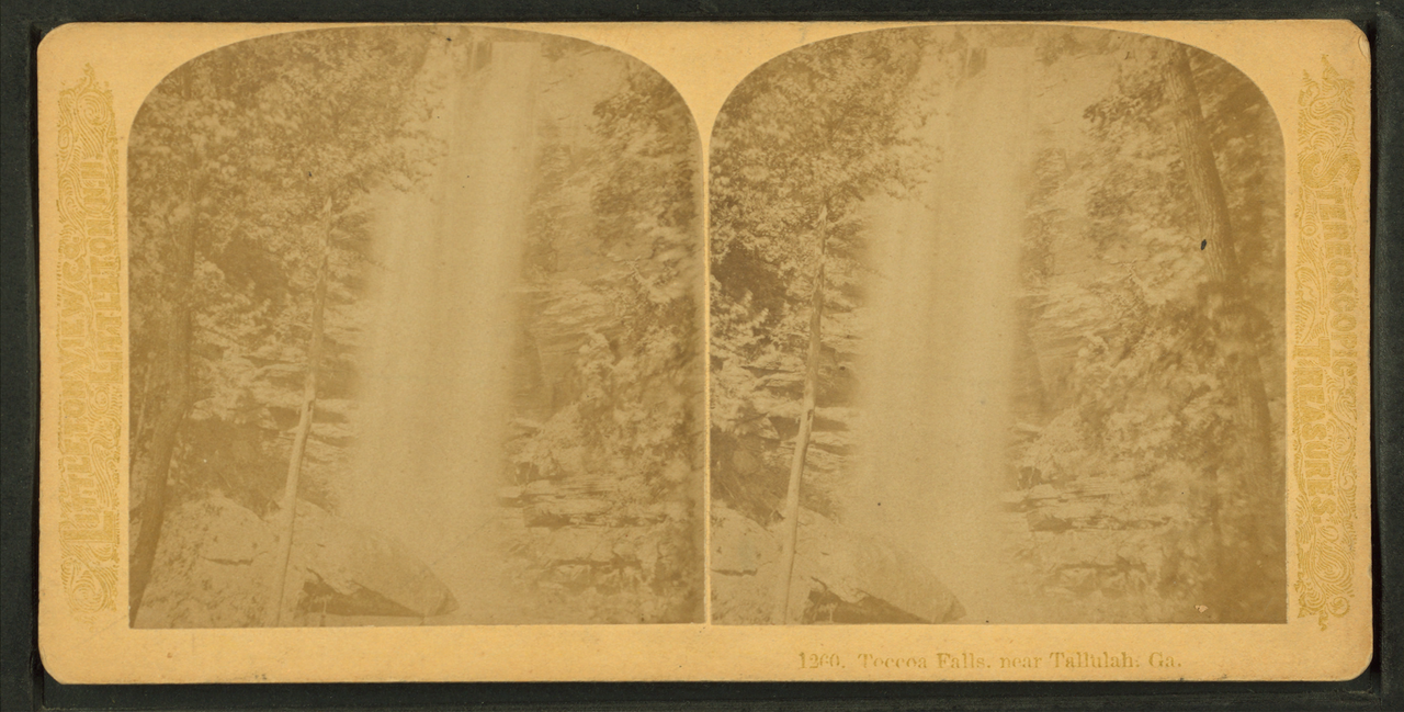
If you have limited time or a mixed-ability group, a few North Georgia falls deliver outsized scenery for almost no effort. The most striking is Toccoa Falls, near the town of Toccoa, a clean roughly 186-foot plunge on Toccoa Creek — taller, in a single drop, than Niagara. It sits on the private campus of Toccoa Falls College, which has long permitted visitors (typically for a small admission); the walk from the gift shop to the base is only about 0.2 miles on easy ground. Spring is the best season, and the falls' history carries weight: a dam above them failed in 1977, a tragedy the college memorializes on site. It is the most accessible genuinely tall waterfall within reach of Atlanta.
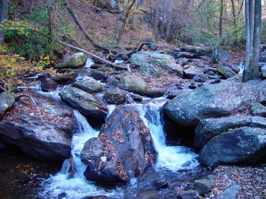
For an easy mountain falls, Helton Creek Falls near Blairsville is hard to beat: two tiers totaling roughly 100 feet on Helton Creek in the Chattahoochee National Forest, reached by a very short trail of about 0.3 miles to viewing platforms. The main catch is the access road — a narrow, often-rough gravel Forest Service road that some passenger cars find slow going. It's a worthy stop if you're already in the far north near Vogel State Park or Brasstown Bald, and it's at its best in spring.
A touch more effort buys you High Shoals Falls near Hiawassee, one of two notable falls on a single trail in the High Shoals Scenic Area. The hike is about 2.4 miles round trip, rated moderate, descending to viewing decks below Blue Hole Falls and High Shoals Falls, the latter a roughly 50-foot cascade on High Shoals Creek. Like Helton Creek, the trailhead is reached by a gravel forest road, and spring brings the strongest flow. It's a quieter alternative to the busy Helen-corridor falls.
These three — Toccoa, Helton Creek, and High Shoals — round out the picture of what's reachable from Atlanta in a day. Between the 729-foot tiered headliner at Amicalola, the dam-released drama of Tallulah Gorge, the dense Helen cluster, and these easy northern wins, a metro-Atlanta visitor can build anything from a single relaxed morning to a multi-day, mountain-spanning waterfall tour without ever leaving the southern Blue Ridge.