Why the Gorge holds so many waterfalls
The Columbia River Gorge is a freak of geology, and its waterfalls are the receipt. Over millions of years, repeated floods of Grande Ronde Basalt — part of the Columbia River Basalt Group — laid down stacked lava flows hundreds of feet thick along what is now the Oregon-Washington border. The Columbia River then sawed a deep, steep-walled canyon straight through that rock. Side streams draining the high country to the south, such as Multnomah, Wahkeena, Horsetail, and Oneonta creeks, were left stranded in 'hanging valleys' — tributary drainages whose mouths sit far above the main canyon floor. Where those creeks reach the lip of the Gorge, they have no choice but to fall.
The Missoula Floods finished the job. Near the end of the last Ice Age, roughly 15,000 years ago, a series of catastrophic glacial-lake outburst floods roared down the Columbia, scouring the canyon walls nearly vertical and steepening the drops. The result is a wall of cliffs, oriented to catch wet Pacific storms, with dozens of creeks tumbling off it in close succession. Multnomah Falls — at 620 feet, the tallest in Oregon — formed at the end of one of these hanging valleys against a face of basalt that records more than 400,000 years of eruptions.
What makes the corridor special is not just height but density and access. Within a short drive on the Historic Columbia River Highway you can stand at the base of Multnomah Falls, Wahkeena Falls, Horsetail Falls, and the trailheads for Triple Falls and Ponytail Falls — most of them visible from or a few minutes' walk from the road. Few places in the country let you see this many tall waterfalls in a single day with so little effort, which is exactly why the corridor draws millions of visitors a year and now requires a timed-entry permit in summer.
A note on the numbers throughout this guide: reported waterfall heights vary by source and by what is being measured. A figure may describe a single clean plunge, the tallest tier, or the cumulative drop of a multi-step cascade. Land managers, the USGS Geographic Names Information System, and waterfall databases do not always agree to the foot. Treat the heights here as well-documented approximations, not survey-grade measurements.
The icons: Multnomah, Wahkeena, and Horsetail
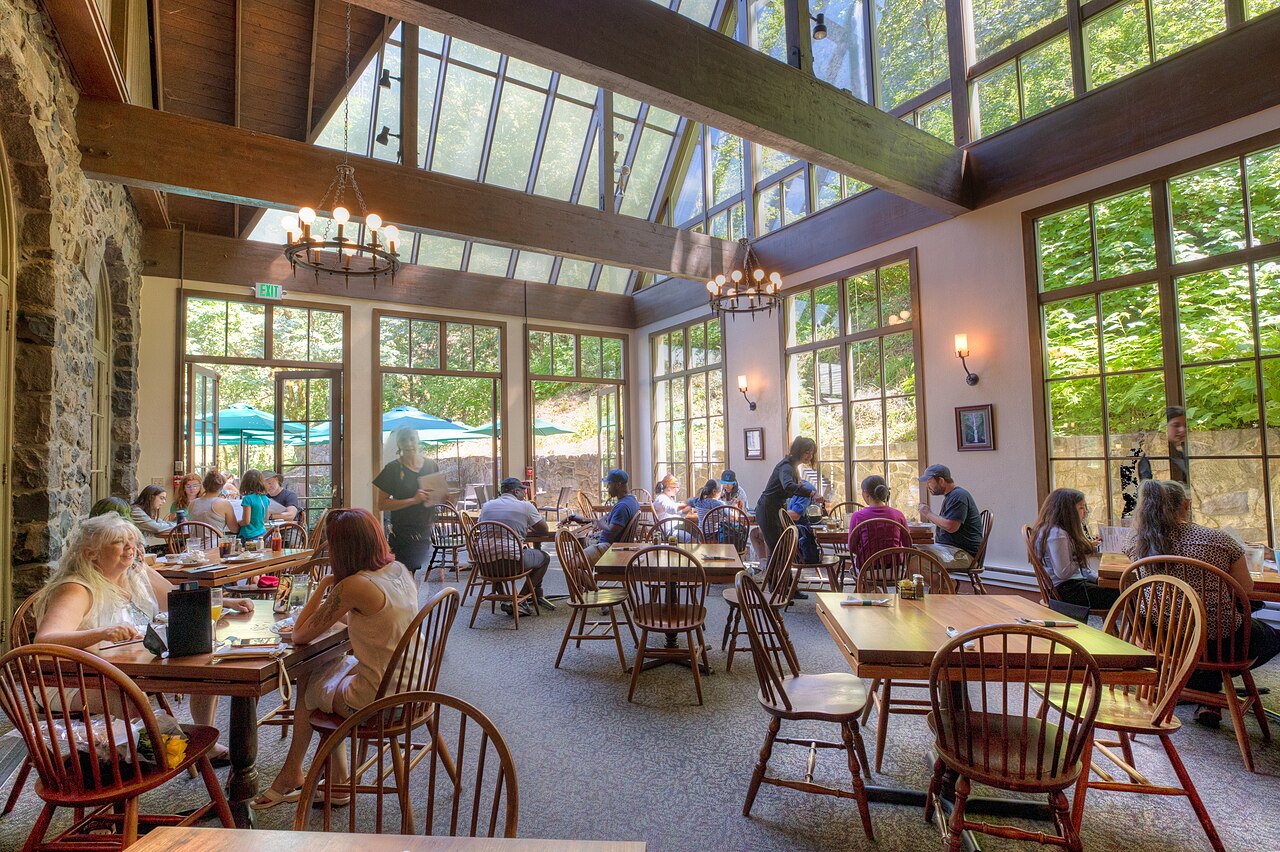
Multnomah Falls (slug multnomah-falls-or) is the one everyone comes for, and it earns the crowds. Fed by Multnomah Creek under the management of the Columbia River Gorge National Scenic Area (USFS), it drops 620 feet in two tiers — an upper fall of about 542 feet and a lower fall of roughly 69 feet, separated by a short stretch of creek. The historic Benson Footbridge spans the gap between the two tiers, putting you directly between them. From the lodge, a paved viewpoint is steps from the parking area; the bridge is a short, steep walk; and a switchbacking trail of about 2.4 miles round trip (moderate) climbs to the top of the upper falls. The falls flow year-round, but the most dramatic volume comes in winter and spring, roughly November through May, when rain and snowmelt are highest. In hard freezes the falls can partially ice over — a rare and spectacular sight.
Just west, Wahkeena Falls (wahkeena-falls-or) is the easy companion. A 242-foot horsetail-type fall on Wahkeena Creek, it slides and fans down the rock rather than free-falling, and a paved path of only about 0.4 miles (easy) reaches a stone footbridge near its base. Wahkeena is at its loud best in spring and after heavy rain (April through June); in late summer it thins to a graceful trickle. Because it sits beside its own parking area a short distance from Multnomah, it is the obvious first stop for anyone wanting a roadside waterfall without the Multnomah crowds — and the two are linked by a popular loop trail for those who want more.
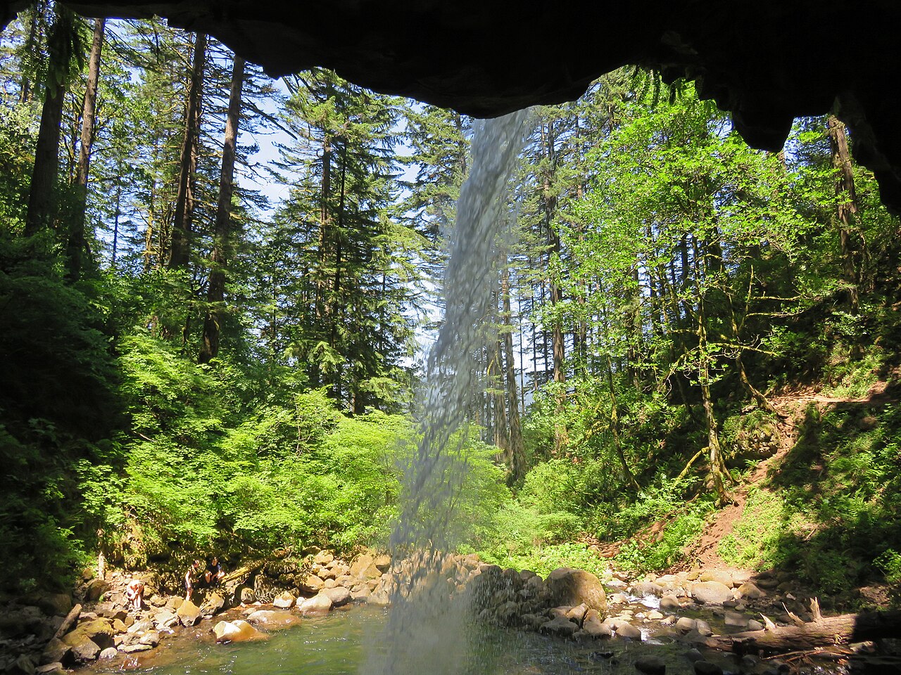
Horsetail Falls (horsetail-falls-or) is the most literally named fall in the corridor: a 176-foot horsetail plunge on Horsetail Creek that drops almost directly beside the Historic Highway, so close you can feel the spray from the road. You do not have to hike at all to see it. But Horsetail is also a gateway — the trail behind it climbs to Ponytail Falls and connects into the Oneonta drainage and Triple Falls, so the trailhead serves both the laziest and the most ambitious visitors. Spring is the best season for full flow.
These three are the corridor's calling card, and their accessibility is double-edged. On a sunny summer weekend the Multnomah Falls lot fills before mid-morning, which is precisely why the Forest Service now runs a seasonal timed-entry system (covered below). The reward for an early start, or a rainy off-season visit, is one of the great waterfall walls in North America with relatively few people on it.
The quieter ones worth the walk
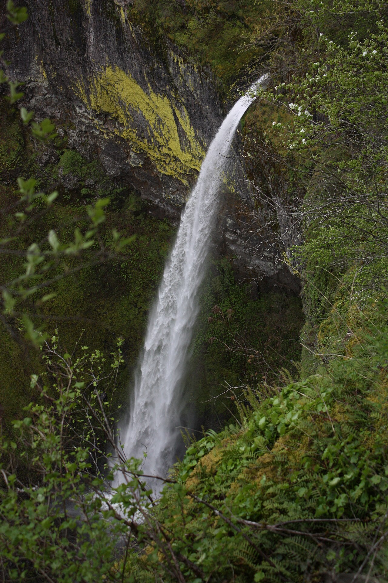
Step a mile or two off the highway and the crowds thin fast. Elowah Falls (elowah-falls-or) is the standout — a 213-foot plunge where McCord Creek free-falls into a mossy, amphitheater-shaped basalt bowl streaked with orange and green lichen. It is reached by an easy trail of about 1.5 miles from the John B. Yeon trailhead near Warrendale, and because it is at the eastern end of the corridor and not visible from the road, it sees a fraction of Multnomah's traffic despite being one of the most photogenic falls in the Gorge. Spring delivers the heaviest flow.
Triple Falls (triple-falls-or) rewards a longer effort. A 135-foot segmented fall on Oneonta Creek, it splits into three roughly parallel channels pouring over a single lip — a genuinely unusual form. The hike runs about 3.6 miles round trip (moderate) up the Oneonta Trail. The same drainage holds Ponytail Falls (ponytail-falls-or), an 88-foot plunge on Horsetail Creek reached in roughly 0.8 miles (easy) from the Horsetail trailhead, where the trail famously passes behind the falling water through a wind-scooped alcove in the rock. Many hikers string Horsetail, Ponytail, and Triple Falls together into a single loop.
Wahclella Falls (wahclella-falls-or) is a local favorite and an easy win: a 127-foot tiered fall on Tanner Creek at the head of a tight, dramatic box canyon, reached by an easy round-trip walk of about 2.4 miles. It runs well year-round, with peak volume from late winter through spring, and the canyon's close walls make it feel far more remote than its short trail suggests. For variety, Fairy Falls (fairy-falls-or) is a delicate 20-foot fan on Wahkeena Creek, encountered about 3.1 miles into the Wahkeena loop (moderate) — small, lacy, and a complete contrast to the giants below it.
Two corridor highlights sit just outside this guide's reach for now. Punch Bowl Falls (punch-bowl-falls-or), a 33-foot punchbowl-type fall on Eagle Creek where the water funnels through a notch into a wide green pool, is one of the most photographed small falls in the Gorge — but the Eagle Creek Trail that reaches it (about 4.2 miles round trip, moderate, Northwest Forest Pass required) is closed under a Forest Service order through late 2026 after December 2025 storm damage. Check current status before planning around it.
How the corridor is laid out and how to drive it
The waterfalls string along the Historic Columbia River Highway (US 30) and Interstate 84 on the Oregon side, roughly between the towns of Corbett and Bridal Veil in the west and Cascade Locks in the east. Nearly everything in this guide drains the south wall of the Gorge into the Columbia, and almost all of it is managed by the Columbia River Gorge National Scenic Area under the U.S. Forest Service. The classic approach is to enter the Historic Highway near Corbett, stop at Vista House at Crown Point for the overview, then descend past Latourell, Shepperd's Dell, Bridal Veil, Wahkeena, Multnomah, Oneonta, and Horsetail in quick succession before rejoining I-84.
Order your stops by tolerance for crowds, not just geography. Roadside falls — Wahkeena and Horsetail — take minutes. Short hikes — the Multnomah top, Wahclella, Elowah, Ponytail — take an hour or two. The longer pushes to Triple Falls or Fairy Falls make a half-day. A common mistake is to spend the whole visit fighting for parking at Multnomah; the falls a few minutes' walk off the road are nearly as spectacular and far calmer.
Season matters as much as timing of day. The corridor is at its most thunderous from late fall through spring, when Pacific storms and snowmelt drive the creeks. Wahkeena, Horsetail, and the smaller falls can shrink dramatically by late summer, while Multnomah, Wahclella, and Elowah hold water year-round. Winter brings the bonus of possible ice formations but also road hazards and occasional closures. Spring — April through June — is the sweet spot for most of these falls: high flow, green understory, and long daylight.
Because the corridor crosses both Forest Service land and Oregon state highway jurisdiction, conditions change. The Historic Highway has had segments closed for repairs into 2026, and individual trails open and close with storms and fire recovery. The Forest Service Columbia River Gorge alerts page is the single best place to confirm what is actually open before you go.
Permits, closures, and the long shadow of the 2017 fire
Two things every visitor needs to know in 2026: the permit and the closures. From May 22 through September 7, 2026, a Multnomah Falls Timed Use Permit is required to access the falls from Interstate 84 between 9 a.m. and 6 p.m. daily. Permits are released on a rolling 14-day window at 7 a.m. Pacific on Recreation.gov, with a small transaction fee; a limited number of fee-free permits are distributed at the Gateway to the Gorge Visitor Center in Troutdale and the Cascade Locks Historical Museum. Arriving before 9 a.m. or after 6 p.m., or visiting outside the permit season, avoids the requirement entirely — another argument for an early start.
The 2017 Eagle Creek Fire, sparked by fireworks, burned roughly 50,000 acres across the heart of the waterfall corridor and reshaped access for years. Some areas have never reopened. Lower Oneonta Gorge — the famous slot-canyon scramble with its log jam and waist-deep wade to Lower Oneonta Falls — remains closed, as do Ruckel Creek, Tanner Butte, and other backcountry trails affected by the fire. The upper Oneonta Trail to Triple Falls is open even though the lower gorge is not; the two are separate, and it is easy to conflate them.
Storm damage keeps adding to the list. As of mid-2026 the Eagle Creek Trail — the route to Punch Bowl Falls — is closed under Forest Service order through October 31, 2026 after December 2025 storms dumped trees, boulders, and roughly 12 feet of debris onto the Historic Columbia River Highway State Trail between Eagle Creek and Cascade Locks. The Multnomah Falls Lodge restrooms are under renovation through November 2026, and segments of the Historic Highway east of Multnomah have been closed for repairs into spring 2026. None of this is permanent, but all of it is the kind of thing that turns a planned hike into a locked gate.
The practical takeaway: the Gorge rewards flexibility. Build your day around what is confirmed open, reserve the Multnomah permit early if you are visiting in summer, and treat any single waterfall as one of many — if a trail is closed, another tall fall is almost always a few minutes down the road.
How the Gorge compares to other waterfall regions
What sets the Columbia River Gorge apart is the combination of height, count, and convenience in one drainage. Other parts of the country have spectacular falls, but they tend to be spread out or harder to reach. The Southern Appalachians, for instance, are studded with cascades: Rainbow Falls (rainbow-falls-nc), a 150-foot cascade on the Horsepasture River in North Carolina's Gorges State Park, takes a 3.1-mile moderate hike, and Lower Whitewater Falls (lower-whitewater-falls-sc), a 200-foot cascade in the Jocassee Gorges of South Carolina, runs about 4.3 miles round trip. These are destinations in their own right, but they are scattered across the landscape rather than lined up along one road.
Some celebrated falls elsewhere depend on human schedules rather than natural flow. Hurricane Falls (hurricane-falls-ga), a 96-foot cascade in Georgia's Tallulah Gorge State Park, is best seen during scheduled aesthetic water releases on spring and fall weekends, reached by a strenuous staircase descent of about 2 miles round trip. That is a fundamentally different experience from the Gorge, where the water answers only to weather and the falls run whenever the creeks are high.
And many of the country's named falls are short by Gorge standards even when they are geologically significant. Sandstone Falls (sandstone-falls-wv), a 25-foot block waterfall spanning the entire New River in West Virginia's New River Gorge National Park, is a wide, powerful sheet rather than a tall plunge, best at spring snowmelt and reached by an easy boardwalk of about 0.5 miles. Prairie Hollow Gorge Falls (prairie-hollow-gorge-falls-mo) in Missouri, a cascade through an igneous shut-in managed by the Missouri Department of Conservation, runs only after rain and has no well-established height on record — a reminder that 'waterfall' covers everything from a 620-foot basalt giant to a seasonal rush over volcanic rock.
Stack these against the Columbia River Gorge and the contrast is clear. Nowhere else in the United States can you stand at the base of a 620-foot fall, walk twenty minutes to a 213-foot plunge into a mossy bowl, and drive five minutes to two more tall falls beside the road — all within a single afternoon, all fed by the same Ice Age geology. That density is the corridor's signature, and it is why, even with permits and closures, it remains the country's premier waterfall drive.