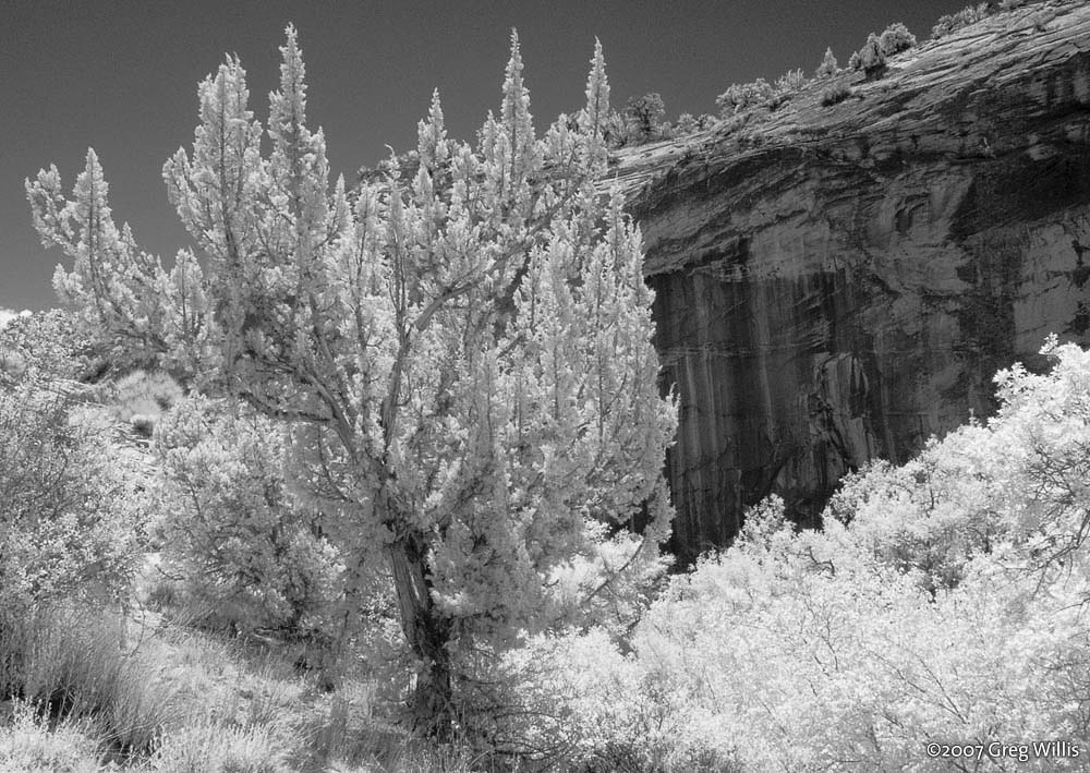
How to think about Utah waterfalls
Utah is not the first state most people picture when they think of waterfalls, and that is precisely what makes its falls worth chasing. The water here is highly seasonal and the landscape it cuts through is wildly varied: snowmelt cascades tumbling out of the Wasatch granite above Salt Lake City and Provo, and desert seeps that pour over red and tan Navajo Sandstone in the Grand Staircase-Escalante country to the south. A single guide can't honestly cover every named drop in the state, so this is a curated selection of nine well-documented falls that together show the range — from a roadside icon to a permit-gated slot canyon to a waterfall fed by an underground lava tube.
Flow is the single biggest variable. The Wasatch falls — Bridal Veil, Stewart, Donut, Lisa, Battle Creek — are driven by mountain snowpack and run hardest during the spring melt, roughly April through June, then taper through summer. The southern desert falls on Calf Creek run from springs and stay more consistent year-round, which is why spring and fall (avoiding brutal summer heat) are the sweet spots there. Kanarra and Cascade falls each have their own quirks of timing covered below. When a height or a flow looks underwhelming in late summer, that is usually the season talking, not the waterfall.
A word on the numbers in this guide: reported waterfall heights in Utah vary considerably between sources, because different people measure different things. Some figures count only the main vertical drop; others add in the talus cascades above and below it to reach a much larger cumulative total. We flag that uncertainty rather than pretend any single figure is definitive — Bridal Veil Falls below is the clearest example. Where a height isn't reliably documented, we say so and lean on what is well established instead: the hike, the land manager, and the season.
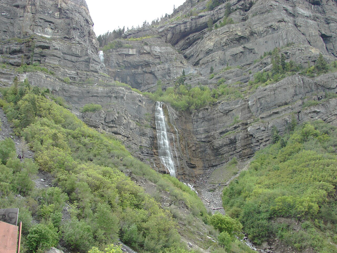
Bridal Veil Falls — Provo Canyon's roadside icon
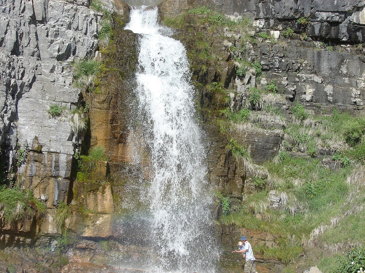
If Utah has a signature waterfall, this is it. Bridal Veil Falls drops down the south wall of Provo Canyon in a series of tiers, just off U.S. Highway 189 a few minutes from Provo and Orem, and it is the easiest major waterfall in the state to reach. From the parking area at Bridal Veil Falls Park — a Utah County park on a tributary of the Provo River — a short, mostly flat paved path of roughly 0.3 miles brings you to the base. It is genuinely accessible to almost anyone, which is a rarity among waterfalls of this scale.
The commonly cited height is 607 feet, which would make it the tallest waterfall in Utah, and you will see that number on signs and in most write-ups. It deserves an honest caveat: topographic analysis suggests the main waterfall itself is more in the range of 440 to 480 feet, with an additional couple hundred feet of talus cascades carrying the water down to the Provo River. The 607-foot figure appears to be a cumulative measurement from top to river. Either way it is a tall, multi-tiered cascade — just don't expect a single uninterrupted 607-foot plunge.
Bridal Veil is at its thundering best during the spring snowmelt, April through June, when the Wasatch high country is dumping water into the canyon. It runs year-round but thins out by late summer, and in cold winters the lower tiers can ice over into an ice-climbing destination. The park itself has picnic tables, grills, and multiple parking lots, and it connects to the paved Provo River Parkway Trail, making it a natural anchor for a half-day in the canyon.
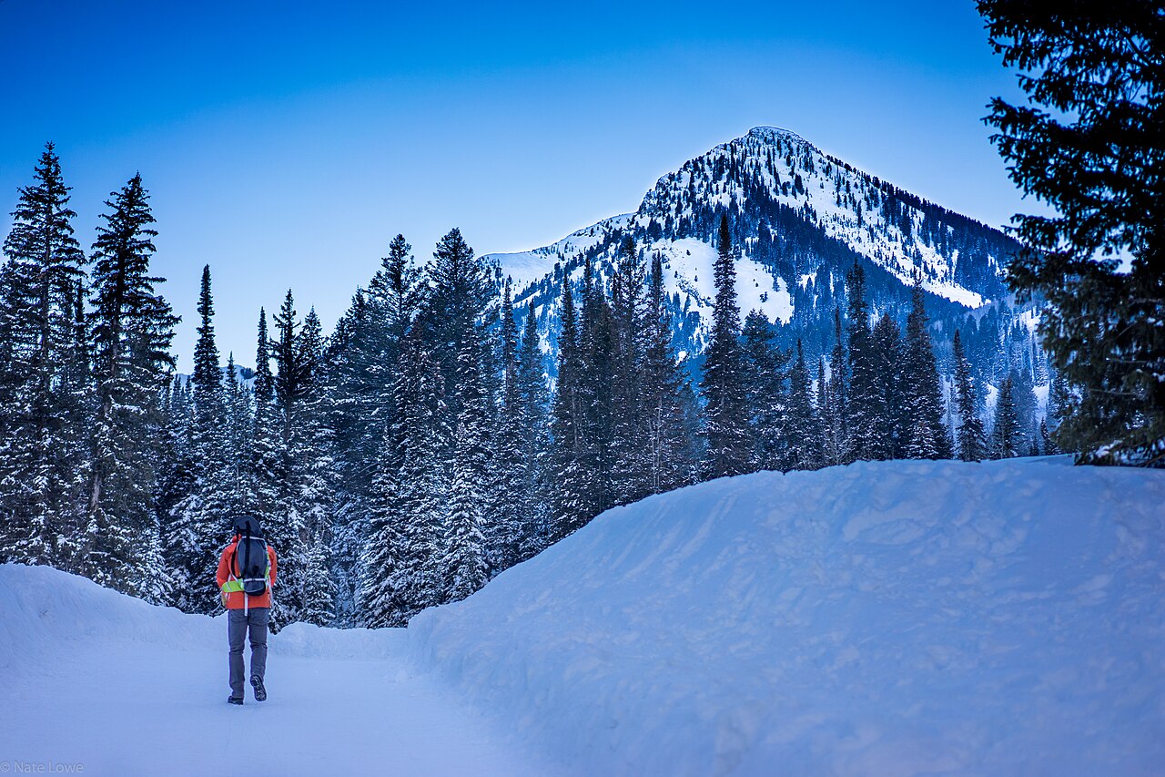
Wasatch snowmelt falls — Stewart, Donut, Lisa, and Battle Creek
The mountains immediately east of Provo and Salt Lake City hold a cluster of approachable falls, all on Uinta-Wasatch-Cache National Forest land and all driven by snowmelt. Stewart Falls is the showpiece of the group: a two-tiered cascade documented at over 200 feet on the east flank of Mount Timpanogos. The standard approach is the Stewart Cascade Trail (USFS #056) from the Aspen Grove / Mount Timpanogos Trailhead near Sundance, a moderate out-and-back in the 3.5-mile range with a few hundred feet of climbing. Late spring through fall is the window — the access road closes seasonally in winter, and the falls run best when the Timp snowpack is melting.
Donut Falls, in Big Cottonwood Canyon above Salt Lake City, is the quirkiest of the bunch. The creek — Mill D South Fork, in the Big Cottonwood drainage — has carved a hole through a rock arch, so the water appears to disappear into a 'donut' before dropping into the chamber below. It is an easy family hike of roughly 3.4 miles round trip from the Mill D trailhead, best in summer once the snow clears (June through September). Two important rules: Big Cottonwood is a protected drinking-water watershed, so no dogs and no swimming are allowed, and visitors are no longer permitted to scramble up to the donut formation itself for safety and erosion reasons.
Two shorter options round out the Wasatch list. Lisa Falls is a small, pretty cascade of about 30 feet in Little Cottonwood Canyon near Alta, reached by a short, easy walk of under half a mile up Lisa Falls Gulch — a quick stop that runs best in late spring and early summer. Battle Creek Falls, above Pleasant Grove, is a horsetail fall on Battle Creek reached by an easy hike of roughly 1.6 miles round trip with a bit of steady climbing; the canyon-bottom trail follows the stream, and you can view the falls from both the base and the top. Its documented height isn't well established, so we leave a precise number off, but it is one of Utah Valley's most popular short waterfall hikes and runs spring through fall.
Calf Creek — the desert sandstone classics near Escalante
Down in the Grand Staircase-Escalante country, Calf Creek produces two of the most beloved desert waterfalls in the American Southwest, and they could hardly be more different in character despite sharing a creek. Both sit on land managed by the Bureau of Land Management within the national monument, and both reward a spring or fall visit — March through May and September through October — when the desert is cool enough to hike comfortably and the creek is flowing well.
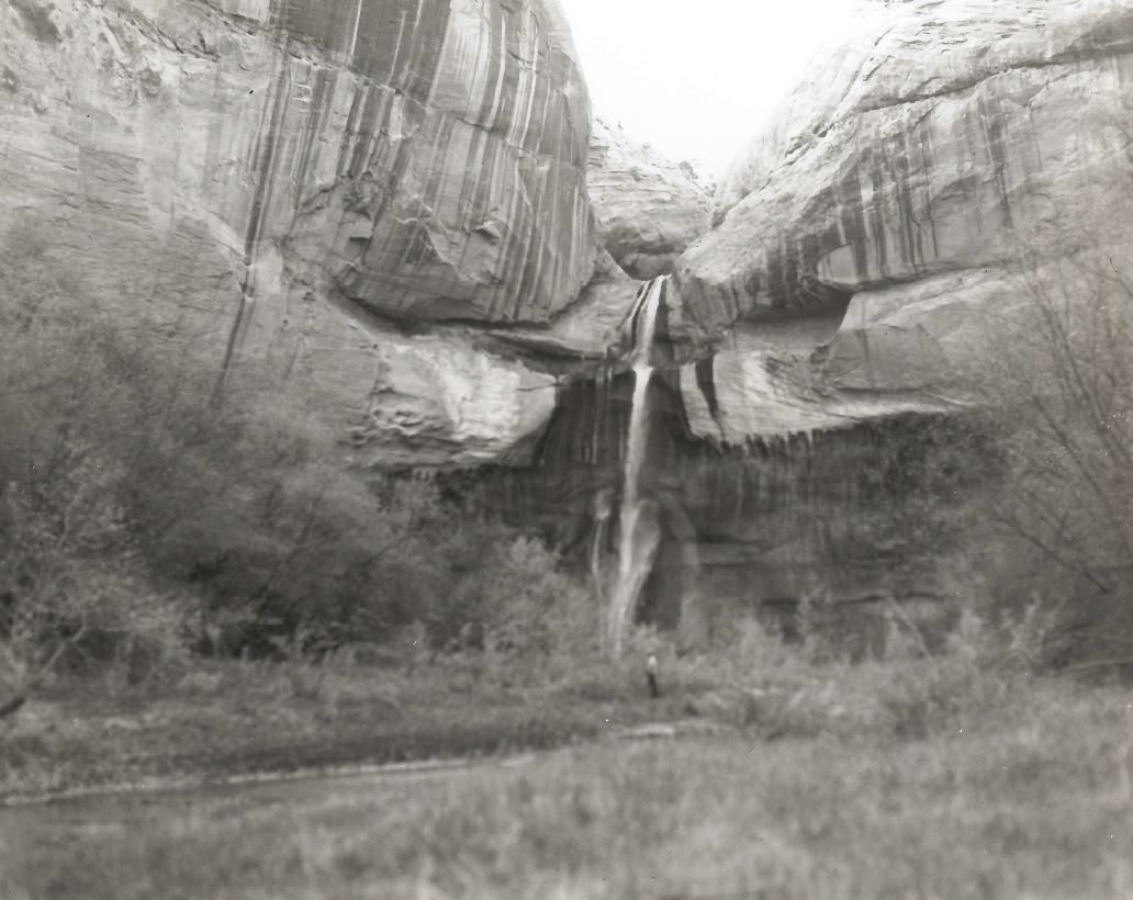
Lower Calf Creek Falls is the headliner: a roughly 126-foot horsetail that pours over a streaked sandstone wall into a green pool, an oasis hemmed in by canyon cliffs. The trail is a 6-mile round trip along the canyon floor from the BLM Calf Creek Recreation Area off Utah Highway 12. It is rated moderate mostly because of deep, sandy footing rather than steepness, and it can get genuinely hot in summer, so carry plenty of water. The walk itself is part of the appeal — you pass beaver-worked cottonwoods, a panel of ancient pictographs high on the opposite wall, and stone granaries left by the Fremont people.
Upper Calf Creek Falls, a few miles up the highway, is the smaller but in some ways more dramatic sibling — a roughly 88-foot plunge into a pool, set in open slickrock. The hike is shorter at about 2.2 miles round trip, but don't let the distance fool you: the trail drops around 500 feet of steep, exposed slickrock from the highway down to the creek, which means the climb out is the real work, and there is little shade. It is well worth it for the swimming hole and the quieter atmosphere. As with the lower falls, spring and fall are the seasons to go.
Two southern Utah originals — Kanarra and Cascade
Kanarra Falls, in the slot canyon above the tiny town of Kanarraville near Cedar City, is less a waterfall hike than a canyon adventure that happens to feature waterfalls. You wade up Kanarra Creek through a narrow, sculpted slot, and reaching the falls means climbing a roughly 20-foot ladder bolted into the rock at the first major drop. The route is about 3.8 miles round trip with several hundred feet of elevation gain and constant ankle-to-knee-deep water, so it earns its moderate rating. Crucially, the canyon is on town and BLM land and requires a paid daily-use permit, with daily numbers capped — in summer, permits routinely sell out a week or more ahead, so plan and book before you drive out. Like any slot canyon, it is off-limits in rain or threatening weather because of flash-flood risk, and dogs are not allowed.
Cascade Falls, on the Markagunt Plateau near Duck Creek Village in the Dixie National Forest, is a geologic oddity worth the detour. The water doesn't come from a surface stream above the cliff at all — it emerges directly from the rock face, fed by Navajo Lake draining through a roughly two-mile lava-tube cave system before bursting out of the cliff and cascading down to form the headwaters of the North Fork of the Virgin River, which eventually flows into Zion. The trail is an easy 1.2-mile round trip with minimal climbing, a well-built path with stairs, benches, and big views across the plateau toward Zion.
Cascade Falls is best in late spring and early summer, when Navajo Lake is high and the lava-tube spring is running strong; by late season, depending on the lake level, the flow can drop from a roaring sheet to a thin trickle. That dependence on the lake makes it one of the more variable falls in this guide — but the combination of a short, scenic walk and the strange underground plumbing behind it makes Cascade a memorable stop on a Cedar Mountain or Bryce-area trip.
Planning notes and honest caveats
This is a curated selection, not a complete inventory. Utah has many more documented waterfalls — seasonal Wasatch cascades, drops along the Uinta and other ranges, and ephemeral desert falls that only run after rain — and a great many that flow only briefly during peak melt or after a storm. The nine here were chosen because they are well documented, reliably worth the trip, and span the geography and character of the state. If your favorite isn't listed, that is the curation at work, not a judgment on the falls.
Match your timing to the source of the water. Snowmelt falls in the Wasatch (Bridal Veil, Stewart, Donut, Lisa, Battle Creek) peak in spring and thin through summer; the desert spring-fed falls on Calf Creek are best in the cooler shoulder seasons; Cascade Falls tracks Navajo Lake's level; and Kanarra's slot is a warm-season, permit-required outing that you should never enter when storms threaten. Several Wasatch access roads close in winter, so check status before driving up.
Finally, treat every height and distance here as a well-sourced estimate rather than a survey-grade fact. Trail mileages vary slightly between trailheads and sources, and waterfall heights — Bridal Veil's 607-versus-440-foot question being the standout — depend entirely on what the measurer chose to include. Carry more water than you think you need, especially in the desert, respect watershed rules in the Cottonwood canyons (no dogs, no swimming), and check current conditions, permits, and parking with the relevant land manager before you go.