How to Read This List (and Why Texas Falls Are Different)
Texas is a flat, dry state for most of its area, and that shapes its waterfalls. Outside of the mountainous Big Bend country in the far west, nearly all of the state's notable falls live in one place: the limestone Hill Country west and southwest of Austin, where rivers and spring-fed creeks cut through the soft Edwards Plateau and pour over harder rock benches. Because so much depends on rainfall and spring discharge, flow is the single biggest variable in a Texas waterfall trip. A creek that thunders in April can be a damp trickle by August.
This is a curated selection, not a census. There are dozens of named and unnamed pour-offs across the state, and the USGS Geographic Names Information System (GNIS) catalogs many small ones that rarely run. We've featured eight falls that are genuinely worth planning a day around: the documented, accessible, and distinctive. We've ordered them roughly from the most dramatic and remote (the Big Bend giants) toward the most accessible Hill Country and central-Texas falls, so you can pick a trip that matches your appetite for driving and hiking.
A note on heights: reported waterfall heights in Texas vary a lot by source and by what's being measured. A single vertical drop, a tiered series of drops, and a long sloping cascade are all reported as a 'height,' and different observers measure them differently. We give the figures from the most authoritative sources available — state parks, the National Park Service, and waterfall databases — but treat them as approximate rather than surveyed. For perspective, the tallest waterfall in Texas, Capote Falls, is reported at roughly 175 feet, but it sits on the private Brite Ranch in Presidio County and is essentially only viewable from the air, so it isn't on this practical list.
The Big Bend Giants: Madrid Falls and Cattail Falls
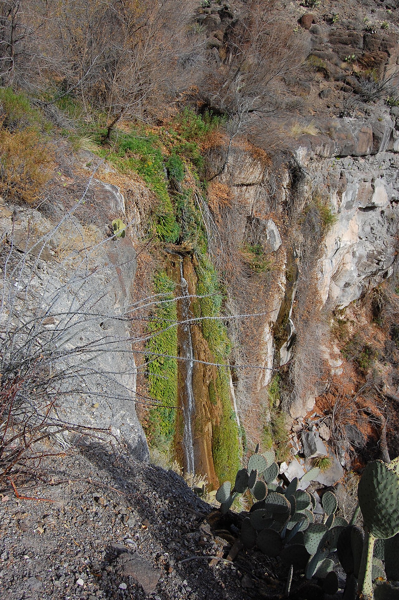
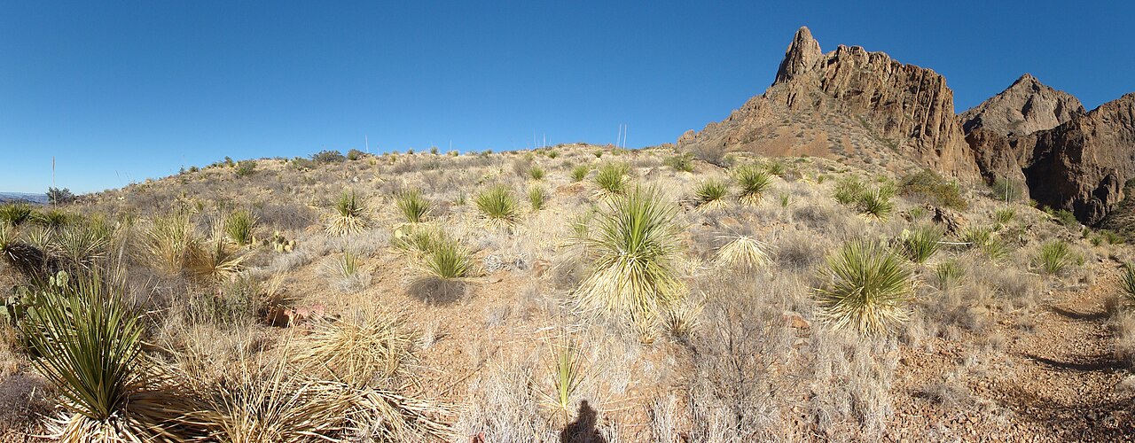
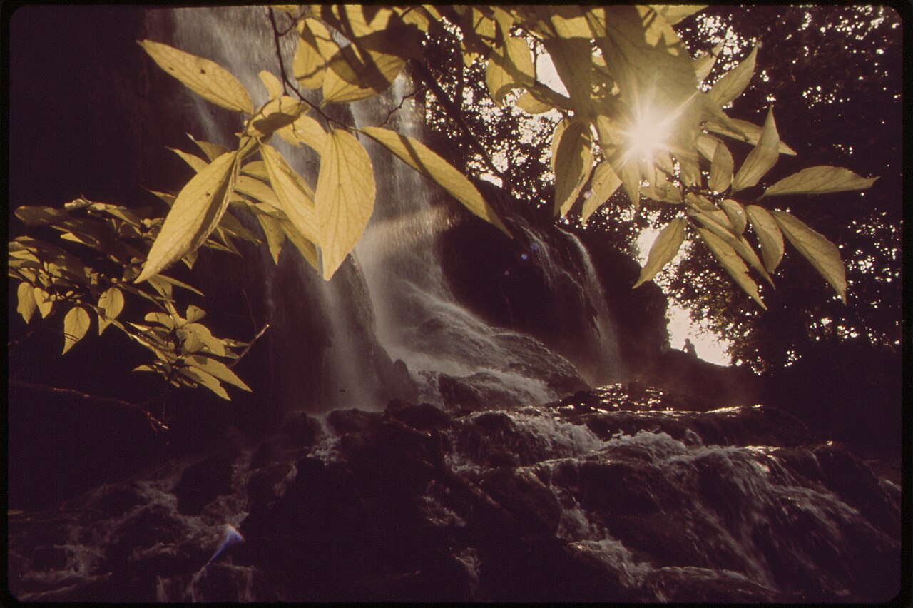
The two most spectacular waterfalls you can actually reach in Texas are both in the Big Bend region of far West Texas, and both are spring-fed desert oases — green, fern-draped surprises in an otherwise arid landscape. Madrid Falls, in Big Bend Ranch State Park, is reported at about 100 feet and is widely described as the tallest publicly accessible waterfall in the state. It's a tiered fall — an upper and lower section that together make up the drop — fed by a spring-fed drainage rather than a big river, so it runs best in spring. Reaching it is the hard part: the falls sit deep in rugged backcountry near Study Butte, the access roads typically require a high-clearance or four-wheel-drive vehicle, and the hike in is short on paper (roughly 4 miles) but strenuous over steep, rough desert terrain. This is a trip for prepared, experienced desert hikers, not a casual stop.
Cattail Falls, by contrast, sits in Big Bend National Park near Terlingua and is reachable on a moderate hike of around 5.7 miles round trip, with relatively modest elevation gain. It's a roughly 80-foot spring-fed plunge that drops into a pool ringed by ferns, columbines, and cardinal flower — a true oasis. The National Park Service deliberately keeps Cattail Falls low-profile: the trail is not marked on the official park map and the trailhead is not signed from the highway, both to protect the fragile spring ecosystem and to keep crowds and trampling down. If you go, treat it accordingly — stay on durable surfaces, don't enter the pool, and pack out everything.
Both falls are governed by the desert's rhythm. Spring is the prime window for flow, and even then a dry year can leave them thin. Summer in the Big Bend is brutally hot and the desert sun is unforgiving on the approach hikes, so plan for an early start, carry far more water than you think you need, and check current conditions with Texas Parks & Wildlife (for Big Bend Ranch) or the National Park Service (for Big Bend National Park) before committing to the drive — these are some of the most remote destinations in the Lower 48.
The Hill Country Showpiece: Gorman Falls
If you only hike to one Texas waterfall, Gorman Falls in Colorado Bend State Park is the strongest single candidate. At roughly 70 feet, it's not the tallest, but it's geologically unusual in a way that makes it stand out from every other fall on this list. Gorman Falls is a 'living' travertine waterfall: instead of eroding the rock beneath it, the spring-fed flow deposits calcium carbonate as it spills downstream, so the falls are slowly growing rather than wearing away. The result is a curving, moss-and-fern-draped cliff that looks more like something from a tropical cloud forest than central Texas — described by Texas Parks & Wildlife as a wonder that has grown a few feet taller over the past decade.
The hike to reach it runs about 3 miles round trip from the trailhead at Colorado Bend State Park near Bend, and it's rated moderate — but the difficulty is concentrated at the end. The final descent to the viewing area drops over slick, uneven rock and is steep enough that the park has installed cable handrails to help hikers down. Wear real footwear with grip, and take your time on the way down and back up. To protect the delicate travertine and the spring ecosystem, you view the falls from a designated overlook rather than climbing into them.
One advantage of Gorman: because it's spring-fed, it runs year-round, making it one of the more reliable Texas falls for flow. It still looks best after rain, when the surrounding creek and the falls are fullest, but you won't drive out to find a bone-dry cliff the way you might at a rain-dependent river fall in late summer.
Grottos and Swimming Holes West of Austin: Hamilton Pool and Westcave
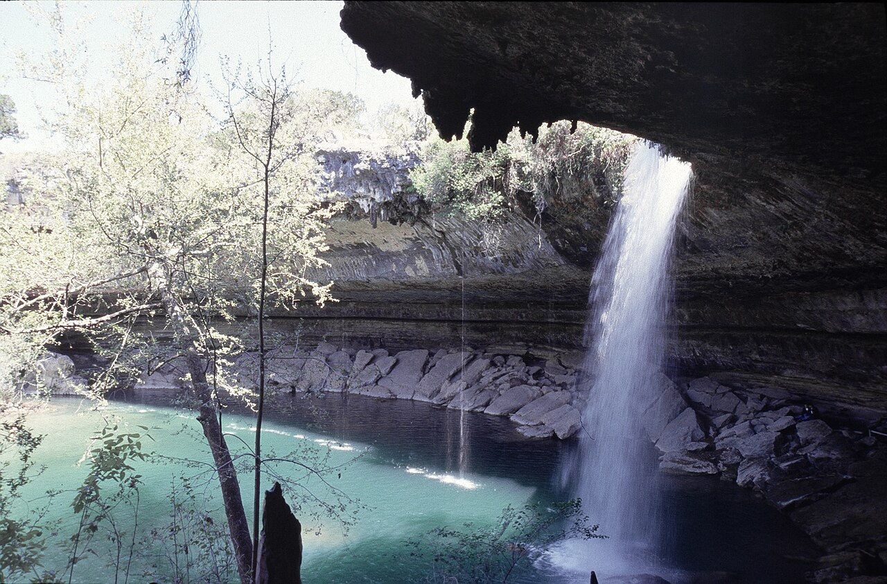
Two of the most photographed waterfalls in Texas are collapsed-grotto falls in the limestone country west of Austin, and they make a natural pair — though they're managed very differently. Hamilton Pool, a Travis County preserve near Dripping Springs, is the famous one: Hamilton Creek spills roughly 50 feet over a limestone lip into a jade-green pool inside a partially collapsed grotto, with an overhanging cliff arching above. Geologists believe the grotto formed as the cave roof collapsed over tens of thousands of years, and the falls have slowly migrated up the canyon as the process repeats. The walk in is short and easy — about half a mile down to the pool — but Hamilton Pool requires advance reservations through Travis County, swimming is only allowed at certain times (it's frequently closed to swimming when bacteria levels are high), and the waterfall itself is most reliable in spring. Don't show up without booking.
Westcave, just across the Pedernales River near Round Mountain, is the quieter, more intimate version. The Westcave Outdoor Discovery Center protects a lush grotto where Heinz Branch drops about 40 feet into an emerald pool beneath travertine formations and a cave you can stand behind. The catch is that you can only see it on a guided tour: access to the canyon and grotto is by reservation and led by a guide, typically on weekends, in part to protect the fragile microclimate that supports ferns, mosses, and bald cypress in this little canyon. The upland trails are open more freely, but the waterfall and grotto are the reason to go, and the falls run best in spring. The guided format makes Westcave a great choice if you want context — you'll learn the geology and ecology rather than just snapping a photo.
Both sites are reminders that in Texas, access is often the gating factor rather than distance. Neither requires a hard hike; both require planning ahead, respecting capacity limits, and timing your visit for the wetter spring months when the falls are at their best.
Cascades on Big Water: Pedernales Falls and McKinney Falls
Not every Texas waterfall is a vertical plunge. Two of the most accessible are wide river cascades where the water staircases over tilted limestone rather than dropping straight down. Pedernales Falls, in the state park of the same name near Johnson City, is the showpiece of this type: the Pedernales River tumbles over tilted layers of Marble Falls limestone, the drop spread across a long run of rock so that it reads as a staircase of cascades rather than a single curtain. It's an easy walk of roughly half a mile from the parking area to the overlook, and the falls look best in spring and fall after rain swells the river. Critically, swimming and wading are not allowed at the falls themselves — the Hill Country is notorious for flash flooding, and the Pedernales can rise from a calm stream to a dangerous torrent in minutes, even from storms miles upstream. Heed the signs, watch for rising or muddying water, and use the designated swimming areas downstream instead.
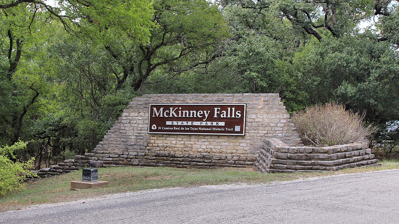
McKinney Falls State Park, remarkably, sits inside the city of Austin, which makes it one of the most accessible falls on this entire list. Here Onion Creek drops over wide limestone benches at two spots — the Upper Falls, where the creek funnels through a chute on the order of 15 feet tall, and the Lower Falls, a broad bench below the confluence with Williamson Creek. The falls are short, but the appeal is the urban accessibility and the surrounding network of nearly nine miles of trails, plus historic sites like the Smith Rock Shelter and the ruins of the old McKinney homestead and gristmill. Trail distances around the falls run a couple of miles or so and are easy. As a creek-fed fall on a city-adjacent watershed, McKinney runs hardest after rain and can slow to a trickle in dry spells — go in spring or after a wet stretch for the best show, and the same flash-flood caution applies on Onion Creek.
These two are the easiest 'win' destinations on the list for travelers who want a genuine Texas waterfall without a backcountry expedition. Both are state parks with facilities, both reward a spring or post-rain visit, and both pair naturally with the Hill Country grottos above for a multi-stop waterfall weekend out of Austin.
A Central-Texas Hidden Gem: Chalk Ridge Falls
Rounding out the list is Chalk Ridge Falls near Belton, a low-key spot just off I-35 that's worth knowing about if you're driving between Austin and Waco. The park sits along the Lampasas River below the Stillhouse Hollow Dam and is maintained by the U.S. Army Corps of Engineers, which manages the reservoir above it. The falls themselves are modest cascades over rock rather than a tall drop — the data we have doesn't assign a confident single height — but the appeal is the easy, shaded riverside hike of roughly 2.5 miles through a surprisingly lush canyon, with side trails, wooden bridges, and good birdwatching.
Because the falls sit below a dam, their flow is a function of both rainfall and dam releases from Stillhouse Hollow Lake, so conditions vary and spring is generally the best bet for water. One important update for trip planners: the park's signature narrow swinging suspension bridge over the river — long one of its main draws — was destroyed and is reported gone as of 2025, so don't plan your visit around crossing it. Always check current Corps of Engineers conditions and closures before going, since dam-managed parks can close trails or sections on short notice.
Admission is free and the park is open from morning to sunset. It's the kind of stop that won't anchor a whole trip the way Gorman or the Big Bend falls will, but as a leg-stretcher with real scenery a short detour off the interstate, Chalk Ridge Falls earns its place — and it's a reminder that a fair number of Texas's most pleasant falls are quiet, dam-tailwater and creek-fed spots that reward locals who know when the water's running.