Why Michigan's Waterfalls Live in the Upper Peninsula
Almost every waterfall worth chasing in Michigan sits in the Upper Peninsula, and the geology explains why. The U.P. is built on layers of ancient sandstone and harder volcanic and metamorphic rock left over from a billion-plus years of Lake Superior basin history. Where a river crosses from soft rock to a resistant ledge, it carves a drop. The Lower Peninsula, by contrast, is glacial outwash and flat-lying sediment with almost no exposed bedrock, so it produces almost no natural falls. If you are planning a Michigan waterfall trip, you are planning a trip north of the Mackinac Bridge.
This guide is a curated set, not a census. The U.P. holds well over 200 named and unnamed waterfalls, and the U.S. Geological Survey's Geographic Names Information System (GNIS) catalogs many of them by official name, county, and coordinates. We have picked five that are well documented, managed by a public agency, reliably accessible to ordinary visitors, and varied enough in height, character, and effort to give you a real sense of the state. The five are Laughing Whitefish Falls, Sable Falls, Bond Falls, Munising Falls, and the Upper Falls at Tahquamenon — three managed by the Michigan Department of Natural Resources and two inside Pictured Rocks National Lakeshore.
A word on the numbers throughout this guide: reported waterfall heights vary a lot depending on who measured and how. A figure may describe a single clean plunge, or it may add up every step of a long cascade. Older published heights were often eyeballed or paced, while newer lidar surveys sometimes come in much lower. We give the commonly cited heights from the managing agencies and flag where the measurement is genuinely disputed rather than pretending to a precision the records do not support.
Tahquamenon Falls (Upper Falls): The Big One
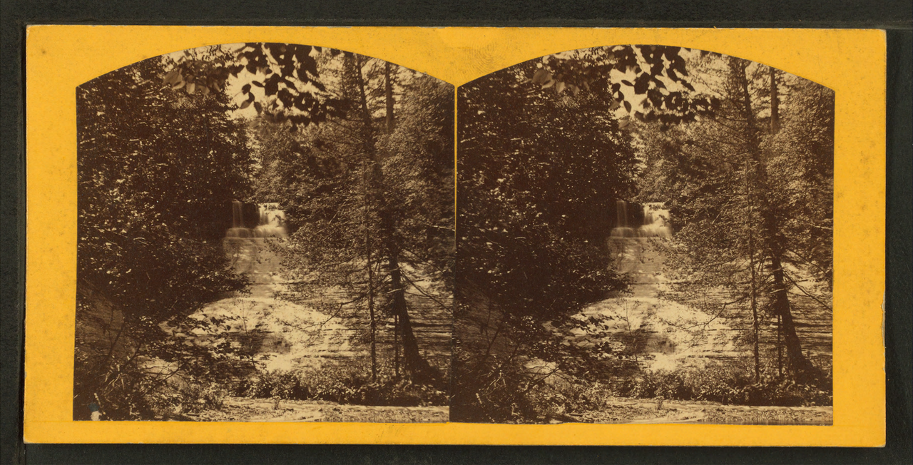
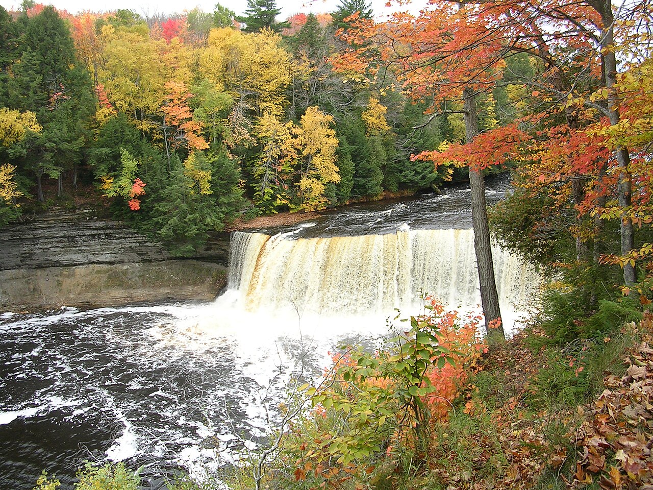
If you visit one Michigan waterfall, make it the Upper Falls at Tahquamenon. Located in Tahquamenon Falls State Park near Paradise and managed by the Michigan DNR, this is the most famous and most powerful waterfall in the state. The river is more than 200 feet wide as it reaches the brink, and during the late-spring runoff it can push as much as 50,000 gallons of water per second over the lip — flow figures that, by volume, rank it among the largest falls east of the Mississippi after Niagara. The water is famously root-beer brown, stained by tannins leached from the cedar swamps the Tahquamenon River drains upstream. Locals call it the "Root Beer Falls," and the color is entirely natural.
On height, this is exactly the case where you should be skeptical of round numbers. The Upper Falls is almost universally described as a 48-foot drop, and that is the figure you will see on park signage. The World Waterfall Database notes, however, that lidar measurement puts the actual vertical drop at no more than about 32 feet. Both can be true depending on where you start and stop measuring a sloping block of rushing water — treat "roughly 40 to 50 feet" as the honest range and focus on the sheer volume, which is the real spectacle here.
Access is easy by waterfall standards. From the Upper Falls parking area, a paved-and-boardwalk path of under a mile leads to a series of viewing platforms, including a brink overlook and a lower gorge view reached by a long staircase. The park is open and popular in all four seasons; the Upper Falls runs year-round, but for peak thunder come during the April-through-June snowmelt. Summer brings the crowds and lower water, fall brings the color, and winter freezes the spray into ice formations along the gorge walls. Note that the park is large and the Lower Falls are a separate stop several miles downriver.
Sable Falls and Munising Falls: The Pictured Rocks Pair
Two of the best easy-access falls in the state sit inside Pictured Rocks National Lakeshore, managed by the National Park Service. They bookend the park: Munising Falls at the western end near the town of Munising, and Sable Falls at the eastern end near Grand Marais. Both are short walks, both drop over the same Lake Superior sandstone that gives Pictured Rocks its painted cliffs, and together they make a natural pair if you are driving H-58 across the lakeshore.
Munising Falls is a roughly 50-foot plunge on Munising Creek, dropping straight over a sandstone cliff at the head of a cool, shaded canyon. A paved 800-foot interpretive trail — about a quarter mile from the trailhead by the Munising Falls Visitor Center — leads to the base, with short stair-stepped platforms for higher views. It is one of the gentler walks in the park and a good first stop. The visitor center itself covers the area's iron-smelting, logging, and geologic history, making this a worthwhile stop even beyond the falls.
Sable Falls is the more dramatic of the two: a roughly 75-foot tiered cascade where Sable Creek tumbles in stages over Munising and Jacobsville sandstone before reaching a beach on Lake Superior. The Jacobsville sandstone exposed at the base is estimated to be at least a billion years old. The catch is the staircase — reaching the best viewpoint at the bottom means descending (and re-climbing) 168 steps, so while the trail from the parking lot is only about a quarter mile, there is no universally accessible route to the falls. Past the falls, a short continuation reaches the Lake Superior shoreline and the Grand Sable Dunes. Both falls run hardest during the April-to-June snowmelt and can slow to a trickle in a dry late summer.
Bond Falls: The Roadside Showpiece
Bond Falls is the entry on this list that asks the least of you and gives back the most per step. Managed by the Michigan DNR as the Bond Falls Scenic Site, it sits on the Middle Branch of the Ontonagon River a few miles east of the tiny community of Paulding, in southern Ontonagon County. Here the river spreads across a wide belt of fractured rock and breaks into a fan of small cascades, dropping a total of about 50 feet across a broad, photogenic front rather than a single plunge.
What makes Bond Falls special for a lot of visitors is the access. An accessible boardwalk with six separate viewing platforms runs along the base of the falls, letting you see it from multiple angles with only a short, roughly 0.3-mile walk and no serious climbing — a rarity among U.P. falls, most of which demand stairs or a real hike. Roadside parking and picnic tables sit right at the site. The DNR typically opens the site to vehicle access from mid-May through mid-October, while the hiking trail itself stays open year-round, though the boardwalks are not cleared of snow and ice in winter.
Because the falls span such a wide rock face, Bond Falls looks impressive across a range of flows, but it is at its fullest and loudest during the spring snowmelt from April into June. It pairs naturally with the nearby Paulding area and is one of the most rewarding stops on a western U.P. waterfall loop for travelers who want a marquee view without a strenuous trek.
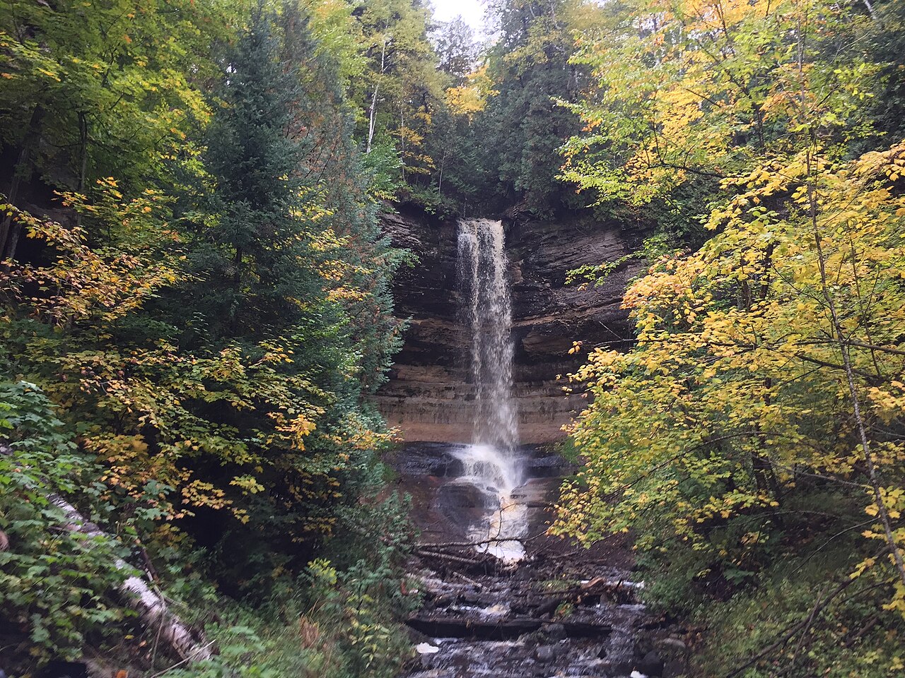
Laughing Whitefish Falls: The Tall, Quiet One
Laughing Whitefish Falls is the tallest single waterfall on this list and the one most likely to give you some solitude. Protected as the Laughing Whitefish Falls State Scenic Site under the Michigan DNR, it lies near the small community of Sundell, inland and south of the Lake Superior shore. The falls drop a documented total of about 100 feet, with the water spreading and skidding down a long, fan-shaped face of fractured limestone rather than free-falling — a different character from the sheer plunges and broad cascades elsewhere on this list.
Be aware that sources disagree on how to classify it: the site is widely described as a fan-shaped cascade, while some waterfall catalogs file it as a slide. Both descriptions are pointing at the same thing — a tall, sloping sheet of water — and the distinction matters more to waterfall taxonomists than to visitors. Either way, the 100-foot figure is a cumulative drop down the rock face, not a single vertical leap.
Reaching it takes a modest effort: from the parking area, a natural-surface trail of about half a mile to a mile leads to three observation platforms set at different levels. A wooden staircase descends roughly 20 steps to a middle platform and continues down around 137 steps total to the lowest viewpoint, so you trade some climbing for the payoff. Like every falls here, it is fed by snowmelt and runs best in spring, from roughly April through June; by late summer in a dry year the fan can thin out considerably. The relative remoteness and the inland setting keep the crowds lighter than at Tahquamenon or the Pictured Rocks stops.
Planning Your Trip: Timing, Access, and Honest Expectations
Season is the single biggest factor in whether you see a Michigan waterfall at its best. Nearly all of these falls are snowmelt-driven, which means the window from roughly April through June is when they run hardest. By late summer in a dry year, a falls that roared in May can shrink to a fraction of its volume — Tahquamenon's massive flow is the exception that stays impressive year-round, while inland falls like Laughing Whitefish are the most sensitive to drought. Autumn adds foliage, and winter turns the spray into ice, though access roads and boardwalks may be unmaintained or closed in the cold months.
Access varies more than the short trail distances suggest. Bond Falls and the Tahquamenon Upper Falls offer boardwalk and paved approaches that suit most visitors, with Bond Falls being the most accessible thanks to its level boardwalk. Munising Falls is a gentle paved walk. Sable Falls and Laughing Whitefish, by contrast, hinge on long staircases — 168 steps at Sable, well over 100 at Laughing Whitefish — so factor in the climb back up, especially in heat or with mobility limits. Always check the managing agency's current page before you go: the Michigan DNR for the three scenic-site and state-park falls, and the National Park Service for the two inside Pictured Rocks.
Finally, treat this as a starting point, not a complete map. Five falls cannot represent a peninsula that holds hundreds, and we have deliberately left out famous spots like the Lower Tahquamenon Falls, the Black River falls near Bessemer, and dozens of smaller cascades that reward the more dedicated waterfall hunter. The USGS GNIS database is the authoritative place to confirm official names and locations, and the World Waterfall Database is the best resource for cross-checking the disputed heights you will inevitably encounter. Verify the numbers, respect the snowmelt calendar, and the U.P. will deliver.