The forces that make falling water dangerous
A waterfall is a place where a moving river accelerates, drops, and slams into a pool. Each of those steps stores and releases energy, and the same energy that throws spray into a rainbow can pull a person off their feet, hold them underwater, or carry them over an edge. Understanding the specific mechanisms is more useful than a generic warning, because the hazards are different at the top of the falls, on the rock beside the flow, and in the plunge pool below.
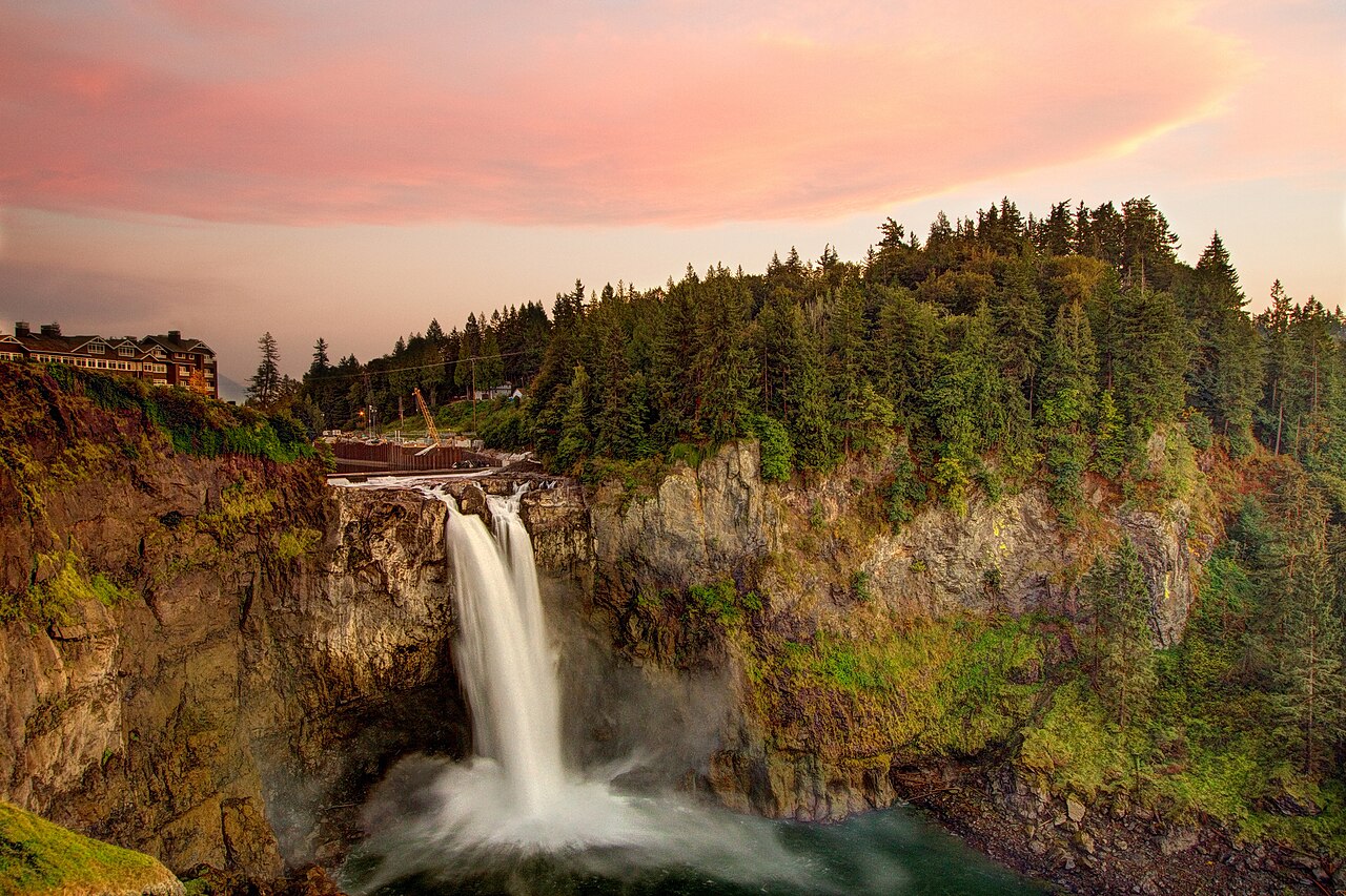
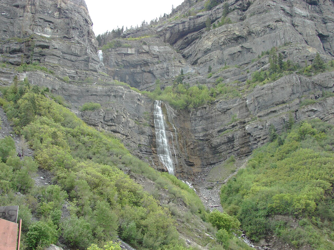
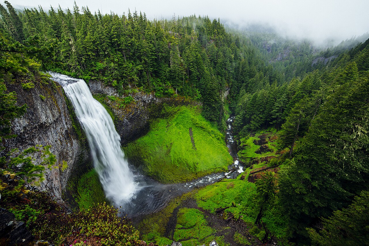
The single most common factor in waterfall injuries is not the height of the drop but the condition of the rock around it. Constant mist keeps bedrock, boulders, and trail surfaces wet long after any rain, and that moisture feeds thin films of algae and biofilm that are far more slippery than wet rock alone. The U.S. Forest Service, which manages falls like Salt Creek Falls in Oregon's Willamette National Forest, repeatedly warns that wet, algae-covered rock near falls is where most slips happen. A short, easy approach lulls people into a false sense of security: Salt Creek Falls is reached in roughly a fifth of a mile from a paved overlook, and Bridal Veil Falls in Utah sits about three-tenths of a mile from the road, so visitors arrive in street shoes with no expectation of technical terrain.
Heights, by the way, are themselves uncertain, and that uncertainty is worth holding in mind. Reported figures depend on whether a source measures a single vertical plunge or the cumulative drop of a whole cascade. Bridal Veil Falls in Utah is commonly cited near 607 feet, but that is a tiered total down the canyon wall, not one sheer drop; Montana's Bird Woman Falls in Glacier National Park is often listed around 560 feet as a horsetail spilling from a hanging valley. The takeaway is practical: a tall number on a sign tells you the river has a long way to accelerate, and the gap between the overlook and the water is usually larger and steeper than it looks.
Hydraulics: the recirculating trap at the base
The most lethal feature of a powerful waterfall is invisible from a viewing platform. Where heavy flow plunges into a pool, the falling water drives down, hits the bottom, and rolls back toward the base of the falls along the surface. This creates a churning, recirculating current that hydrologists call a hydraulic. Search-and-rescue and Forest Service safety materials describe how this reverse circulation can push a swimmer back toward the falling water and down again, trapping even strong, calm swimmers in a loop they cannot swim out of. Because the water is aerated and full of bubbles, it is also less buoyant than it looks, so flotation that works in a calm lake does not work here.
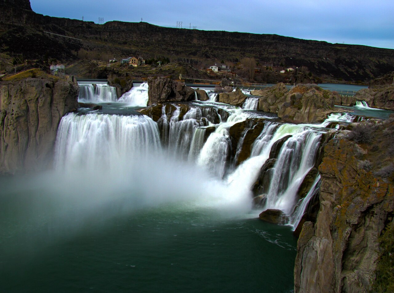
High flow makes the hydraulic stronger, and the falls featured here run hardest exactly when visitors arrive. Shoshone Falls on Idaho's Snake River, a 212-foot block falls in a Twin Falls city park, peaks in spring with snowmelt and reservoir releases (roughly April through June) — the same window that draws crowds to see it at full thunder. Snoqualmie Falls in Washington, a 268-foot plunge on the Snoqualmie River, flows year-round and surges in winter and spring; it is managed by Puget Sound Energy as part of a hydroelectric project, and the river below the falls is subject to flow changes tied to that operation, another reason the pool is no place to wade.
The practical rules follow directly from the physics. Do not swim near where a waterfall strikes its pool, do not jump from the lip, and do not dive into a plunge pool whose bottom you cannot see. Submerged logs and boulders collect at the base of falls and are impossible to spot from above, and the same recirculation that traps a body also pins debris. Even at falls with no formal swimming area, people are tempted to scramble down for a closer look; the closer you get to the curtain of water, the stronger every one of these currents becomes.

Cold-water shock: why even a strong swimmer goes under
Many iconic American falls are fed by snowmelt, which means the water is shockingly cold regardless of the air temperature. Bridal Veil Falls in Utah and Bird Woman Falls in Glacier run highest during late-spring and early-summer snowmelt, when valleys are warm but the water leaving the high country is only a few degrees above freezing. A warm, sunny day at the overlook gives no clue to the temperature of the river, and that mismatch is what catches people.
Sudden immersion in cold water triggers a well-documented physiological cascade. Research summarized by the American Physiological Society and the National Weather Service describes an involuntary gasp reflex within the first seconds, followed by hyperventilation that can run six to ten times the normal breathing rate. If the head is underwater during that first gasp — which is exactly what happens to someone who slips into a plunge pool — water enters the lungs and drowning can occur in moments. The National Weather Service treats water at 70°F or below as cold, and notes the cold-shock response is most intense between 50°F and 60°F, temperatures that feel merely bracing to a hand but overwhelm the whole body on full immersion.
The danger is front-loaded in time. Most cold-water deaths occur in the first minute or two from this gasp-and-hyperventilation response, before hypothermia is even a factor. Within five to fifteen minutes, cold incapacitation sets in: blood retreats to the core, hands and arms lose strength and dexterity, and even a fit swimmer can no longer grip a rock or pull themselves out. This is the chain of events behind drownings at otherwise gentle-looking pools — the person was never going to swim to safety, because the cold took the swim away in seconds.
Flash flooding: when the river itself becomes the hazard
The waterfalls people see are snapshots of a river that changes volume constantly. A canyon or creek can be calm and clear one moment and carry a wall of fast, muddy water the next, and the cause is often a storm miles upstream that never touches the spot where you are standing. The National Weather Service describes how water levels in narrow drainages can rise several feet in ten to fifteen minutes, funneled and amplified by the terrain, which is why the agency's blunt slogan is 'Turn Around, Don't Drown.'
The warning signs are worth memorizing because they often arrive before any official alert: a rising roar from upstream, water turning from clear to muddy, floating sticks and debris, and a noticeable jump in the current's speed or the water's level. Any one of these means leave low ground immediately and climb. Do not try to cross a flooded creek or stand on a midstream rock to ride it out, and never judge a canyon's safety by the blue sky overhead — the rain that fills it may be falling on high country you cannot see.
Spring is the riskiest season for both flow and flooding at the falls featured here, and it is no coincidence that it is also peak season. Bird Woman Falls in Glacier and Salt Creek Falls in Oregon are at their fullest during late-spring snowmelt, and warm afternoons accelerate that melt and load the rivers further. Check the forecast for the drainage above your destination, not just the trailhead, and treat any thunderstorm potential as a reason to stay out of slot canyons and narrow creek beds entirely.
Railings, closures, and the case for staying back
Most American waterfall overlooks are engineered for exactly the hazards above, and the railing is not decorative. At managed sites — the City of Twin Falls' Shoshone Falls Park, the public viewing park at Snoqualmie Falls operated around the Puget Sound Energy project, the National Park Service pullout for Bird Woman Falls along Glacier's Going-to-the-Sun corridor — the developed overlooks place visitors where the view is best and the footing is sound. The temptation to step over a railing or skirt a fence for a clearer photo puts you onto precisely the wet, algae-slick, unstable rock that the barrier exists to keep you off, often directly above a long drop or a recirculating pool.
Closures and signs reflect specific, current knowledge that a casual visitor does not have: an undercut bank, a section of trail destabilized by high flow, an icy approach, or a stretch of river running dangerously fast after upstream rain. Land managers close these areas because something has changed, not to spoil the visit. When the Forest Service or Park Service posts a closure at a falls, the safest interpretation is that they have information about today's conditions that the scenery is actively hiding from you.
The good news is that none of this requires giving up the experience. The most photographed, most powerful falls in the country — Shoshone in full spring flood, Snoqualmie thundering after winter rain, Bridal Veil tumbling 600-some feet down its canyon — are designed to be enjoyed from solid, railed overlooks a few hundred feet from parking. Wear shoes with real tread, keep children and dogs close and leashed near any edge, stay behind barriers, keep out of the water above and below the falls, and check the weather for the whole drainage before you go. The view from the right side of the railing is the one the falls were made to give you.