How Shenandoah's waterfalls work (and why timing matters)
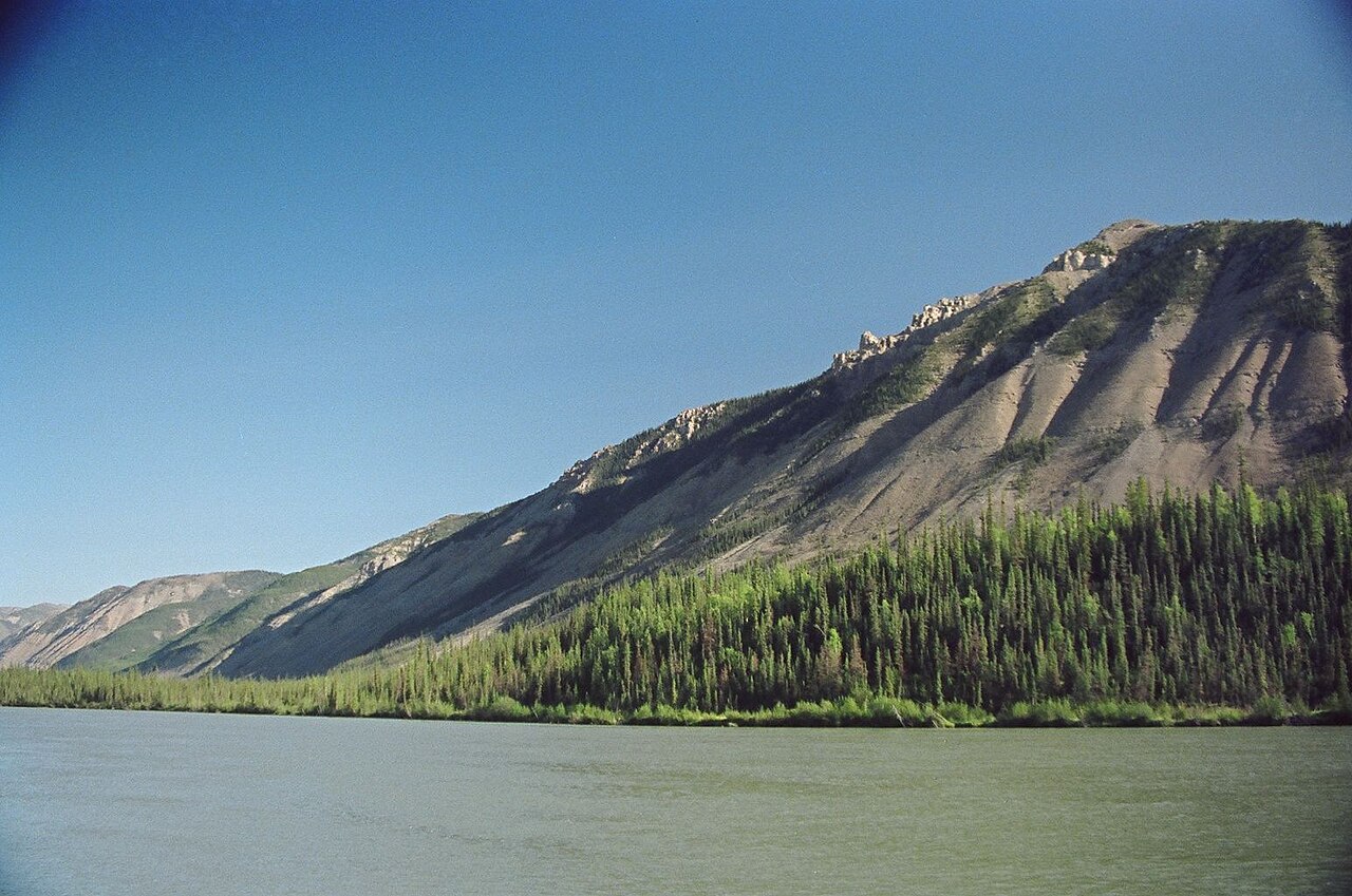
Shenandoah National Park runs as a long, narrow ridge down the Blue Ridge of Virginia, and Skyline Drive traces the spine of it for 105 miles. Almost none of the park's waterfalls are visible from the road. They live down in the side hollows, where streams like Whiteoak Run, the Rose River, Hawksbill Creek, and the South River cut through the ancient rock on their way off the mountain. That single geographic fact shapes every hike on this list: you start high at a Skyline Drive trailhead, walk downhill to the falls, and then climb back out. The descent is the easy part. The return is where the work is, and it is why a 'short' Shenandoah waterfall hike can still leave your legs burning.
Because these are mountain streams fed by snowmelt and rain rather than a large reservoir, flow swings hard with the seasons. Spring, roughly April through mid-May, is when snowmelt and spring rains push the most water over the ledges and the falls look their best. By late summer many of them thin to a trickle, and after a dry spell some can run nearly dry. Several waterfall pages note that unless there has been recent rain, the higher cascades like Overall Run can be minimal. If a roaring waterfall is the point of your trip, go in spring or within a day or two of a good rain.
Heights here should be read as approximate. Reported figures vary by source and by how each one measures a multi-step cascade, since several of these 'waterfalls' are really long chains of drops rather than a single clean plunge. The numbers in this guide (93 feet for Overall Run, 86 for Upper Whiteoak, 83 for South River, and so on) reflect commonly cited park figures, but treat them as ballpark rankings rather than surveyed measurements. What is consistent is the order: Overall Run is the tallest in the park, Upper Whiteoak is second, and South River is third.
One more practical note. Shenandoah charges an entrance fee and the falls cluster by district, North, Central, and South, so it pays to group hikes by milepost rather than zigzagging the length of Skyline Drive in a day. The Central District around Big Meadows packs the most waterfalls into the smallest stretch of road.
Best payoff for the effort: the top-tier hikes
If you want the single most dramatic Shenandoah waterfall and you are willing to work for it, Overall Run Falls is the one. At a commonly cited 93 feet it is the tallest waterfall in the park, dropping in a long cascade off Overall Run in the park's North District. The catch is access and reliability. The most common route runs roughly 5.1 miles round trip from near the Mathews Arm Campground area around milepost 22.1, and it is rated strenuous, with a real climb on the way back out toward Bentonville. It is also the most flow-dependent falls in the park: time it for spring or right after rain, because in dry stretches it can shrink to a thin ribbon over the rock. When it is running, it is the best big-payoff waterfall Shenandoah has.
For a more reliable showpiece, Whiteoak Canyon is hard to beat. The canyon holds a staircase of waterfalls, with the Upper Falls (the slug here is whiteoak-canyon-falls-upper-va) the tallest of the chain at about 86 feet, the second-highest in the park. The standard hike to the upper-falls overlook is around 4.6 miles round trip from the trailhead between mileposts 42 and 43 on Skyline Drive, with roughly 1,000-plus feet of elevation gain, putting it in moderate-to-strenuous territory depending on your legs. Whiteoak is the scenic gem of the park because you are not hiking to one waterfall, you are walking down a tiered canyon past a series of them, with plunge pools the whole way. Spring brings the fullest flow; midsummer thins it but turns the pools into popular swimming holes near Syria.
South River Falls rounds out the heavyweight tier as the park's third-highest at about 83 feet. It is also the friendliest of the three to reach. The most-used route is a 2.6-mile round trip from the South River Picnic Grounds between mileposts 62 and 63 in the park's south-central stretch near Stanardsville, ending at an observation point that looks across at the falls. It is rated moderate, with the usual Shenandoah pattern of an easy walk down and a steady climb back. For a tall waterfall on a relatively short hike, South River is the best value on this list.
All three of these are spring-season standouts. If you only have one day and want the biggest waterfalls, pair South River with a North District push to Overall Run, or build the whole day around Whiteoak Canyon and let the staircase do the work.
Best for less effort: short hikes and roadside-close falls
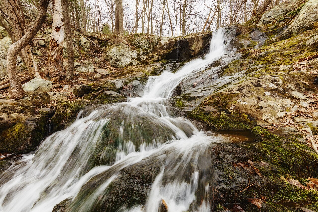
Not every Shenandoah waterfall demands a strenuous climb. Dark Hollow Falls is the park's most popular waterfall hike for exactly this reason: it is one of the closest scenic falls to Skyline Drive, reached on a short 1.4-mile round trip from the parking area near milepost 50.7 in the Central District, close to Big Meadows. The waterfall itself is a roughly 70-foot cascade tumbling down Hogcamp Branch over dark greenstone. Do not mistake short for trivial, though. The trail drops steeply to the base, which means the way back is a continuous uphill grind, and the rocks near the falls are slick. It earns a moderate rating despite the modest distance. Because it is short, central, and famous, it is also the most crowded falls in the park, so go early.
Lands Run Falls is the genuinely easy pick. Sitting in the North District near the Front Royal end of Skyline Drive, it is reached by a short 1.3-mile round trip that mostly follows a gravel fire road downhill to where Lands Run spills off the mountainside. It is the least technical waterfall hike on this list and a good warm-up or a stop when you want a waterfall without committing to a half-day. As with everything in Shenandoah it is flow-dependent, so it is far more impressive in spring than in a dry late summer.
Lewis Falls, also cataloged as Lewis Spring Falls, drops about 81 feet off Hawksbill Creek and is one of the most convenient tall falls in the park because of where it sits, right next to the Big Meadows complex near milepost 51. A common way to do it is a roughly 3.3-mile moderate loop using the blue-blazed Lewis Falls Trail and the white-blazed Appalachian Trail, which lets you stack a tall waterfall, a stretch of the AT, and easy access to food and lodging at Big Meadows into one outing. It appears in the ground-truth data under two slugs (lewis-falls-va and lewis-falls-lewis-spring-falls-va) reflecting how different catalogs record the same falls; both point to the same 81-foot waterfall on Hawksbill Creek.
These three are the best choices for families, for a half-day, or for stacking multiple stops, and all three cluster conveniently around Big Meadows and the park's two ends.
Best for collectors: loops, the southern falls, and backcountry
If your goal is to bag several waterfalls in one outing, Shenandoah's loop hikes are the move. The Rose River loop is the classic. A roughly 4-mile circuit from the Fishers Gap Overlook area around milepost 49.4 in the Central District takes you down along the river to the 67-foot Rose River Falls, then back out on the Rose River Fire Road. Run clockwise it puts the falls and the river walk first and saves the easier fire-road grade for the climb out. Its real advantage is proximity: the loop runs close to Dark Hollow Falls, so with a short add-on you can knock out two of the park's best Central District waterfalls in a single moderate day near Syria.
In the South District, the Doyles River and Jones Run pairing is the collector's hike. Doyles River Falls is a roughly 63-foot plunge (with a smaller upper falls of about 28 feet above it) reached on a 3.3-mile out-and-back from the Browns Gap area near Crozet. Jones Run Falls is a roughly 42-foot plunge on a 3.2-mile out-and-back nearby, near Grottoes. Hikers often link the two into a single loop of around 6.5 miles that strings together a trio of drops through the Browns Gap wilderness. Both are moderate, both are spring-fed, and both reward an early start before the South District's trailhead parking fills.
For the truly completist, Naked Creek Falls sits in backcountry territory near Stanley on Naked Creek. Its height is not reliably cataloged, and access is rougher and less developed than the marquee falls, so treat it as a strenuous, navigation-required objective rather than a casual stop. It is the kind of falls you seek out once you have already done the classics and want something quieter and off the standard rotation.
Stacking strategy: build a Central District day around the Rose River loop plus Dark Hollow, and a South District day around the Doyles River and Jones Run loop. That captures five of the park's named falls in two outings, leaving the North District's Overall Run and Lands Run for a separate trip from the Front Royal end.
The ranked shortlist, by payoff against effort
Treating 'payoff' as the height and drama of the falls and 'effort' as distance, elevation, and difficulty, here is how the classics stack up. Best overall when it is flowing: Overall Run Falls (93 ft), the tallest in the park, but strenuous at about 5.1 miles round trip and the most rain-dependent, so it is a spring-only or post-rain pick. Best reliable showpiece: Whiteoak Canyon Upper Falls (86 ft), a 4.6-mile round trip with real climbing that delivers a whole staircase of waterfalls rather than one. Best value: South River Falls (83 ft), the third-tallest on just a 2.6-mile moderate round trip.
Best short hike with a tall payoff: Lewis Spring Falls (81 ft) on a roughly 3.3-mile loop right beside Big Meadows. Most popular and most accessible cascade: Dark Hollow Falls (70 ft) at 1.4 miles, the closest scenic falls to Skyline Drive, though steep and crowded. Easiest of all: Lands Run Falls at 1.3 miles on a fire road near Front Royal. Best two-for-one loop: Rose River Falls (67 ft) on a 4-mile loop that pairs naturally with Dark Hollow.
Best southern collector hike: the Doyles River (about 63 ft) and Jones Run (about 42 ft) loop, two plunges and an upper drop strung through the Browns Gap wilderness. And for the completist willing to leave the maintained routes: Naked Creek Falls, backcountry and strenuous, with no reliable published height.
Across the board, two rules hold. First, go in spring, ideally April through mid-May, or within a day of solid rain, because every one of these falls is snowmelt-and-rain fed and several can run thin or dry in late summer. Second, respect the climb out. Shenandoah hikes start at the road and drop to the water, so the hardest part of every one of these comes at the end, when you are walking back uphill to Skyline Drive.