Why the Smokies Are Waterfall Country
The Great Smoky Mountains and the ranges that surround them form one of the wettest landscapes in the contiguous United States. High elevations wring 50 to 85 inches of rain a year out of moisture-laden air pushing up from the Gulf, and that water has to go somewhere. It pours off the spine of the range through a dense web of creeks and prongs, and wherever those streams meet a band of harder, slower-eroding rock, the result is a waterfall. Great Smoky Mountains National Park alone straddles the Tennessee and North Carolina line, and the national forests that ring it, Nantahala and Cherokee, hold dozens more cataracts within an easy drive.
This guide covers the classic falls across that whole region, not just the ones inside the park boundary. That distinction matters for planning, because the land managers set very different rules. Inside the park, the National Park Service prohibits climbing on or above waterfalls and keeps the trails primitive. In the Nantahala and Cherokee National Forests, the U.S. Forest Service manages roadside overlooks and short interpretive walks. And a handful of the best falls, including Mingo Falls and Soco Falls, sit on the Qualla Boundary, the homeland of the Eastern Band of Cherokee Indians, who steward those sites directly.
Heights in this guide are drawn from agency signage and from standard references such as Kevin Adams' North Carolina Waterfalls, the U.S. Geological Survey's Geographic Names Information System, and the World Waterfall Database. Be aware that a single waterfall is often reported at several different heights. A figure may describe one clean plunge, or it may add up a long series of cascades into a cumulative drop. Cullasaja Falls, for example, is listed at 200 feet in Adams' guidebook and at 250 feet by other catalogs. When the numbers disagree, this guide notes it rather than pretending to a precision the sources do not support.
Whitewater Falls: The Tallest Drop in the East
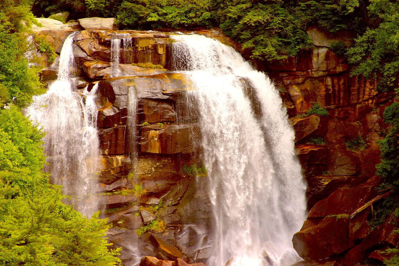
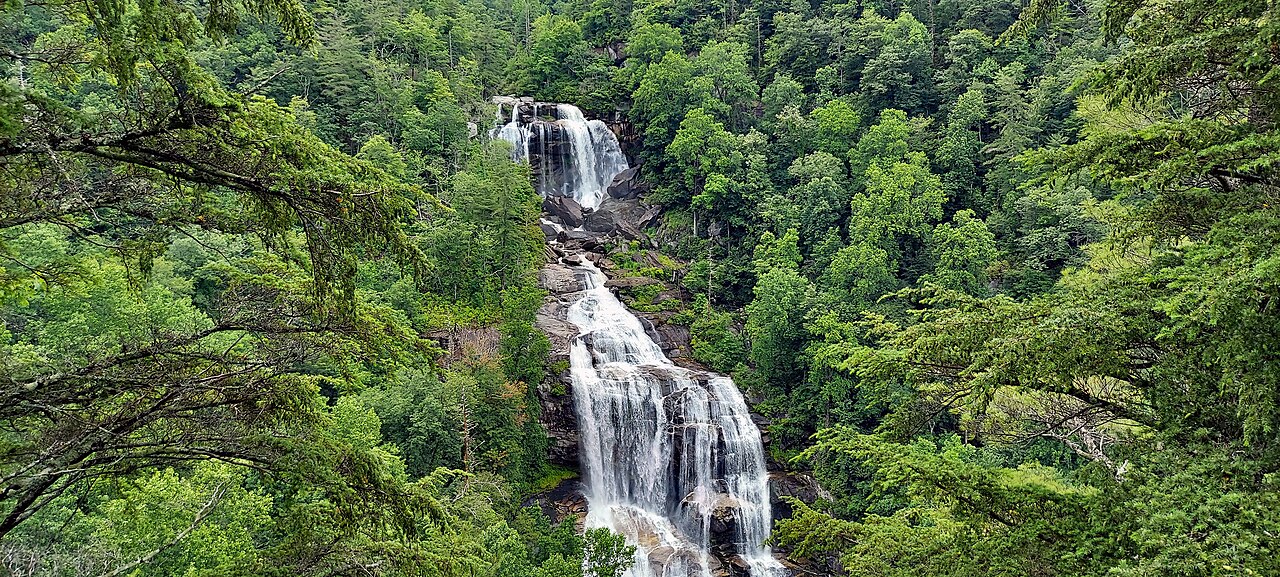
If you visit only one waterfall in the southern mountains, make it Whitewater Falls. Set on the Whitewater River in the Nantahala National Forest near Sapphire and Cashiers, North Carolina, the upper falls drops a reported 411 feet in a thundering, multi-tiered cascade. That figure makes it a frequent claimant to the title of highest waterfall east of the Rocky Mountains, though the crown is genuinely contested. Crabtree Falls in Virginia, Amicalola Falls in Georgia, and Glassmine Falls in North Carolina all stake similar claims depending on how you define and measure a single waterfall. What is not disputed is that Whitewater is enormous, loud, and unforgettable.
You may see the falls referred to under several names, including Whitewater Falls, Upper Whitewater Falls, and Whitewater Falls (Upper). These all describe the same drop on the same river. The naming tangle comes from the fact that the Whitewater River carries water over a second, lower cataract downstream in South Carolina; over the roughly 3.5 miles between the two falls, the river loses about 1,500 feet of elevation and crosses the state line. The North Carolina drop is the famous one, and its character is best described as tiered, with the water breaking into a series of plunges and slides down the gorge wall rather than a single free fall.
Reaching the overlook is genuinely easy. A paved path of roughly half a mile climbs from the Forest Service parking area to a fenced upper viewing platform, and a longer stairway descends toward a lower view of the gorge. The trail is rated easy and is partly accessible, which makes Whitewater one of the few falls of this scale that nearly anyone can see. The best time to go is during spring snowmelt and after heavy rain, roughly March through May, when the volume is at its peak. As at every tall waterfall in the region, stay behind the railings; the wet rock above these drops has killed people who tried to climb it.
Inside the Park: Ramsey Cascades, Rainbow Falls, and Grotto Falls
The three signature waterfall hikes inside Great Smoky Mountains National Park sit on the Tennessee side near Gatlinburg, and they form a neat ladder from gentle to grueling. Grotto Falls is the easy entry point. A 2.6-mile round-trip walk on the Trillium Gap Trail, starting from the Roaring Fork Motor Nature Trail, leads through an old-growth hemlock forest to a 25-foot plunge on Roaring Fork. Its signature feature is that the trail passes behind the falling water, the only waterfall in the park you can walk behind. The hike is rated moderate and is rewarding in any season.
Rainbow Falls is the step up. The trail climbs about 2.7 miles each way, roughly 5.4 miles round trip, along LeConte Creek from a trailhead on the Roaring Fork Motor Nature Trail, gaining serious elevation on a rocky, root-laced path that is rated strenuous. The payoff is an 80-foot drop, described by the Park Service as the tallest single-drop waterfall in the Smokies; on sunny afternoons, mist at the base can throw the rainbow that gives the falls its name. The same trail continues another four-plus miles to the summit of Mount LeConte for those wanting a much longer day.
Ramsey Cascades is the giant of the park, both in height and in effort. At a reported 105 feet, it is the tallest waterfall in Great Smoky Mountains National Park, falling in a steep, fanning cascade over Ramsey Prong. Earning the view requires an 8-mile round-trip hike from the Greenbrier area that gains more than 2,000 feet, winding through some of the finest old-growth cove hardwood forest in the East and crossing several footlog bridges. Plan on four to six hours and treat it as a real backcountry day. The Park Service warns explicitly against climbing the wet rock at the top, where several visitors have drowned. Spring and fall are the prime seasons, with spring delivering the heaviest flow and fall the color.
The Cullasaja Gorge: A Drive-Up Waterfall Corridor
For travelers who want maximum waterfall per mile with minimal hiking, the Cullasaja Gorge between Franklin and Highlands, North Carolina, is the place to point the car. U.S. 64 threads the narrow gorge along the Mountain Waters Scenic Byway, and the Cullasaja River drops past a string of falls visible from or near the road, all on Nantahala National Forest land. It is one of the most concentrated stretches of roadside waterfalls in the southern mountains.
Cullasaja Falls anchors the lower gorge. The river slides roughly 200 feet, by Kevin Adams' measurement, over a long cascade of about 0.2 miles; some catalogs put the total nearer 250 feet, a discrepancy that comes down to where you start and stop counting the cascade. There is no trail to speak of: the falls are viewed from a small, awkward pull-off carved into a blind curve on US-64, with sheer rock above and below the road. The view is spectacular and the parking is genuinely dangerous, so approach with care and watch for traffic.
A few miles upstream sits Dry Falls, the gorge's crowd-pleaser. This 75-foot plunge on the same Cullasaja River is reached by a paved walkway of about 0.2 miles from a Forest Service lot, and the trail leads behind the curtain of water, letting you stand in the cool overhang and look out through the falls. It is rated easy and is one of the most family-friendly walk-behind falls in the state. The flow is best in spring and after heavy rain, roughly March through June. Together, Cullasaja and Dry Falls let you experience two very different waterfalls within a short drive of Highlands.

Cherokee Country: Mingo Falls and Soco Falls
On the North Carolina side, near the town of Cherokee, two of the region's most striking falls sit on or beside the Qualla Boundary, the homeland of the Eastern Band of Cherokee Indians. Mingo Falls is the headliner: a 120-foot ribbon of water tumbling down a mossy rock face on Mingo Creek, among the tallest waterfalls in the southern Appalachians. The name derives from a Cherokee word often translated as Big Bear. The hike is short, about 0.4 miles round trip, but it earns its moderate rating with a steep staircase of roughly 160 steps at the start; once you top the stairs, a level path leads quickly to a wooden footbridge with a head-on view of the falls.
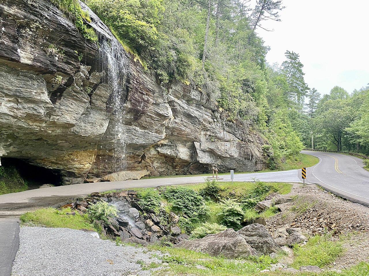
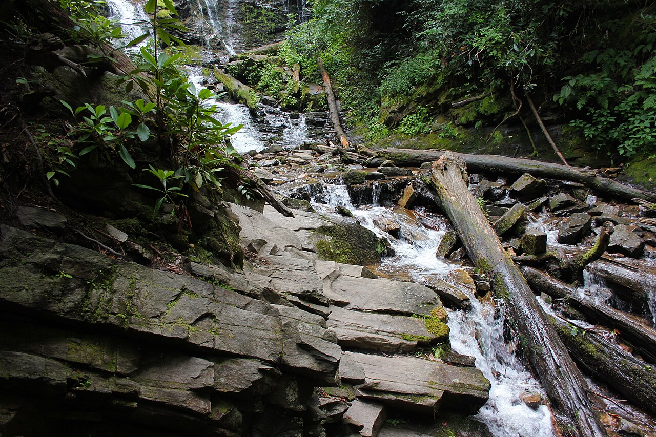
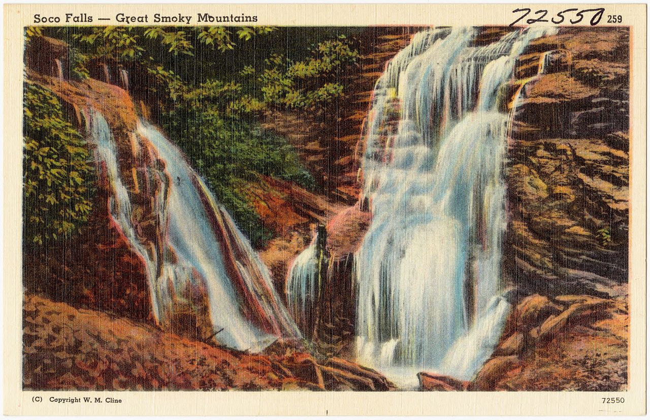
Soco Falls, just off U.S. 19 between Maggie Valley and Cherokee, is a rarer thing: a segmented, or double, waterfall where two separate streams plunge side by side into a shared pool. The taller of the two drops about 120 feet. The site sits at a small, easily missed roadside pull-off about 1.5 miles south of the Blue Ridge Parkway at Soco Gap. A short but steep and often muddy path of roughly 0.6 miles round trip drops to an observation deck; reaching the base itself involves a rough, slick scramble that the cautious should skip. Rate the walk moderate and wear real shoes.
Because these sites are stewarded by the Eastern Band of Cherokee Indians rather than a federal agency, visitors should treat them with extra respect, pack out everything, and follow any posted guidance. Both falls run year-round, with the heaviest flow in late winter and spring.
Cherokee National Forest and Planning Your Trip
Across the state line in Tennessee, the Cherokee National Forest holds the region's best pure roadside waterfall. Bald River Falls drops about 90 feet in a wide, powerful cascade right beside Tellico River Road (Forest Road 210) near Tellico Plains, where the Bald River empties into the Tellico. You can see and photograph it without leaving the bridge, which makes it one of the easiest big falls in the region to reach. The Forest Service notes it runs strongest in winter and spring, when snowmelt and rain swell the river.
A few practical notes apply across the whole region. Waterfall volume is entirely a function of recent rain, so for the most dramatic flow, plan around spring snowmelt or visit within a day or two of heavy rain; late-summer droughts can reduce even the tall falls to a trickle. Fall delivers the famous foliage but often lower water. Inside the national park, the National Park Service prohibits climbing on or above any waterfall, a rule written in the blood of visitors who ignored it at Ramsey Cascades and elsewhere; the wet rock at the lip of these falls is far more slippery than it looks.
Match the falls to your group. For minimal walking, choose Whitewater Falls, Cullasaja Falls, Bald River Falls, and Dry Falls, all roadside or near-roadside. For a moderate family outing, Grotto Falls, Mingo Falls, and Soco Falls reward a short, steeper effort. For a full hiking day, Rainbow Falls and Ramsey Cascades demand strenuous, multi-hour treks but deliver the park's tallest drops. Carry the standard hiking essentials, check the National Park Service and Forest Service sites for current trail and road closures before you go, and remember that the Roaring Fork Motor Nature Trail, which serves both Grotto and Rainbow Falls, is seasonal and closed in winter.