How to Think About Wyoming's Waterfalls
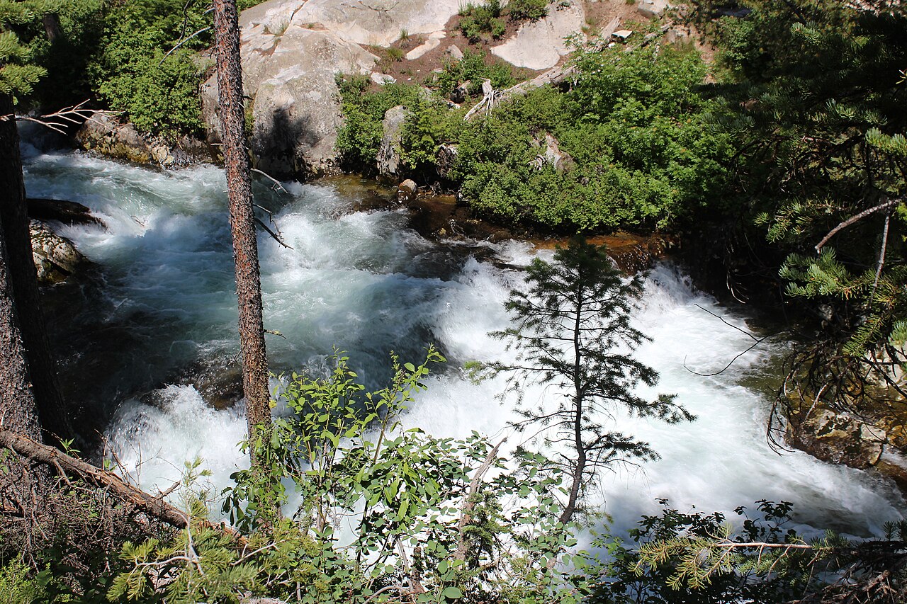
Wyoming is a high, dry state, but it holds two of the most concentrated and dramatic waterfall districts in the American West. Almost everything memorable sits inside Yellowstone National Park or Grand Teton National Park, both managed by the National Park Service. That is not an accident of curation — it is geology. The Yellowstone Plateau and the Teton Range catch deep winter snowpack, and when it melts in late spring it drives rivers and creeks over hard volcanic rock and glacial ledges. The result is waterfalls with both height and serious volume, which is a rarer combination than it sounds.
This guide is a curated set, not a census. The U.S. Geological Survey's Geographic Names Information System (GNIS) catalogs hundreds of named falls and rapids across the state, and Yellowstone alone is documented to contain hundreds of waterfalls, many of them unnamed, off-trail, and visited by almost no one. What follows are four well-documented, reachable falls that reward a deliberate visit: Lower Yellowstone Falls, Tower Fall, Upper Yellowstone Falls, and Hidden Falls. Three sit in Yellowstone; one sits in Grand Teton. All four are reached by short hikes rather than backcountry expeditions.
One honest caveat runs through every entry below: reported heights vary by source and method. A clean single plunge like Lower Yellowstone Falls is relatively easy to measure, but cascades that step down a slope are often reported as a cumulative drop, and different agencies and databases round differently. The figures here come from the National Park Service and are corroborated by the World Waterfall Database and GNIS, but treat them as well-supported estimates rather than surveyed-to-the-inch certainties.
Lower Yellowstone Falls: The Headliner
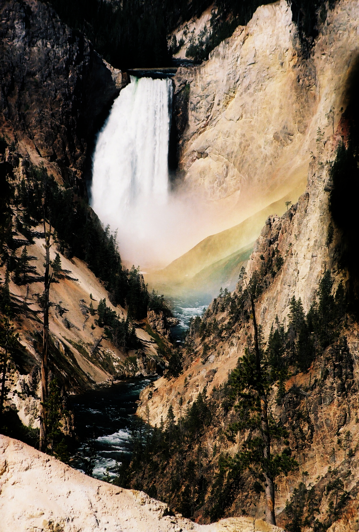
If you visit one waterfall in Wyoming, make it Lower Yellowstone Falls. At a documented 308 feet, this single plunge of the Yellowstone River into the Grand Canyon of the Yellowstone is nearly twice the height of Niagara, and it is the largest-volume waterfall in the Rocky Mountains. During peak runoff, anywhere from a few thousand to tens of thousands of gallons of water per second pour over the brink — the kind of force you feel in your chest at the overlooks, not just see.
The falls anchor the Canyon Village area, and the nearest hub for food, lodging, and a visitor center is Canyon Village itself. You do not need to be a hiker to experience it. The most popular and accessible vantage is Artist Point on the South Rim, reached on a paved path a few minutes from the parking area. For a more visceral encounter, the Brink of the Lower Falls Trail drops roughly 0.7 miles down a steep, switchbacking grade to a platform right at the lip, where the entire river funnels past your feet. Remember that what goes down must come back up — the return climb is the hard part, and the elevation here is over 7,700 feet.
Time it for late spring. Peak runoff in May and June puts the most water over the falls and the canyon's famously yellow and orange rhyolite walls at their most saturated. The falls run year-round, but by late summer flow drops noticeably. Note that Yellowstone's interior roads are seasonal: most don't open until spring plowing finishes, so confirm road status with the park before planning an early-season trip.
Upper Yellowstone Falls: The Quieter Companion
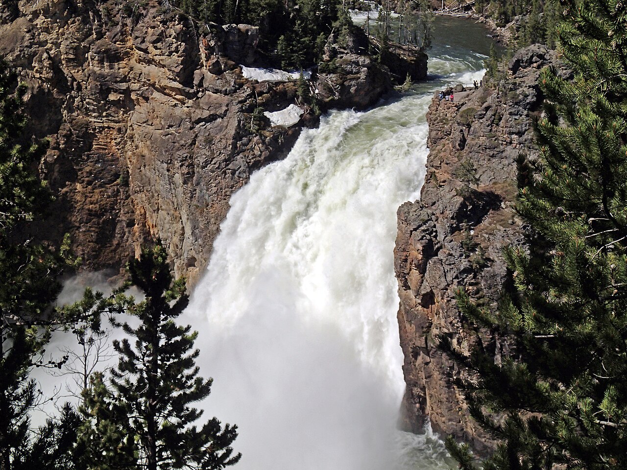
Just upstream of its bigger sibling, Upper Yellowstone Falls drops a documented 109 feet where the Yellowstone River makes its first major plunge before entering the Grand Canyon. It is shorter than the Lower Falls and gets less attention, which is precisely its appeal — you can often find a quieter moment here even on a busy day. The two falls together tell the story of the canyon: the river gathers itself at the Upper Falls, then commits fully at the Lower Falls a short distance downstream.
Access is genuinely easy. From the Canyon Village area, the Brink of the Upper Falls is reached by a short walk of about half a mile, putting you close enough to feel the spray and watch the river compress and accelerate over the edge. Because it shares the same watercourse and the same source snowpack as the Lower Falls, it peaks on the same calendar — May and June runoff is when it is loudest and fullest.
Pairing the Upper and Lower Falls in a single visit is the smart move. They are minutes apart by car along the canyon's rim roads, and seeing both back to back gives you the full vertical narrative of the Yellowstone River in one stop. If you are choosing where to spend your energy, treat the Upper Falls as the warm-up and the Lower Falls overlooks as the main event.
Tower Fall: The Roadside Classic
Tower Fall is the easiest serious waterfall to see in Yellowstone, and one of the most photographed. The name is singular — Tower Fall, after the spire-like rock pinnacles, or 'towers,' that frame the top of the drop. Tower Creek plunges a documented 132 feet here, roughly 1,000 yards above where it joins the Yellowstone River, and the dark eroded pinnacles give the scene a distinctive, almost gothic silhouette that has drawn artists since the 19th century.
Reaching the main viewpoint asks almost nothing of you. The overlook sits just off the road in the Tower-Roosevelt area, reached by a flat walk of only about a tenth of a mile from the parking area near the Tower General Store. That makes it an ideal stop for travelers short on time or hiking ability, and a natural pairing with wildlife watching in the nearby Lamar Valley and Tower-Roosevelt district. A longer trail historically continued down toward the base, but trail conditions at the bottom have varied over the years — check current status with a ranger or the park website before counting on a base-of-falls route.
Like the rest of the Yellowstone falls, Tower Fall runs hardest during late spring and early summer snowmelt. Tower Creek is a smaller watercourse than the main Yellowstone River, so its flow is more sensitive to the season — by late summer it can thin considerably. Late May through June is the sweet spot for a full, thundering Tower Fall set against the pinnacles.
Hidden Falls: The Teton Standout
Cross into Grand Teton National Park and the character of the water changes. Hidden Falls is a 100-foot cascade on Cascade Creek, near the mouth of Cascade Canyon, fed directly by Teton snowmelt. Unlike the clean vertical plunges of the Yellowstone falls, Hidden Falls steps and fans down the rock in classic cascade form — the kind of waterfall that looks different at every flow level and rewards lingering. Its reported height reflects that cascading geometry, so as with any stepped fall, the figure is best read as the overall drop rather than a single sheer face.
The falls sit on the far side of Jenny Lake, near the town of Moose, and how far you walk depends on how you cross the water. Take the Jenny Lake boat shuttle across and it is a short, roughly mile-long round trip on the order of 1.2 trail miles, with only modest elevation gain to the viewing area. Skip the boat and hike around the lake instead and the round trip stretches to roughly five miles. Most visitors take the shuttle, which makes Hidden Falls one of the most accessible big waterfalls in the Tetons. From the falls, an extra half-mile of climbing reaches Inspiration Point and the gateway to Cascade Canyon for those who want more.
Best season here runs a touch longer than in Yellowstone — spring snowmelt drives the heaviest flow, generally May through July, with the highest water typically in late spring as the Teton snowpack lets go. Early in the season, lingering snow and ice can affect the trail and the boat shuttle schedule, so confirm shuttle operating dates with the park. In a high-snow year, Hidden Falls in June is one of the finest short-hike waterfalls in the state.
Planning, Seasons, and a Note on the Numbers
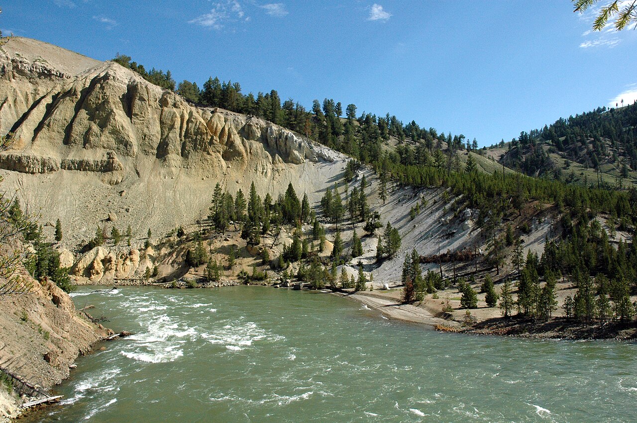
The unifying lesson of Wyoming's best waterfalls is timing. All four are snowmelt-driven, which means late spring is the window: roughly May and June for the Yellowstone falls and May through July for Hidden Falls in the Tetons. Visit in that window and you get maximum volume; visit in late summer or fall and you trade thundering flow for thinner water, smaller crowds, and easier travel. Winter access is limited or closed for all of them, since both parks' interior roads close seasonally and many open only after spring plowing.
Practical logistics matter as much as the falls themselves. These are high-elevation sites — Yellowstone's canyon overlooks sit above 7,700 feet — so even short 'brink' trails like the 0.7-mile descent at Lower Yellowstone Falls can feel strenuous on the climb back, and altitude affects pacing. Check road and trail status with the National Park Service before you go, carry water, and build in time for traffic and parking at marquee stops like Canyon Village, Tower-Roosevelt, and Jenny Lake, all of which see heavy summer demand.
Finally, a word on the heights cited throughout: 308 feet for Lower Yellowstone Falls, 132 for Tower Fall, 109 for Upper Yellowstone Falls, and 100 for Hidden Falls. These come from the National Park Service and align with the World Waterfall Database and USGS GNIS, but reported waterfall heights legitimately vary by source and measurement method — a sheer plunge is measured differently than a multi-step cascade. Use these as reliable, well-corroborated figures, not as the final decimal word. And remember this is a curated shortlist: Wyoming holds hundreds more named and unnamed falls in GNIS, from remote Yellowstone backcountry drops to quiet creeks on national forest land, waiting for a more ambitious itinerary.