What Makes a Vermont Waterfall Worth the Drive
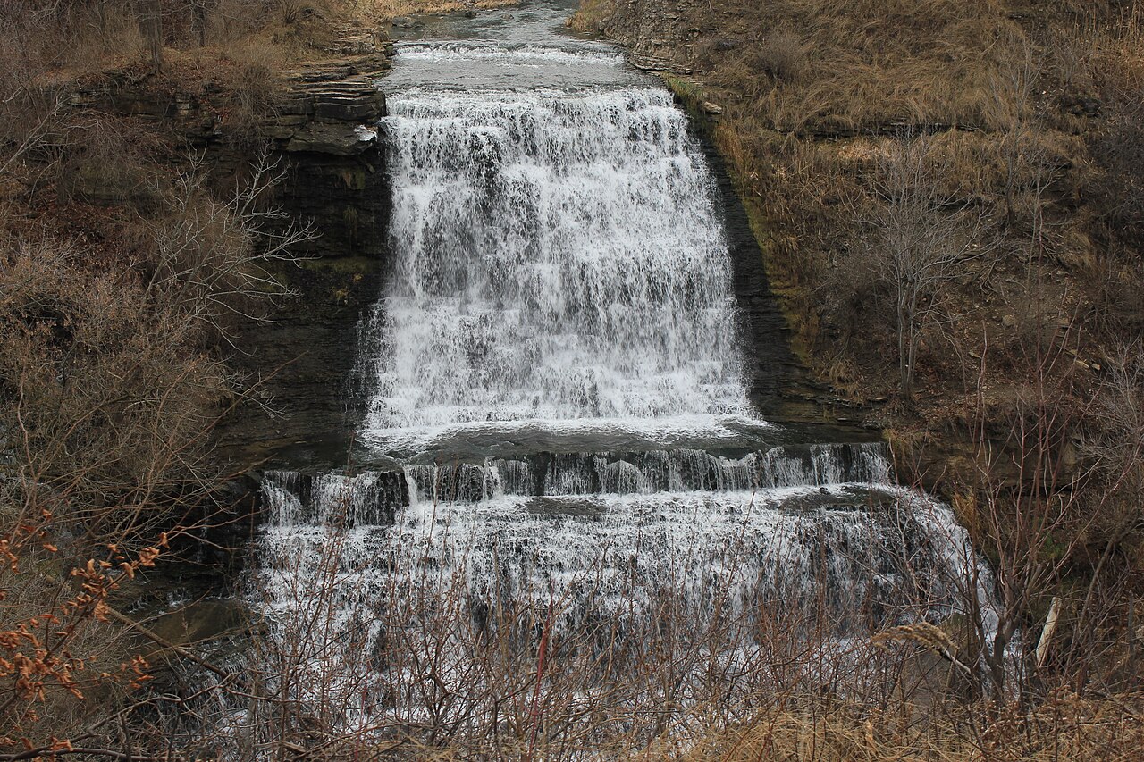
Vermont does not have a single towering, postcard plunge the way some states do. What it has instead is the Green Mountains — a north-south spine of resistant metamorphic bedrock (schist, gneiss, quartzite) folded and faulted over hundreds of millions of years — and dozens of cold mountain brooks that step down through it in long, sliding cascades and tight gorges. Most of the state's celebrated falls are cascades or tiered drops rather than free-falling plunges, and several of the most impressive are technically a long sequence of drops measured cumulatively. That distinction matters when you read a height figure: a number like '140 feet' usually describes the total drop of a cascade strung out over a slope, not a single vertical curtain of water.
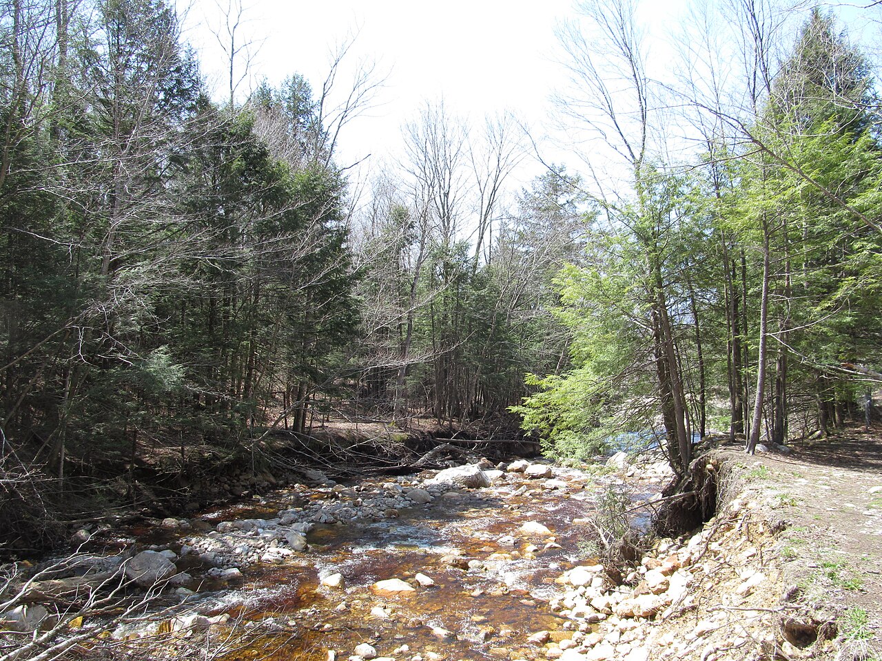
Because these are snowmelt- and rain-fed mountain streams rather than large rivers, flow is highly seasonal. The general rule across the state is that the falls run hardest from roughly April through June, when winter snowpack melts off the high ground, and again after heavy rain. By late summer many Vermont brooks drop to a trickle, and a falls that thundered in May can be a quiet slide of water in August. The trade-off is that summer brings warm pools and easy footing, while spring brings volume, mud, and slick rock. There is no single 'best' season — it depends on whether you want power or swimming.
Most of these waterfalls sit on public land: the Green Mountain National Forest (managed by the U.S. Forest Service), state forests and parks run by Vermont's Department of Forests, Parks and Recreation (FPR), and in a couple of cases town-owned land. That public ownership is why they're accessible and reasonably documented, but it also means rules vary — some have day-use fees in season, some restrict swimming or jumping for safety reasons, and several have a documented history of serious accidents. The sections below order the falls roughly from the tallest and most dramatic down to the smaller roadside and swimming-hole stops, but every one of them is a genuine destination.
The Tall Cascades: Thundering Brook, Moss Glen (Stowe), and Lye Brook
Thundering Brook Falls near Killington is one of the most accessible big-drop falls in the state. The waterfall is a cascade with a reported height in the neighborhood of 140 feet, descending Thundering Brook on land tied to the Green Mountain National Forest and the Appalachian Trail. The viewing experience is unusually easy for a falls this size: a roughly half-mile route, including a boardwalk section that is largely barrier-free, brings you to a lower viewpoint, making this one of the few tall Vermont falls reachable by visitors who can't manage a rugged trail. Spring through fall is the window, with the heaviest flow earlier in that range.
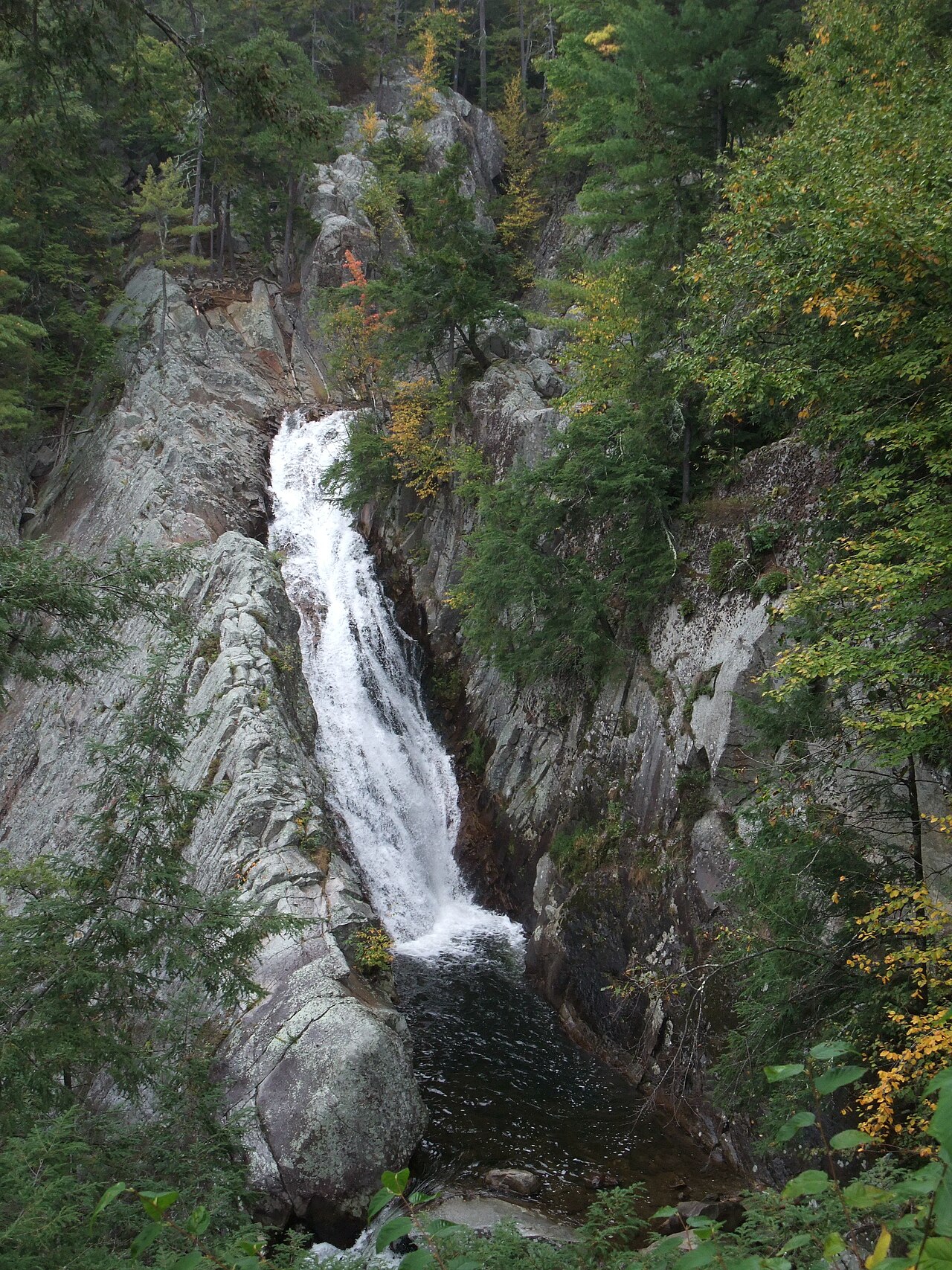
Moss Glen Falls in Stowe — not to be confused with the Granville waterfall of the same name discussed later — is a tall cascade on Moss Glen Brook within the C.C. Putnam State Forest, managed by Vermont FPR. Sources put its overall height around 125 feet across its tiers. The hike is short, on the order of 0.6 miles, but it earns a 'moderate' rating because the upper viewpoints involve steep, eroded, and sometimes slippery sections. It's at its best in spring and early summer when snowmelt drives the brook. Take the upper-viewpoint footing seriously here; the terrain above the falls is steep and has been the site of accidents.
Lye Brook Falls, in the Lye Brook Wilderness of the Green Mountain National Forest near Manchester, is the reward for the longest hike on this list — roughly 4.5 miles round trip on the Lye Brook Trail, rated moderate. It's a long, fanning cascade reported at around 125 feet, and because it sits inside a designated Wilderness area the setting is quiet and undeveloped. The best season runs April through October; like the other tall cascades, it shows far more water in spring and after rain than in a dry late summer. The distance and elevation gain make it a half-day outing rather than a quick stop.
All three of these share the same caveat about height: the figures are cumulative cascade measurements, and different sources and measurement methods produce somewhat different numbers. Treat '125 to 140 feet' as a reasonable order of magnitude rather than a surveyed exact drop.
Gorge and Pool Falls: Hamilton, Falls of Lana, and Bingham
Hamilton Falls, near Jamaica, is among the tallest and most dangerous waterfalls in Vermont. It drops roughly 125 feet down Cobb Brook within the Hamilton Falls Natural Area, associated with Jamaica State Park and managed by Vermont FPR. The most common approach is a longer outing — on the order of 5.8 miles round trip via the park's trails, rated moderate for distance rather than technical difficulty. The falls are beautiful, with sculpted potholes in the bedrock, but those same smooth, water-polished chutes have a documented history of fatal falls. Swimming and climbing on the falls themselves are restricted, and the warnings here are not boilerplate; this is a look-don't-climb destination.
Falls of Lana, near Salisbury, drops about 100 feet on Sucker Brook in a setting shared between the Green Mountain National Forest and Branbury State Park, close to Lake Dunmore. The hike runs roughly 3 miles and is rated moderate; the trails here connect to the broader Silver Lake and Rattlesnake Cliffs network, so the falls can be a stop on a longer loop with lake and overlook views. The best season is wide — April through November — though as always the flow is strongest in spring. The series of drops and pools makes it photogenic across its length rather than at a single viewpoint.
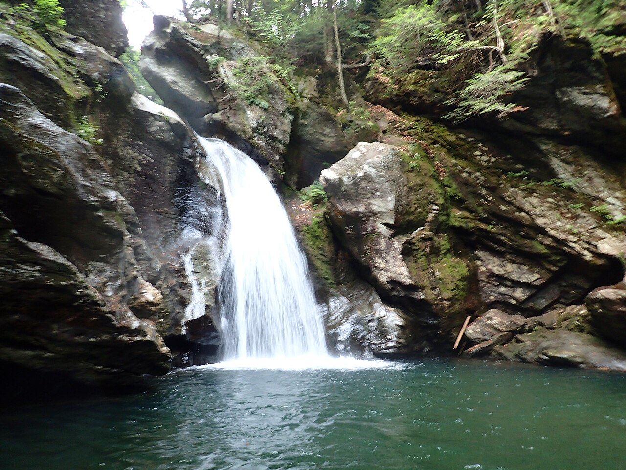
Bingham Falls, just outside Stowe on the West Branch of the Little River within Mount Mansfield State Forest, is a tiered falls reported around 91 feet. The trail is short — about half a mile — but rated moderate because the path descends steeply into the gorge over roots and rock to reach the lower pools. It's a popular spot precisely because the payoff (a deep emerald pool below the main drop) comes after a brief walk, and it's good spring through fall. As with the other gorge falls, the wet rock is slick and the descent demands care, especially in spring high water.
Roadside and Short-Walk Falls: Granville Moss Glen, Texas Falls, and Terrill Gorge
Moss Glen Falls in Granville (the second waterfall of that name on this list) is the easiest of all to reach — essentially a roadside stop. It's a fan-type falls of about 35 feet on Deer Hollow Brook along the Vermont Route 100 corridor in the Green Mountain National Forest, with a viewing platform only a hundred feet or so from the pullout. Because the brook is small, this one is most rewarding during spring snowmelt, roughly April through June; in dry spells it thins out considerably. It pairs naturally with a scenic drive along Route 100 rather than a dedicated hike.
Texas Falls, near Hancock, is a punchbowl-style falls of about 35 feet on the Hancock Branch, also in the Green Mountain National Forest. The Forest Service maintains a short interpretive nature trail and footbridges here — figure on roughly a 1.2-mile easy loop — making it one of the most family-friendly stops in the state. The water has carved smooth potholes and a small gorge that's the real attraction up close. Like Granville's Moss Glen, it peaks with spring snowmelt from April into June. There's a picnic area nearby, which makes it a good combined outing.
Terrill Gorge, also known as Cady Falls, sits on Kenfield Brook on town land in Morristown. Its height isn't well documented in the public record — which is itself a useful reminder that not every notable Vermont falls has been formally surveyed — but it's a punchbowl-style falls reached by a short walk of about a mile, rated easy, and it's best known as a summer swimming destination. Because it's town-owned rather than part of the state or federal system, signage and amenities are minimal; treat it as a local spot and tread lightly. Summer is the season here, when the lower flow and warm pools make for swimming rather than spectacle.
Planning Your Trip: Seasons, Safety, and Geography
If you're building an itinerary, geography clusters these falls helpfully. The Stowe area alone holds Moss Glen Falls (Stowe) and Bingham Falls within a short drive of each other, with Texas Falls and both the Granville Moss Glen reachable down the Route 100 corridor toward the center of the state. The southern Green Mountains hold Lye Brook (Manchester) and Hamilton Falls (Jamaica). Falls of Lana sits to the west near Lake Dunmore, and Thundering Brook is central near Killington. With early starts you can reasonably string two or three together in a day if they're in the same cluster.
Time your visit to your goal. For raw power and full cascades, go in the snowmelt window — roughly April through June — accepting mud, high water, and slick rock as the cost. For swimming and easy footing, go in summer, knowing that some falls will be running thin. Fall adds foliage to several of these, particularly the longer-hike falls like Lye Brook and Falls of Lana, whose seasons stretch into October and November. After any heavy rain, even the smaller brooks come alive briefly.
Take the safety warnings literally. Several of these falls — Hamilton Falls and Moss Glen (Stowe) most notably — have documented histories of serious and fatal accidents, almost always involving climbing on or jumping into the falls themselves on rock that is far slicker than it looks. The same polished bedrock that makes a falls beautiful makes the edges treacherous. Stay on marked trails and viewpoints, respect posted swimming and climbing restrictions, and remember that spring high water turns an ordinary scramble into a real hazard. These are public lands held in trust; pack out what you bring, stay on durable surfaces, and check the managing agency's site for current fees, closures, and conditions before you go.