How to read this guide (and why New Mexico is different)
New Mexico does not announce itself as waterfall country, and that is the point. This is a high, dry state where most streams are seasonal and many are dry by midsummer. So the waterfalls that do exist here tend to fall into two camps: snowmelt falls in the forested mountains that run hard for a few weeks in spring and then fade, and a smaller, more interesting set of spring-fed and travertine features that flow when nearly everything around them is parched. Understanding which camp a fall belongs to matters more here than in a wetter state — it is the difference between a thundering cascade and a damp stain on the rock.
This is a curated selection, not a census. There are more named and unnamed falls in New Mexico than any single list can hold, and many of the best are small, seasonal, or tucked into canyons without official trail descriptions. What follows is nine documented falls chosen for a strong combination of scale or distinctiveness, public or permitted access, and a real record from agencies like the U.S. Forest Service, plus the tribal and land-grant authorities who manage two of them. If a fall you love is missing, that is a limit of scope, not a verdict on the water.
A word on the numbers, because waterfall heights are slippery everywhere and especially here. A reported height depends on how it was measured — the tallest single uninterrupted drop, or the cumulative fall of a multi-tier cascade from the top of the first plunge to the bottom of the last. Several New Mexico falls are series of drops, so different sources disagree by tens of feet. We give the commonly documented figures and flag where a height is a series total or simply not well established. Trail distances are drawn from the managing agency's own descriptions where available; some are round-trip and some one-way, and we note which. Always check the current conditions page before you go, because trails close, roads wash out, and in this state the season makes or breaks nearly every fall on the list.
The desert standouts: Sitting Bull Falls and Soda Dam
If you visit one waterfall in New Mexico, make it Sitting Bull Falls. In the desert canyons of the Lincoln National Forest southwest of Carlsbad, a spring-fed stream pours roughly 150 feet over a limestone wall into a pool below — and because it is fed by springs in the canyon above rather than by snowmelt, it runs year-round. That reliability is what makes it remarkable: an oasis of falling water and travertine pools in country that is otherwise hot and dry. The Forest Service maintains a real recreation area here, with a short, ADA-accessible paved path of roughly half a mile from the parking lot to the base viewing area, plus a steeper stepped trail that climbs to the spring-fed pools at the top. Picnic shelters, water, and restrooms make it an easy, family-friendly outing rather than a wilderness slog. Note that the documented 150 feet describes a series of spring-fed drops, not one continuous plunge.
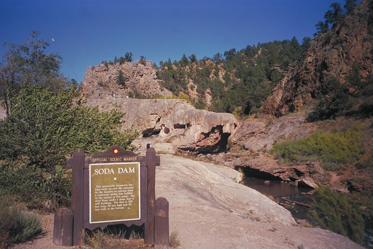
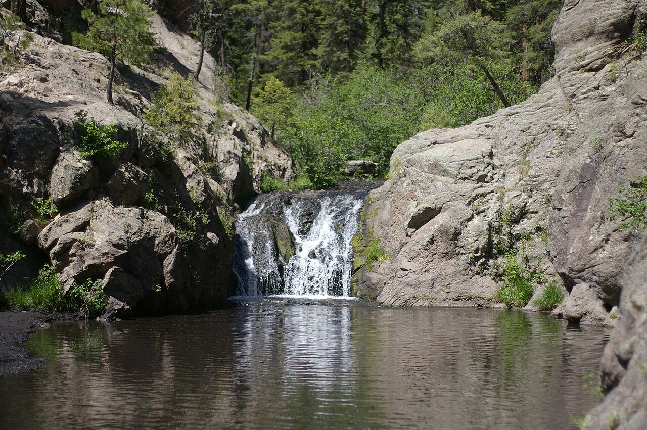
An hour and a half north of Albuquerque, in the Jemez Mountains, Soda Dam is a waterfall of an entirely different kind — one made of rock as much as water. Over roughly 7,000 years, a line of hot springs along the Jemez fault has deposited calcium carbonate and travertine across the Jemez River, building a dome-like natural dam that the river now spills through and over. Sources describe the waterfall portion as roughly 50 feet high and around 50 feet wide at its base, with the river bursting out of the mineral formation in a way that looks almost engineered. It is heated, ultimately, by the volcanic magma of the nearby Valles Caldera.
Soda Dam's great virtue is access: it sits right along New Mexico State Route 4 just north of Jemez Springs, so it is essentially roadside, no hike required, and it flows year-round. Part of the original travertine dam was removed when the highway was built, but the remaining formation east of the road is still a striking, photographable thing. Pair it with a Jemez Mountains day and you can see it on the same drive as Jemez Falls.
The Jemez and Sangre de Cristo snowmelt falls
Higher in the Jemez Mountains, on the East Fork of the Jemez River in the Santa Fe National Forest, Jemez Falls is the tallest waterfall in the range at a documented 70 feet. It is also one of the easiest big falls in the state to reach: the Jemez Falls Trail runs about 0.8 miles round trip on gentle, ponderosa-shaded ground with only modest elevation gain, and a short quarter-mile spur leads straight to the overlook. The trailhead is at the Jemez Falls Campground and day-use area, perched near 7,880 feet. Because the East Fork is snowmelt-fed, the fall is at its loudest during the late-spring melt, roughly May into June; come too late in summer and the drop thins considerably.
Closer to Santa Fe, in the foothills above Tesuque, Rio en Medio offers a different experience — not one signature plunge but a string of cascades and small falls strung along a creek. The trail follows the Rio en Medio upstream with multiple stream crossings, and after roughly two miles you reach a waterfall, with more cascades and shallow pools above it as the canyon narrows into slot-like granite and gneiss. Counted to the falls and back, it runs about 3.6 miles round trip at a moderate grade. The individual drops are modest — on the order of 20 feet for the main fall, with no single authoritative height — so the appeal is the green, water-laced canyon as a whole. It is best in spring and early summer when the creek is full. Important caveat: portions of the Rio en Medio Trail (#163) and its small trailhead have been subject to closures, so confirm current access with the Santa Fe National Forest before planning a trip.
Farther north, near Arroyo Seco above Taos, El Salto del Agua is the most storied fall on this list — and the most encumbered. A series of tiered drops spills down the canyon beneath a large cave on the historic Martinez land grant, private land dating to the early 1700s. The setting has a genuine literary pedigree: the cave and falls reportedly informed D.H. Lawrence's writing and served as a model for a cave in Willa Cather's Death Comes for the Archbishop. Access is real but gated by the land grant: you must sign a liability waiver, buy a daily or annual pass at the trailhead, and check in with the El Salto warden before entering. The hike to the lower falls is short — roughly half a mile, though steep and rocky in places, with more falls higher up the canyon. Go in late spring through early summer, when snowmelt gives the tiers their fullest flow, and treat the permit and check-in requirements as non-negotiable, not optional.
Nambe Falls: a tribal-managed two-tier drop
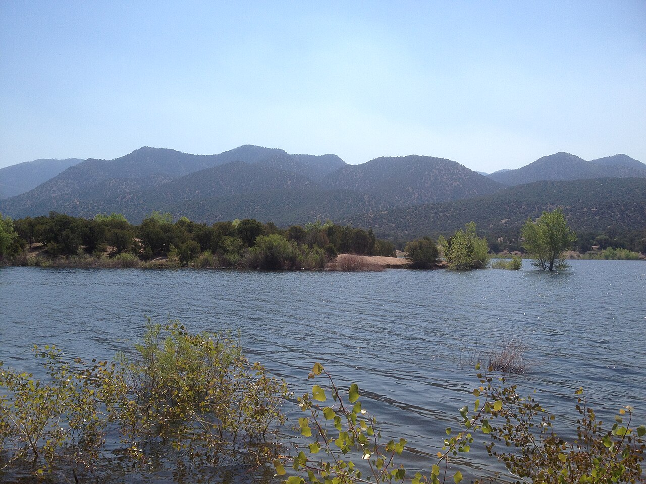
Just off the high road between Santa Fe and Taos, Nambe Falls is one of New Mexico's most photographed waterfalls, and one of the few managed entirely by a tribal nation rather than a federal agency. The Rio Nambe drops through a rugged canyon on Nambe Pueblo land in a tiered fall — historically described as having upper sections on the order of 75 and 100 feet — making it among the more vertical falls on this list. The pueblo runs the Nambe Falls and Lake Recreation Area around it, with the lake, fishing, and camping rounding out a visit.
Access is straightforward but tribally regulated, which is part of what makes Nambe distinctive. Two short trails, each roughly a quarter mile, leave from the Ramada area: one climbs a dry, rocky path to a dramatic overlook above the falls, while the other follows the creek through the canyon to the lowest pool, where a beach area and (when conditions allow) swimming await. Counting the combined approach and the climb, the outing is commonly logged at around 2.4 miles round trip at a moderate effort. A permit is required and is included in the recreation-area entry fee; the area historically operates on a seasonal, limited-days schedule (often Thursday through Sunday, with set day-use hours), so check the pueblo's current hours and fees before you drive out.
Time it for the spring snowmelt, when the Rio Nambe is running and the tiers are full — this is a snowmelt fall, not a spring-fed one, so flow drops off as the season dries. When it is running, the combination of the vertical drop, the canyon walls, and the lake below makes it one of the most rewarding short waterfall trips in northern New Mexico.
Short, family-friendly falls: Catwalk, Travertine, and Bluff Springs
Three falls round out the list as easy, high-reward day trips. In the Gila National Forest five miles east of Glenwood, the Catwalk National Recreation Trail threads Whitewater Canyon on a suspended metal walkway bolted to the canyon's pink volcanic walls — a route that traces a water-and-power pipeline built in the 1890s for the mining town of Graham and rebuilt by the Civilian Conservation Corps in the 1930s. The trail is short and accessible, about three-quarters of a mile one way (roughly 1.5 to 2.2 miles round trip depending on how far you push past the catwalk section), and along Whitewater Creek you pass hidden pools and small splashing falls, with a popular waterfall-fed swimming hole near the end. It is a day-use area with a modest per-vehicle fee, open sunrise to sunset, and runs best in spring and after the summer monsoon rains. No single authoritative height exists for the falls here — the draw is the canyon and the creek, not one big drop.
Twenty miles east of Albuquerque, just off I-40 near Tijeras, Travertine Falls is the Sandia Mountains' accessible waterfall hike. From the Canyon Estates trailhead, a short walk of roughly a mile round trip on the Crest Trail (130) leads to a seasonal fall in the Cibola National Forest, with a small cave above it that hides fossils for the curious. The catch is in the word seasonal: this fall depends on spring snowmelt and is most active in spring and early summer; by late summer it can be dry. As an easy, kid-friendly, leashed-dog-welcome outing close to a major city, it is hard to beat — just go when the water is actually flowing.
Finally, up in the cool, forested high country near Cloudcroft, Bluff Springs is the gem of the more than eighty springs scattered through that corner of the Lincoln National Forest. A spring-fed tributary in the Rio Penasco headwaters flows a short distance and then pours over a roughly 40-foot bluff just before joining the larger creek. Access is exceptionally easy — the site sits at a partially developed picnic and dispersed-camping area reached by paved and then dirt road south of Cloudcroft, with a short trail leading up and over the falls. It runs best with spring snowmelt and after summer rains. The combination of high-elevation pine forest, an easy approach, and a genuine drop makes it a favorite family stop in the Sacramento Mountains.
Planning your New Mexico waterfall trip
Season is the single most important variable here. For the snowmelt falls — Jemez Falls, Nambe Falls, Rio en Medio, Travertine Falls, and El Salto del Agua — aim for the spring melt, roughly April into June, when the streams are full; arrive in a dry late summer and you may find a fraction of the water, or none. The two desert standouts are the exceptions that anchor a year-round itinerary: Sitting Bull Falls and Soda Dam both flow regardless of season because they are spring-fed and travertine features, not snowmelt-dependent. The summer monsoon, typically July into September, can also briefly revive flow at the canyon falls — Catwalk and Bluff Springs especially — though desert rains are unpredictable.
Geography splits the state into a few natural trip clusters. The Jemez Mountains hold Jemez Falls and Soda Dam on one drive northwest of Santa Fe. Northern New Mexico's high road country adds Nambe Falls, Rio en Medio near Tesuque, and El Salto del Agua up near Taos. The south offers Sitting Bull Falls near Carlsbad and Bluff Springs near Cloudcroft, while the far southwest has the Catwalk in the Gila. Travertine Falls is the easy add-on for anyone passing through Albuquerque. Pairing falls within a cluster makes far more sense than trying to string the whole state together in one trip.
Two access notes deserve repeating because they are easy to overlook. Nambe Falls and El Salto del Agua are not standard public-land hikes — Nambe Falls is on Nambe Pueblo land and requires a permit and entry fee on a limited operating schedule, and El Salto del Agua sits on the private Martinez land grant and requires a signed waiver, a paid pass, and a check-in with the warden before you set foot on the trail. Respecting those requirements is both a legal and a courtesy obligation to the communities that steward these places. For the Forest Service falls, verify current trail and road status before you go; Rio en Medio in particular has seen closures. Carry more water than you think you need, watch the weather for flash-flood potential in narrow canyons, and you will find that this dry state hides some genuinely beautiful falling water.