Why Nevada Waterfalls Are a Different Kind of Hunt
Nevada averages less precipitation than any other U.S. state, so the first thing to understand about chasing waterfalls here is that almost all of them are seasonal. Unlike the perennial cascades of the Pacific Northwest or Appalachia, most Nevada falls depend on a specific window — usually spring snowmelt off a high range, or the days immediately after a desert rainstorm. Show up at the wrong time and you may find a dry rock face where a guide promised a waterfall. Timing is not a detail here; it is the whole game.
Geographically, Nevada's documented waterfalls cluster in two areas separated by hundreds of miles of basin and range. The first is the Spring Mountains (the Mount Charleston area) just west of Las Vegas, where peaks rising above 11,000 feet hold snow that feeds Kyle Canyon and the surrounding drainages well into spring. The second is the Reno-Tahoe corridor and the high country of the Carson Range and Mount Rose Wilderness in the state's northwest, where alpine snowpack lingers later and feeds creeks like Galena and Hunter. A third, more remote pocket sits in the Ruby Mountains near Elko in the northeast. Then there are the slickrock canyons of Red Rock Canyon National Conservation Area, where waterfalls appear only as fleeting, weather-driven events.
This guide is a curated selection of Nevada's most notable documented waterfalls, not an exhaustive inventory. The state has many more unnamed seasonal drops, ephemeral storm cascades, and hard-to-reach scrambles that locals know but that lack reliable public documentation. We have prioritized falls that appear in agency materials, established trail databases, and waterfall references — and we have flagged honestly where access is currently restricted or where heights are uncertain. One important note up front: heights reported for waterfalls vary widely by source and method. A figure measured as a single vertical drop will differ from one that sums a long cascade, so treat the numbers below as documented estimates rather than surveyed certainties.
The Spring Mountains: Mount Charleston's Snowmelt Falls
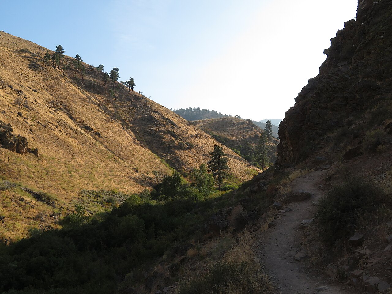
The Spring Mountains National Recreation Area, managed by the Humboldt-Toiyabe National Forest, is the closest waterfall country to Las Vegas and the most popular. Its headline attraction has long been Mary Jane Falls, a roughly 200-foot horsetail-type fall tucked at the head of Kyle Canyon near the town of Mount Charleston. The hike was a moderate 3.2-mile round trip that climbed a set of switchbacks to a shaded amphitheater where snowmelt seeps down the cliff face, running best during spring snowmelt from April through June. It is the kind of fall that draws crowds precisely because the payoff is large and the trail is short.
There is a crucial caveat, however, and it is the most important thing to know before planning a Spring Mountains trip: the Mary Jane Falls trail has been closed since Tropical Storm Hilary caused severe damage in August 2023. The U.S. Forest Service has reported that the trail requires a reroute and significant reconstruction, and as of 2026 it was not expected to reopen until roughly fall 2027. Hiking a closed federal trail is illegal and can carry steep penalties. Check current Forest Service conditions before you go, and do not rely on older guidebooks or app listings that still describe the trail as open.
Sharing the same canyon is Big Falls, an 85-foot seasonal horsetail that is well-hidden and considerably harder to reach. Historically the route branched off the Mary Jane Falls trail roughly halfway up and then continued off-trail up a boulder-filled ravine, degenerating into a stream scramble with real route-finding, loose rock, and steep drop-offs — a strenuous outing rated well beyond the casual hiker. Because its approach depended on the same now-closed corridor, Big Falls is effectively inaccessible by the standard route until the area's trails are restored. When it did run, it ran on the same spring snowmelt clock, and the shady, north-facing canyon held its flow later than most of the range.
Two gentler Spring Mountains options round out the area for when access is restored or for those staying lower. Little Falls is a short, easy roughly 1-mile walk to a 40-foot cascade in the Kyle Canyon drainage; because part of its flow is spring-fed, it often keeps trickling into summer after the snowmelt-only falls have gone dry. Fletcher Canyon, near Mount Charleston, is a moderate 4.2-mile round-trip hike up a forested drainage to a set of photogenic sheer-walled narrows. It is best thought of as a seasonal-stream-and-slot-canyon hike rather than a guaranteed waterfall: Fletcher Spring is usually dry by summer and fall, and the canyon flows strongly only in spring after a heavy snow winter.
Reno-Tahoe High Country: Galena and Hunter Creek
Northwestern Nevada's Carson Range and Mount Rose Wilderness hold more reliable water than the desert ranges, thanks to deeper, later-melting Sierra-adjacent snowpack. The standout here is Galena Creek Falls, an 82-foot cascade on Galena Creek reached via the Mount Rose trail near Incline Village. The hike runs about 5 miles round trip at a moderate grade, with the falls sitting along the route toward the Mount Rose summit. The World Waterfall Database and lidar-based measurements put the drop at roughly 85 feet, closely matching the figure cited here — a reminder that even careful sources land in the same ballpark rather than on an exact number.
Galena's high elevation is both its strength and its quirk. Because the falls sit in the high country, snow can linger across the trail and around the falls well into July, so an early-summer visit (June into July) is the sweet spot once the route melts out. The flip side is that the same elevation gives Galena a sustained flow deep into late summer in most years, long after the desert falls have stopped. If you want one Nevada waterfall that rewards patience and reliably has water when you arrive, this is a strong candidate.
Closer to the city, Hunter Creek Falls is the Reno area's beloved local waterfall hike — a roughly 30-foot horsetail at the end of a moderate trail along Hunter Creek in the Humboldt-Toiyabe National Forest. The outing is about 6 miles round trip with a climb of around 1,200 feet, and reviewers consistently warn that the early stretch is exposed and hot with little shade. Bring more water than you think you need and start early. The falls run best on spring snowmelt from April through June; later in summer the flow thins and the heat on the approach gets punishing. Several shallow creek crossings along the way are part of the appeal rather than an obstacle.
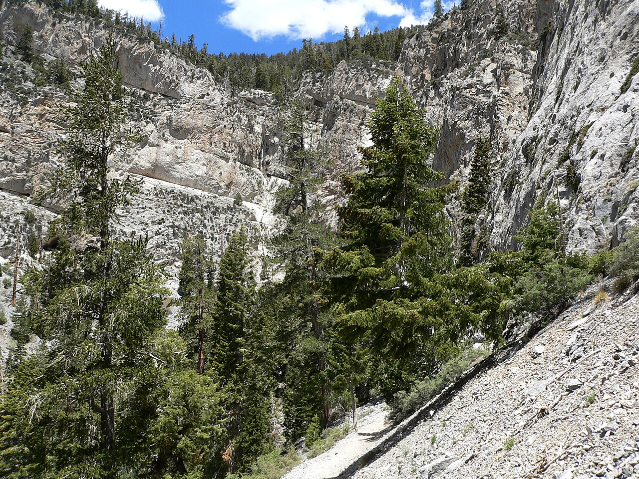
The Ruby Mountains: Lamoille Falls and Nevada's Alpine Backcountry
Far from Las Vegas and Reno, in the northeastern corner of the state near Elko, the Ruby Mountains rise like an island of alpine terrain above the high desert. Lamoille Canyon — the largest valley in the Rubies, sculpted by ice-age glaciers and about 12 miles long — is the heart of this country, and Lamoille Falls is its accessible waterfall. The cascade sits on Lamoille Creek near the junction with Right Fork Canyon, reachable from the Lamoille Canyon Scenic Byway, with the falls themselves a moderate short walk from the road corridor.
The Rubies operate on a later seasonal calendar than the rest of Nevada. The Lamoille Canyon road is generally closed in winter and typically open from around May through October, weather permitting, and the high country is best hiked from early June into October once the snow has cleared — though snow can cling to the peaks even in June. That makes Lamoille Falls a late-spring-through-summer destination, when snowmelt keeps the creek running. Of the falls in this guide, Lamoille has the shortest documented approach data, so treat trail specifics as approximate and confirm conditions with the Humboldt-Toiyabe National Forest or local Elko resources before driving out.
It is worth knowing the broader context: the Rubies are laced with serious backcountry routes, including the 43-mile Ruby Crest National Recreation Trail, that pass alpine lakes, meadows, and seasonal waterfalls far beyond Lamoille Falls itself. For most visitors the roadside-accessible falls are the goal, but the canyon rewards anyone willing to walk farther into one of Nevada's least-crowded mountain ranges.
Red Rock Canyon: Desert Falls That Only Run After Storms
Just west of Las Vegas, Red Rock Canyon National Conservation Area — managed by the Bureau of Land Management — is famous for its red-and-tan sandstone, but after rain or snowmelt it briefly hides waterfalls in its canyons. These are the most weather-dependent falls in this guide: they can run strong or run completely dry, sometimes within the same week, so they are best chased in winter and spring (roughly December through April) and ideally in the day or two after a storm.
Lost Creek Falls is the easiest to reach: a plunge at the back of a box canyon on Lost Creek, accessible via a short, easy loop of about 0.7 miles round trip with only modest elevation change. It pours from an overhang at the head of the canyon when rain and melting snow feed it, and it is dry the rest of the time. Because the walk is so short and family-friendly, it is a low-commitment gamble — perfect to tack on when you are already in the area and conditions look right.
Ice Box Canyon is the more adventurous Red Rock option. The roughly 2.2-mile route leads from open desert into a cool, shady, high-walled box canyon, with seasonal waterfalls that appear from December through April after rain or snowmelt. It is rated moderate but is more rugged than the mileage suggests: you cross the creek repeatedly, scramble over boulders, and pick your way through ledges and brush, with route-finding required at several points. The canyon's deep shade is what gives it its name and what lets water and ice persist there longer than on the exposed slopes nearby. As with Lost Creek, manage expectations — the falls are a reward for good timing, not a guarantee.
Planning, Safety, and Honest Expectations
If you take one practical lesson from this guide, let it be this: check current conditions before every Nevada waterfall trip. The Spring Mountains closures triggered by Tropical Storm Hilary are the clearest example — popular trails like Mary Jane Falls have been shut for years and may not reopen until 2027 — but seasonal flow, road closures, and snow-blocked high-country routes affect every fall here. The Humboldt-Toiyabe National Forest, the BLM's Red Rock Canyon resources, and recent trail reports are far more reliable than static guidebooks or older app entries.
Match your timing to the watershed. Desert canyon falls in Red Rock (Lost Creek, Ice Box) run in winter and early spring after storms. Spring Mountains snowmelt falls (Mary Jane, Big, Fletcher) peak from April through June. High-country falls in the Carson Range and Rubies (Galena, Lamoille) come into their own in early-to-mid summer once the snow melts out, and the highest of them hold water into late summer. The same calendar that fills one of these falls leaves another bone-dry, so plan around the specific watershed, not the season in general.
Finally, respect the terrain. Several of these outings involve loose rock, creek crossings, exposure, and route-finding, and the desert approaches can be brutally hot with little shade and no water — carry far more than you think you need and start early. Off-trail scrambles like the historic Big Falls route are genuinely hazardous and demand experience. Nevada rewards the prepared waterfall hunter with surprisingly beautiful water in an unexpected place; it punishes the unprepared and the poorly timed with a dry hike in the heat. Plan accordingly, and the trip will be worth it.