How to think about Minnesota's waterfalls
This is a curated field guide, not a complete inventory. Minnesota has many documented waterfalls, and depending on how you count rapids, ledges, and seasonal cascades, the total runs into the dozens. What follows is a selection of ten that are well-documented, publicly accessible, and worth the drive — weighted heavily toward the North Shore of Lake Superior, where the state's most dramatic drops are concentrated. If you want a single weekend that captures the best of Minnesota's falls, the corridor of state parks along Highway 61 between Two Harbors and Grand Marais is the answer.
The geography is no accident. Along the North Shore, rivers like the Baptism, Gooseberry, Cascade, Temperance, Brule, Caribou, and Kadunce run off the volcanic basalt highlands and cut down toward Lake Superior, which sits roughly 600 feet lower. That elevation difference, compressed into the last few miles before the lake, is what produces a string of plunges, cascades, and gorges within a short drive of one another. The Minnesota DNR has built much of this corridor into a well-marked system of state parks and waysides, so most of these falls are reachable on maintained trails rather than bushwhacks.
One honest caveat about numbers: reported waterfall heights vary by source and by method. A figure can describe a single vertical drop, or it can sum a series of stepped cascades over a stretch of river. High Falls of the Baptism River, for instance, is variously listed around 60, 70, or even 100 feet depending on what is being measured and which body is doing the measuring. We lead with the documented DNR-style single-drop figures where available and flag the spread rather than pretend to a precision the sources don't support. Treat every height here as a reasonable estimate, not a surveyed certainty.
The big drops: High Falls and Devil's Kettle
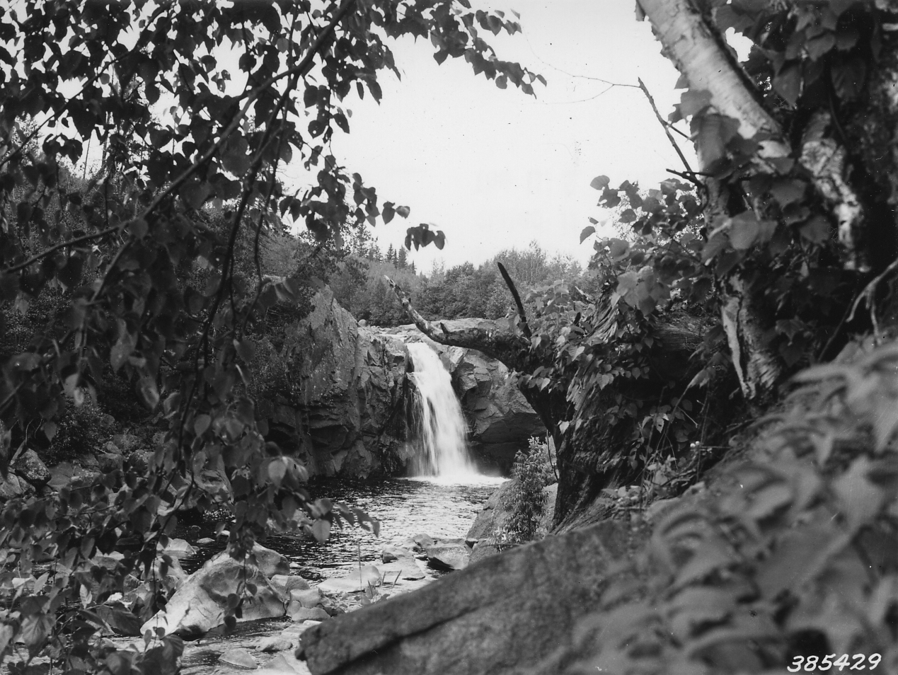
High Falls of the Baptism River, inside Tettegouche State Park near Silver Bay, is the tallest waterfall wholly within Minnesota's borders — the DNR puts it at about 63 feet, though you'll see higher figures (70 and even 100 feet) cited elsewhere depending on what stretch of the drop is being counted. It's a true plunge: the Baptism River funnels into a narrow chute and falls off a basalt lip. The standard out-and-back is roughly 3 miles round trip along a well-maintained section of the Superior Hiking Trail, rated moderate, with boardwalks, stairs, and a suspension bridge above the falls. Spring snowmelt is the showcase season, when volume is at its highest and the plunge is loudest.
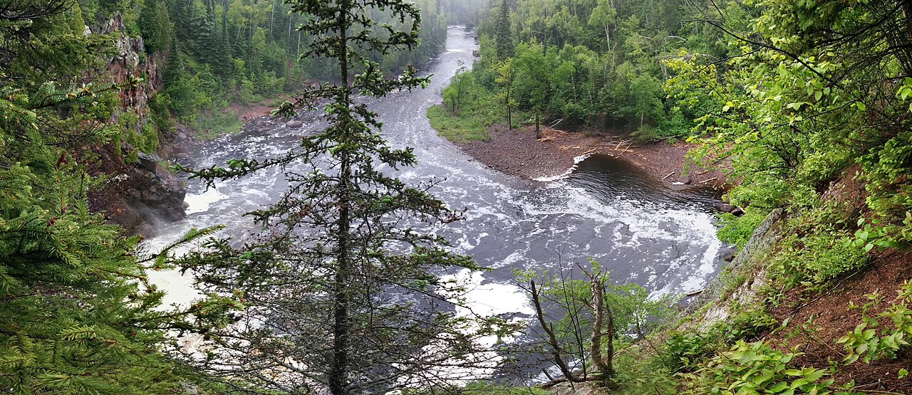
Devil's Kettle, in Judge C.R. Magney State Park near Grand Marais, is the most mythologized waterfall in the state. Here the Brule River splits around a rock outcrop: half drops into a visible pool, and the other half pours into a pothole — the 'kettle' — and appears to vanish. For decades, the legend held that the water disappeared into an unknown underground passage, and people famously tossed in objects to see if they would resurface. In 2017, DNR hydrologists measured the flow above and below the falls and found essentially no loss of water, confirming that the river simply resurges downstream a short distance below. It's a swirling, force-of-nature plunge pool, not a portal to nowhere — but it's no less worth seeing for being explained.
Devil's Kettle is the more demanding hike of the two. The trail to the falls is roughly 2 miles round trip and is best described as strenuous, with a long descent on staircases into the river gorge that you have to climb back out of. Spring runs strongest here too, when the Brule is swollen and the kettle churns hardest. Both of these falls reward visitors who come early in the season; by late summer in a dry year, the volume can drop noticeably.
The classics: Gooseberry and Minnehaha
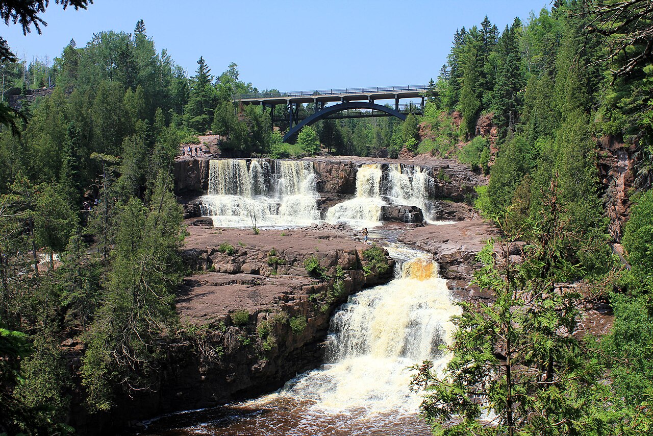
Gooseberry Falls State Park, about 13 miles northeast of Two Harbors, is the most-visited waterfall destination on the North Shore, and for good reason: it packs Upper, Middle, and Lower falls into a compact, easy-to-walk area right off Highway 61. The Gooseberry River steps down a series of basalt ledges in tiered drops before reaching Lake Superior. The Lower Falls is the headline cascade — described in the cumulative sense as a drop of around 60 feet over its tiers before the river spills toward the lake — and it's reachable on a short, easy trail of roughly a mile from the visitor center. The Middle Falls, a tiered drop of around 25 feet, sits just upstream and is reachable on an even shorter walk of about half a mile.
Because the falls are so accessible, Gooseberry is ideal for families, mixed-ability groups, or a quick stop on a longer North Shore itinerary. The trade-off is crowds: on a summer weekend the overlooks fill up. The best time for raw power is spring snowmelt, generally April through June, when the river runs full. As with all the North Shore rivers, height figures for the Gooseberry tiers vary by source depending on whether a single ledge or the full stepped descent is being measured — treat the numbers as approximate.
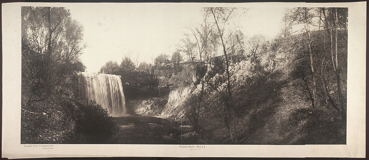
Minnehaha Falls is the outlier on this list and the one most Minnesotans know best. It sits inside Minnehaha Regional Park in Minneapolis, far from the North Shore, where Minnehaha Creek plunges about 53 feet over a limestone ledge before continuing toward the Mississippi River. The name comes from the Dakota words for water, and the falls are culturally significant to the Dakota people. A short, easy walk of under a mile from the park's main area gets you to the overlook and the stairs into the glen below. Spring brings the fullest flow, but Minnehaha is also famous in deep winter, when sustained subzero cold freezes it into a sculpted ice column — a genuinely distinctive urban spectacle, with the important caveat that the stairs and base area are often closed or hazardous when iced over.
The quieter North Shore falls
Beyond the marquee names, the North Shore is studded with smaller falls that reward visitors willing to step off the busiest trails. Illgen Falls, also on the Baptism River within Tettegouche State Park near Silver Bay, is a roughly 40-foot plunge that many people miss because the big High Falls draws the crowds. It's an easy reach — under a mile of walking — and the comparatively low effort for a clean vertical drop makes it one of the better effort-to-payoff falls on the shore. Spring is again the strongest season.
Caribou Falls, near Finland, is a tiered cascade of about 35 feet on the Caribou River, reached from a state wayside via a trail of roughly 1.3 miles. It sits within ground managed in association with Superior National Forest, and the short hike through woods to the gorge keeps the crowds thinner than at the state-park headliners. Cascade Falls, on the Cascade River near Lutsen, lives up to its name: rather than a single plunge, the river tumbles in a churning cascade of around 30 feet through a rock gorge, with an overlook reachable on a very short trail of about half a mile. Cascade is at its best in spring and after heavy rain, when the volume turns the gorge into a continuous sheet of whitewater.
Two more deserve mention for their character even where exact heights aren't well-documented. Hidden Falls, on the Temperance River near Schroeder, sits inside Temperance River State Park, where the river has carved an unusually deep, narrow gorge — the falls are reached on a moderate trail of about 2 miles round trip, and the slot-canyon walls are as much the attraction as the drop itself. Kadunce River Falls, near Grand Marais, is a series of cascades within a tight gorge reached via a moderate trail of roughly 1.2 miles from the Kadunce River State Wayside; unusually for the shore, summer is often cited as a fine time to visit, when low water lets confident hikers wade the gorge. For both, published height figures are inconsistent enough that we'd rather describe the experience than commit to a number.
Planning your trip: season, difficulty, and logistics
Season is the single biggest variable in how impressive these falls will be. Across nearly every North Shore river, spring snowmelt — roughly April through June — produces the highest, loudest flows. By mid-to-late summer in a dry year, the same falls can shrink to a fraction of their spring volume, and a few of the smaller cascades slow to a trickle. If raw power is what you're after, plan for spring; if you want comfortable trail conditions and warmer water in the gorges, summer is the trade-off. Minnehaha Falls is the exception that rewards a deep-winter visit, when it freezes into an ice sculpture.
Difficulty on this list ranges from genuinely easy to honestly strenuous. Gooseberry's Lower and Middle falls, Illgen, Caribou, Cascade, and Minnehaha are all short, easy walks suitable for most visitors. High Falls and the Temperance and Kadunce gorges are moderate, involving more distance, stairs, or uneven footing. Devil's Kettle is the most strenuous, with a long staircase descent into the Brule River gorge that you have to reverse on the way out. Wear real footwear: the rock near every one of these falls is wet, and it is slick.
Logistically, the North Shore falls are clustered along Highway 61 between Two Harbors and Grand Marais, which makes a multi-stop day or weekend straightforward. Most sit within Minnesota state parks or state waysides — Tettegouche, Gooseberry Falls, Judge C.R. Magney, Cascade River, and Temperance River among them — so a Minnesota state park vehicle permit covers entry to the park-managed sites, and the DNR maintains parking, trails, and signage. Check current conditions and trail closures with the DNR before you go, especially in shoulder seasons when stairs may be icy or trails wet. Always stay behind railings and out of restricted areas near the lips and plunge pools; these rivers move with real force in high water.