How to think about Idaho's waterfalls
Idaho has roughly 70 named waterfalls cataloged in the U.S. Geological Survey's Geographic Names Information System (GNIS), and they fall into two very different worlds. The south is canyon country: the Snake River and its tributaries pour over basalt and rhyolite rims in the lava plains around Twin Falls and Idaho Falls, where many of the biggest, most accessible falls sit a short walk — sometimes just a few steps — from a parking lot. The north and central mountains are a different story, where snowmelt-fed creeks tumble through forested canyons and granite high country that you generally have to earn on foot.
This is a curated selection, not a complete inventory. We've chosen eleven well-documented falls that together represent the range of what the state offers: roadside showstoppers, easy family walks, and a couple of genuine backcountry objectives. For each one, the facts below — heights, trail distances, land managers, and best seasons — come from public records and the land agencies that manage them. We've flagged where sources disagree.
One honest caveat about height numbers: reported waterfall heights vary depending on how they're measured. A single vertical plunge is straightforward, but a tiered or segmented falls can be quoted either as its tallest single drop or as its cumulative descent, and different surveys round differently. Where you see a figure here, treat it as a careful approximation rather than a surveyed certainty. The more important variable for most of these falls isn't height anyway — it's water. Many of Idaho's signature falls are governed by snowmelt timing or, in the case of the dammed Snake River falls, by irrigation and hydropower diversions that can turn a thundering cataract into a trickle by late summer.
Shoshone Falls and the Twin Falls canyon showpieces
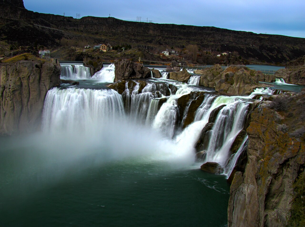
If you see one Idaho waterfall, make it Shoshone Falls near Twin Falls. Often called the "Niagara of the West," it drops 212 feet — about 45 feet higher than Niagara — over a rim nearly a thousand feet wide on the Snake River. The falls were carved by the catastrophic Bonneville Flood roughly 14,000 years ago, and for millennia they marked the upper limit of salmon migration on the Snake. Access could hardly be easier: Shoshone Falls Park, run by the City of Twin Falls, has overlooks just a couple hundred feet from the parking area, a roughly 0.2-mile stroll on paved paths. The catch is timing. Idaho Power and upstream irrigators divert the river, so the falls run hardest during spring snowmelt and reservoir releases, generally April through June. Visit in a dry August and you may find bare rock.
Two miles downriver, the city's other namesake — Twin Falls itself — gives the canyon its name. In its natural state the river thundered about 125 feet over two side-by-side plunges, but in 1935 Idaho Power blocked the south channel for a hydropower plant, leaving a single waterfall on the north side. Like Shoshone, it's best from roughly March into early June before water is pulled for the irrigation season. There's a roadside overlook near the Twin Falls Dam.
For something that runs even when the river falls are dry, Perrine Coulee Falls is the local secret. This roughly 197-foot plunge drops off the canyon's south rim, and because it's fed largely by irrigation return flows, it runs year-round — unusual for the region. A short quarter-mile path off Canyon Springs Grade leads you behind the curtain of water, one of the few walk-behind waterfalls in the state, and it's also visible from the paved Canyon Rim Trail above. Bring a rain shell; you will get misted.
The most adventurous Twin Falls-area objective is Pillar Falls, a series of low cascades and rapids totaling only about 20 feet of cumulative drop but threaded between dramatic eroded pillars of volcanic rock mid-river. Reaching it means either a two-mile paddle upstream from Centennial Waterfront Park or a steep, strenuous hike of roughly 2.4 miles that loses several hundred feet down loose canyon terrain. This is the one to be careful with: the river funnels into a narrow, powerful torrent that is a documented drowning hazard, paddlers must portage, and swimming is not advised. Late summer's lower water is the most navigable window.

The Mesa Falls and Swan Valley falls of eastern Idaho
Up on the Henrys Fork of the Snake River, the Mesa Falls pair is the eastern Idaho equivalent of Shoshone — big, accessible, and managed for visitors. Upper Mesa Falls drops about 114 feet over a wide rim of Mesa Falls Tuff, volcanic rock laid down by the Henrys Fork caldera over a million years ago. Managed by the Caribou-Targhee National Forest off the Mesa Falls Scenic Byway near Ashton, it's reached by a paved path and a network of boardwalks and stairs — call it about three-quarters of a mile of easy walking to take in all the viewpoints — that put you close enough to feel the spray. It runs well from late spring through fall.
A short drive downstream, Lower Mesa Falls is the quieter sibling. It's a shorter cascade — sources put the drop somewhere in the 65-to-85-foot range — viewed from a more distant overlook, so it reads as less dramatic than the upper falls. You can see it from a roadside overlook a tenth of a mile from parking, or reach it via the roughly one-mile Mesa Falls Nature Trail through the forest. It's at its best during the May-to-June snowmelt.
Farther east in Swan Valley, Fall Creek Falls is one of the most photogenic roadside falls in the state. About 60 feet of water fans out over a travertine outcropping and spills directly into the Snake River — a rare falls that empties straight into a major river rather than feeding it from above. It's managed by the Caribou-Targhee National Forest, sits just off Highway 26 with parking and a brief walk to the viewing area, and runs best from spring through early summer. The surrounding South Fork country below Palisades Dam is famous trout water, making this an easy add-on to a fishing or float trip.
Backcountry and northern Idaho falls
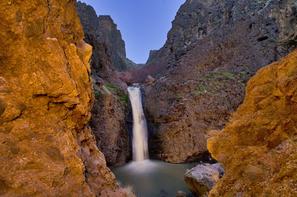
The desert southwest corner has its own gem in Jump Creek Falls, southwest of Marsing in the Owyhee country managed by the Bureau of Land Management. A short out-and-back of about half a mile threads up a narrow rhyolite canyon to a roughly 55-to-60-foot falls dropping into a pool — a genuinely surprising oasis in arid sagebrush terrain. It's an easy hike and a popular swimming and birding spot in warm months, but two notes: poison ivy grows thick along the creek in places, and the BLM has moved toward a modest day-use fee. Spring is the prime window for flow.
For a real Sawtooth backcountry experience, Bridal Veil Falls above Stanley Lake is the classic. From the Stanley Lake trailhead in the Sawtooth National Recreation Area, Trail 640 winds through wildflower meadows beneath the dramatic spire of McGown Peak before climbing to a horsetail falls on Stanley Lake Creek — a long day hike that also passes Lady Face Falls along the way. AllTrails and local trail guides describe the round trip as roughly eight miles, so plan for a strenuous full day. The reliable season is July through September, after the high country opens up and the creek crossings drop to a safe level; earlier, snowmelt can make the crossings difficult.
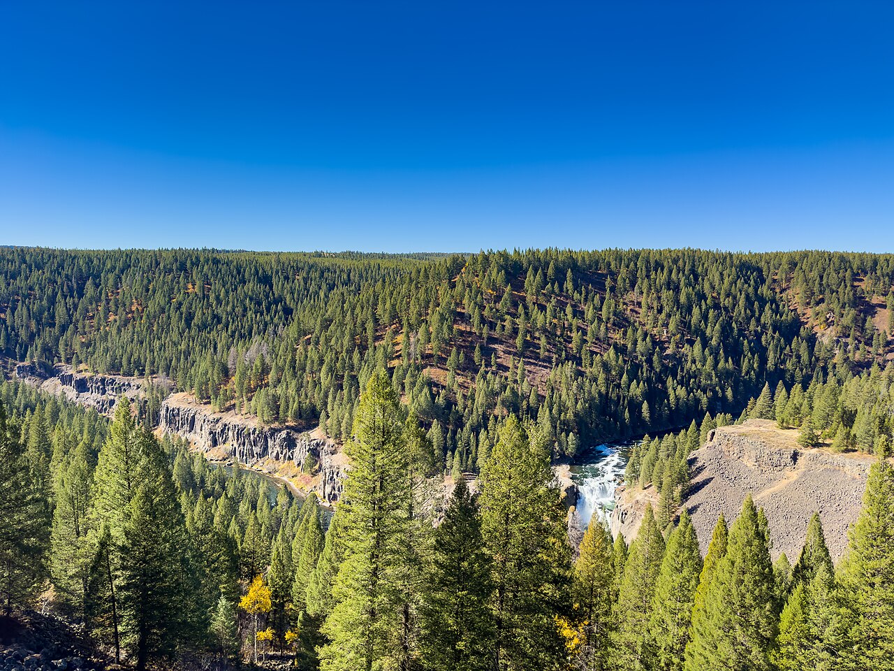
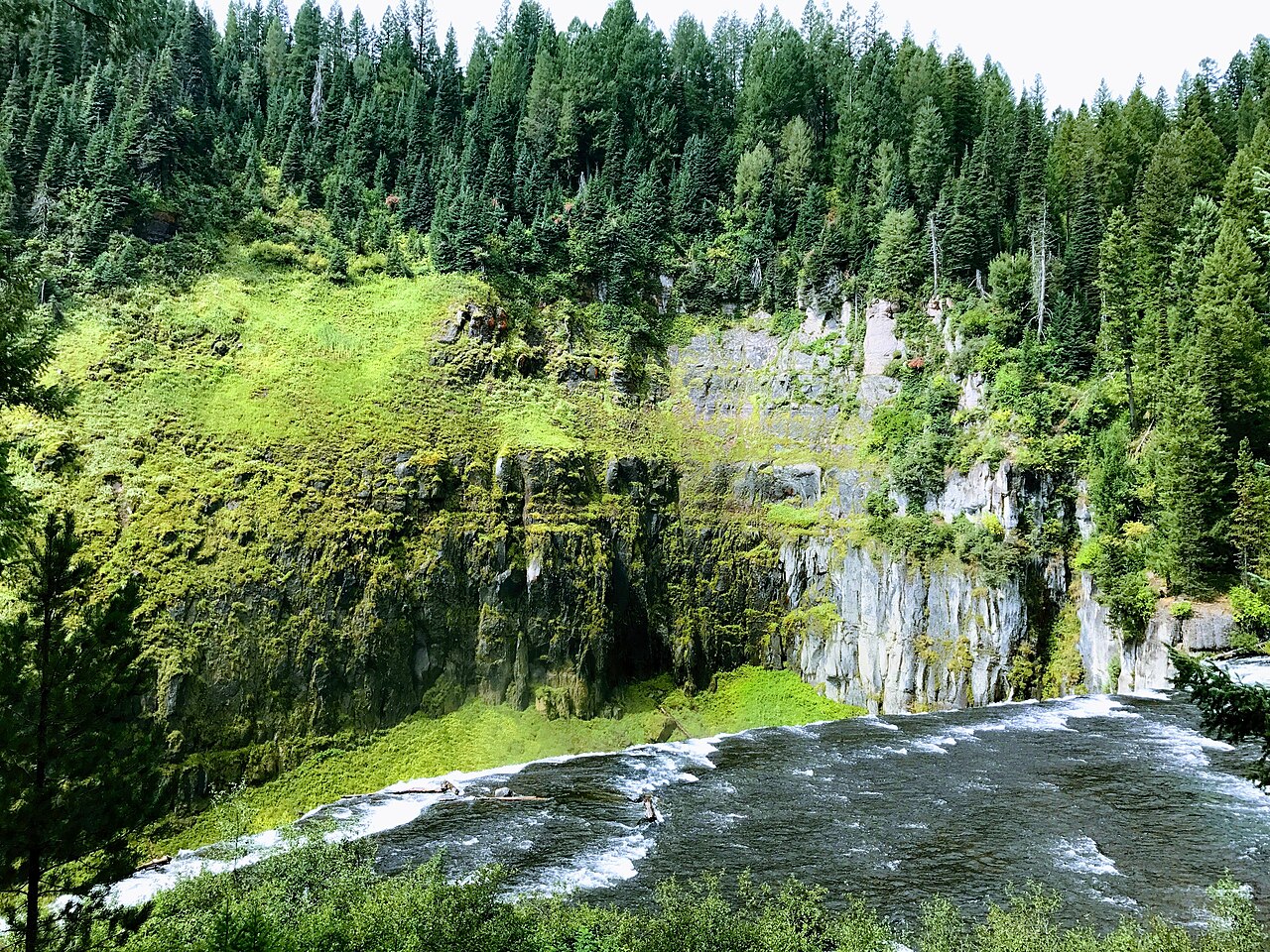
In the Clearwater country of north-central Idaho near Elk River, Elk Creek Falls is a tiered showcase: three separate drops — upper, middle, and lower — totaling well over 140 feet, carving a basalt canyon. The middle falls, the tallest of the three at roughly 88 feet, is sometimes cited as the tallest single waterfall in the state. A moderate loop of about 2.9 miles in the Nez Perce-Clearwater National Forest, with spur trails to each drop and benches along the way, makes it manageable; the Forest Service maintains a trailhead and picnic area. Go from late spring into early summer for the strongest flow, and watch your footing — the trail gets slick after rain.
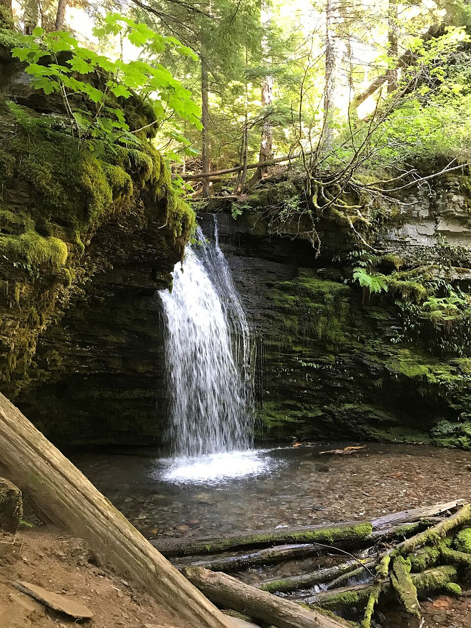
Finally, far up in the Panhandle near Prichard, Shadow Falls is a moss-draped 25-foot cascade on Yellow Dog Creek in the Idaho Panhandle National Forests, reached via Forest Service Trail #513. It's most often hiked together with nearby Fern Falls, a short, easy walk apart, making a quiet two-waterfall outing in deep northern forest. Spring is the season for both. The drive in is the commitment — a long stretch of forest roads off I-90 — but it rewards you with the kind of green, secluded grotto that feels a world away from the Snake River canyons to the south.
Planning your trip: seasons, access, and safety
The single most useful planning rule in Idaho is to match the falls to the calendar. The dammed Snake River falls around Twin Falls — Shoshone and Twin Falls proper — peak with spring snowmelt and reservoir releases, roughly April through June, then can dwindle dramatically once irrigation diversions ramp up in summer. Perrine Coulee, fed by return flows, is the dependable year-round exception in that area. Mountain falls like Bridal Veil and Elk Creek run hardest as the snowpack melts out, but the high-elevation trails to reach them may not be safely open until midsummer, so the best flow and the safest access don't always line up. When in doubt, late spring is the broadest sweet spot statewide.
Access ranges from effortless to demanding. Shoshone, Perrine Coulee, Twin Falls, the Mesa Falls pair, and Fall Creek Falls are all roadside or very short walks suitable for nearly anyone. Jump Creek and Shadow Falls are easy hikes of half a mile or so. Elk Creek Falls is a moderate loop. Pillar Falls and Bridal Veil Falls are the serious efforts — a strenuous canyon descent or paddle for the former, a long mountain day hike for the latter. Check land-manager conditions before you go: Forest Service road and trail status for the national-forest falls, BLM notices for Jump Creek, and Idaho Power flow conditions for the Snake River sites.
A few safety reminders carry across the whole list. The Snake River canyon falls sit above powerful, cold water with documented drowning hazards — Pillar Falls especially — so stay behind railings and out of the current. Spring runoff makes creek crossings on the mountain trails genuinely dangerous; what's an easy step in August can be a hazardous ford in June. Watch for poison ivy at Jump Creek, slick rock after rain at Elk Creek, and steep loose footing on the Pillar Falls descent. Wear real footwear on the hiking falls, carry water, and treat posted closures and fee notices as the current word over anything you read online.