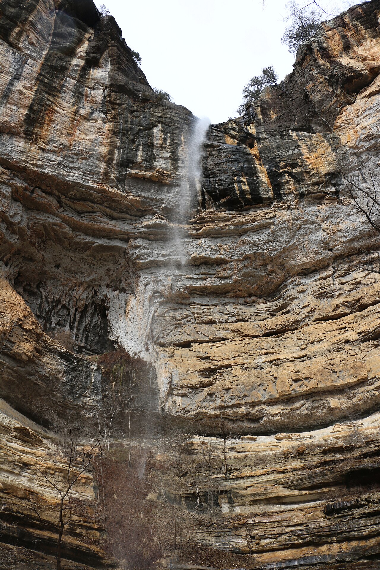
A waterfall of roughly 20 to 29 feet that flows directly out of a cave mouth adjacent to Big Creek in the Ozark National Forest. There is no official trail; about half the route is easy to follow and the rest requires bushwhacking.
Its 29 ft drop is taller than about 17% of the 775 waterfalls we track.
The falls are fed by Big Creek. It lies in Newton County, Arkansas. The site is on public land managed by Ozark National Forest (U.S. Forest Service).
This is a backcountry waterfall: a remote, long, or permit-required trek for prepared visitors. This one is deep enough in that you should plan for a full backcountry trip — map, water, and a margin of daylight. The walk to the main viewpoint runs about 2.9 miles round trip. The nearest town is Cowell.
When to go: Spring (after rain). Water volume swings with the seasons here, strongest after snowmelt or rain and lowest in late summer, so check recent streamflow before you go.